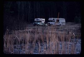
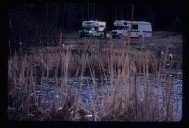
Image depicts a snow-covered road with vehicle tracks, and several houses. The location is uncertain.
Image depicts the ferry at Soda Creek, B.C.
Image depicts what appears to be a Ranch at Soda Creek, B.C.
Image depicts the interior of the ferry at Southbank, B.C.
Image depicts a fishing boat on the water somewhere near Prince Rupert, B.C. Only half of its name is visible: "spirit."
Image depicts a large vessel docked in Prince Rupert, B.C. The name on its side is "Star Capella." The slide itself is labelled "superport."
Image depicts the start of Joffre Creek Road, most likely somewhere in the Joffre Lakes Provincial Park.
Image depicts a steep mountain road somewhere in the area of Seton Portage, B.C.
File consists of notes, clippings, and reproductions relating to sternwheelers. Includes material regarding Pacific Great Eastern sternwheelers on the Fraser River; the B.X. sternwheeler; Trelle Morrow's book "Sternwheelers on the Upper Fraser" published in 2009; and sternwheeler travel on the Fraser River. Includes: "The Pirates of South Fort George" clipped article from Today's Consumer magazine (April 1989).
Image depicts a man, possibly Kent Sedgwick, leaning against a sign forbidding public traffic on the Stewart Access Road from between 5 am to 8 pm. Located in Hazelton, B.C.
Image depicts an unknown individual leaning against a sign at the Stewart Access Road which warns travellers to pack several days of food. Located in Hazelton, B.C.
Image depicts Stewart Harbour in Stewart, B.C.
Image depicts the BCR, as well as the Dunkley Lumber Mill, in Strathnaver, B.C.
Image depicts a street in Giscome. The store was previously located on the left. The church is in the background. Map coordinates 54°04'18.5"N 122°21'57.7"W
Image depicts a trailer for a logging truck suspended off the ground by a wooden structure. This is used to load the trailer onto the back of the truck. The name on the truck says "Rormarniewich Trucking Ltd."
Image depicts a set of railway tracks, and a building with a sign which reads: "Telegraphs." The location is uncertain, but possibly in the Peace River Region.
Image depicts two bridges in Telkwa, B.C. One is for trains.
Image depicts a rail road bridge located somewhere near Terrace, B.C.
Image depicts a vehicle on a gravel road somewhere near Tête Jaune Cache, B.C.
Image depicts the Duchess engine, which was built in 1878 and taken out of service in 1919. It was part of a matched set with the Duke and is now a tourist attraction in Carcross, Y.T.
File consists of notes and reproductions relating to a railway article written by Kent Sedgwick entitled "The East Line Section of the Grand Trunk Pacific Railway in Central British Columbia" (2010).
Image depicts half of a ship, which is named the Tutshi, in Carcross, Y.T.
Image depicts Highway 16 en route to Prince Rupert, B.C.
File consists of notes and reproductions relating to townsites along the Grand Trunk Pacific Railway. Includes material regarding townsite planning for McBride, Willow River, Prince George, Terrace, Prince Rupert, and South Hazelton.
Image depicts a tractor with a claw lifting logs at a saw mill in Prince George, B.C.
Image depicts a train in an uncertain location, though it is possibly Howe Sound in the background.
Image depicts a train in an uncertain location.
Image depicts the side of a train and the tracks it is on, somewhere in the Seton Portage area.
Image depicts what is possibly a train fuelling station at the GTP Roundhouse in Prince George, B.C.
Image depicts what is possibly a train fueling station at the GTP Roundhouse in Prince George, B.C.
Image depicts a train in the interior of the GTP roundhouse in Prince George, B.C.
Image depicts a train in the GTP roundhouse in Prince George, B.C.
Image depicts a train on the Hansard Bridge across the Fraser River looking west. Map coordinates 54°04'37.7"N 121°50'39.9"W
Image depicts a train and several unidentified individuals who appear to be waiting for it as it passes through Sinclair Mills, BC.
Image depicts a train track and several buildings in an unknown location.
Image depicts a train transporting wood planks, possibly in Prince George, B.C.
Image depicts a train carrying logs somewhere in Prince George, B.c.
Image depicts a train and a group of unknown individuals at the GTP roundhouse in Prince George, B.C.
Image depicts several trains at the Giscome mill site in Giscome, B.C. Map coordinates 54°04'19.7"N 122°22'04.7"W
Image depicts trains at the Grand Trunk Pacific railway roundhouse in Prince George, B.C.
Subseries consists of material collected and created by Kent Sedgwick for research regarding transportation. Includes notes and research on airplanes, specifically Prince George aviation and the Junkers aircraft named "The City of Prince George"; highway transportation; the Grand Trunk Pacific Railway; ferry boat service including the Fraser River Fort George ferry, the Isle Pierre ferry, and the Miworth ferry; the Pacific Great Eastern Railway line; the British Columbia Railway; and the Canadian National Railway. Also includes essays and typed documents on railway history in Prince George.
Image depicts two unidentified individuals examining a thick log still attached to the machine that cut it down. It is located somewhere in Prince George, B.C.
Image depicts a green car among some trees on Cottonwood Island.
Image depicts a group of people preparing to depart on a trip. Location is uncertain, though it is possibly in Prince George, B.C.
Image depicts the White Pass Train entering a tunnel in the mountain side.
Image depicts two campers at an uncertain location, possibly somewhere near Meldrum Creek, B.C.
Image depicts two trucks on a road at an uncertain location.