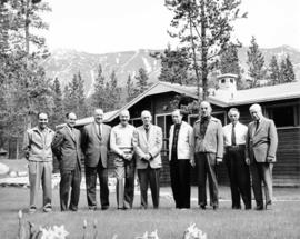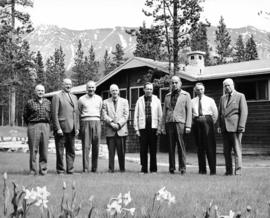
2000.1.1.4.3.11
·
Item
·
[ca. 1960]
Part of Cassiar Asbestos Corporation Ltd. fonds
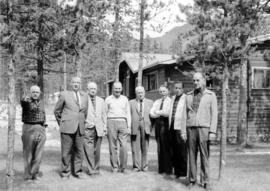
Photograph depicts group of eight men standing on lawn in front of building known as "House 130" or "Director's Lodge". Left to right: Nick Gritzuk, Charles Rainforth Elliot, W. Harold Connell, Jack Christian, Fred Martin Connell, Ken A. Creery, Plato Malezemoff (from Newmont Mining), Tam Zimmermann. Gritzuk appears to be pointing at photographer. Trees and mountains in background. Most men featured in photo are believed to be members of Cassiar's Board of Directors.