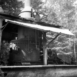
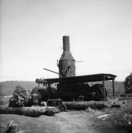
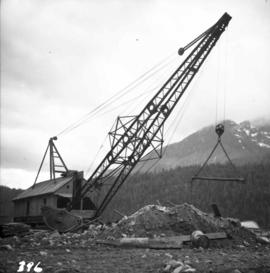
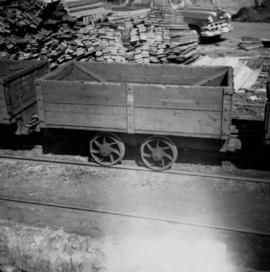
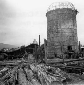
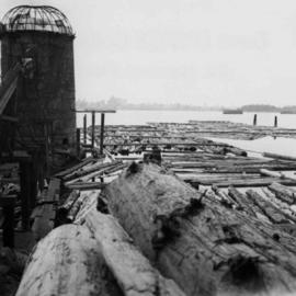
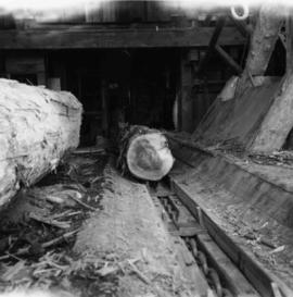
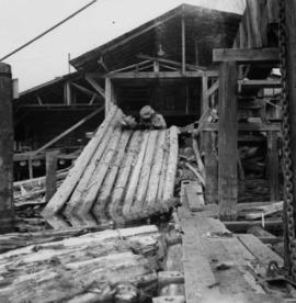
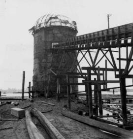
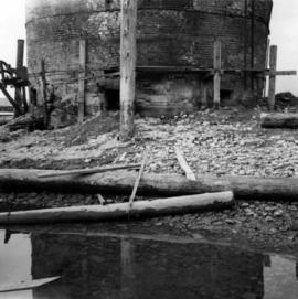
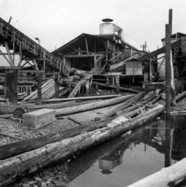
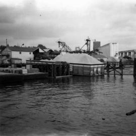
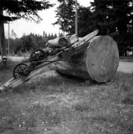
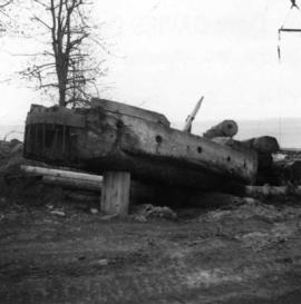
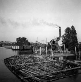
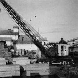
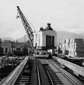
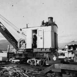
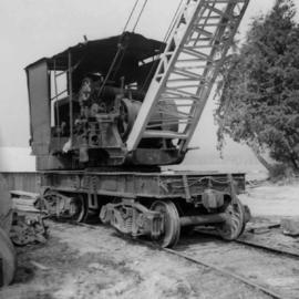
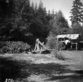
Photograph depicts a view of a steam donkey probably at Sayward near Kelsey Bay on North Vancouver Island.
Photograph depicts a Vancouver Iron Works built steam donkey in use until the early 1950s. It was purchased for $800 by an enthusiast in 1963 , set up beside home and roadside at Sayward near Kelsey Bay on North Vancouver Island.
Photograph depicts a tractor owned by G. Wellburn at the Duncan Forest Museum.
Map depicts the route of BC Rail and its connecting rail lines.
Map depicts location of treasure hidden between Clearwater and Clemina, BC.
Photograph depicts a steam donkey beside a mill pond of a shingle mill at Sappho or Tyee, on the Olympic Peninsula. It is steam fed from the main plant boiler.
Photograph depicts a steam donkey located in the Crown Zellerbach Museum at Ladysmith on Vancouver Island.
Photograph depicts a steam crane in the yard of the Lions Gate Lumber Co. at the foot of Lloyd St. in North Vancouver. The crane was made by the Brown Hoisting Machinery Co. in Cleveland, Ohio and is undated. It has a 20 ton capacity, is well maintained, and freshly painted.
Photograph depicts a steam crane in the yard of the Lions Gate Lumber Co. at the foot of Lloyd St. in North Vancouver. It is used to load scows from stacks shown to left and right of track. Thick baulks of timber on edges of pier are part of a safety device. Crane has transverse underframe which just clears these baulks normally. Under a heavy load and extended jib the underframe rests on the baulks.
Photograph depicts a steam crane in the yard of the Lions Gate Lumber Co. on the foot of Lloyd St. in the North Vancouver. It has been freshly painted with a yellow exterior, white interior, and black boiler.
Photograph depicts a steam crane in a lumber yard on the north side of Porpoise Bay in Sechelt on the Sechelt Peninsula. The steam crane has been converted to diesel and was made by the Brown Hoisting Co. from Cleveland, Ohio. It lifts 21 tons at a 12ft radius and 5 tons at 35ft radius, and is in daily use. The 200 yards of rail track form a "Y" with the bottom piece onto the wharf.
Photograph depicts a recently used steam crane, but driven by compressed air, at a former quarry at Granite Falls on the northeast end of the Indian Arm. The timbers on of the cabin were thick to withstand the blasting rock falls.
Photograph depicts a steam crane at the Allied Shipbuilders Ltd. on 145 West First Ave in Vancouver, BC
Photograph depicts an early spool donkey at the Cowichan Valley Forest Museum
Photograph depicts a small sawmill on the Old Yale Rd., near the intersection of Robson Rd. in South Westminster, Surrey.
Photograph depicts a small coal tram at Tsable coal pit near Fanny Bay on Vancouver Island.
Photograph depicts a small coal drift mine which worked perhaps 6 months prior to the picture being taken. Timber lands # 8, Cranberry, about 17 miles south of Nanaimo.
Photograph depicts a derelict shovel beside the coaling wharves at Union Bay.
Photograph depicts a general view of a Horne Bros. Ltd. shingle mill on #305 West Esplanade Rd. in North Vancouver.
Photograph depicts a view of the booming ground of the Horne Bros. Shingle Co. Ltd. On #305 West Esplanade Rd. in North Vancouver.
Photograph depicts a view of the main saw and bull chain of the Horne Bros. Ltd. Shingle mill on #305 West Esplanade Rd. in North Vancouver.
Photograph depicts the bull chain skid at the Horne Bros. Ltd. Shingle mill on #305 West Esplanade St. in North Vancouver.
Photograph depicts an abandoned brick burner now used to take excess steam blowing off from the wood fired double boiler. The burner is at the Horne Bros. Ltd. Shingle mill on #305 West Esplanade Rd. in North Vancouver.
Photograph depicts an unused brick burner, surrounded at high tide by sea water. The burner is at the Horne Bros Ltd. Shingle mill on #305 West Esplanade Rd. in North Vancouver.
Photograph depicts a general view of the Horne Bros. shingle mill on #305 West Esplanade Rd. in North Vancouver.
Photograph depicts a scow with chips landing on the north shore of Vancouver harbour. There are Saskatchewan wheat elevators in the background.
Photograph depicts a saw on the outskirts of Courtenay on the road to Cumberland.
Photograph depicts a Ruston steam roller owned by Gary Wellburn in Duncan, BCIt was previously owned by the Oak Bay municipality.
Photograph depicts the reverse view of a steam donkey at Sayward near Kelsey Bay on North Vancouver Island.
Photograph depicts the pit head refuse at Extension Coal Mine, 5 miles southwest of Nanaimo. It worked between 1901 and 1931.
Map depicts the Shuswap Lakes, Rogers Pass, Kamloops, Yellowhead Pass, Thompson Valley, and the Nicola Valley. Also includes the first clues to a treasure hunt.
Photograph depicts an oxen powered log carrier with wheels that are approximately 10 feet in diameter. It is at Pioneer Park and Museum near Totem Lake, 3 miles north of Yahk and 30 miles east of Creston.
Photograph depicts an old pelton wheel at a former quarry at Granite Falls on the northeast head of the Indian Arm.
Photograph depicts a once used booming boat made of log sections at a log dump on seashore about 5 miles north of Powell River, and opposite Harwood Island. Stern at left with prop guard.
Photograph depicts the newsprint plant of MacMillan, Bloedell, and Powell River Ltd. In Powell River, B.C. The view is looking northwards and shows that the plant is working on Easter Day/
Photograph depicts Moyie Lake, 15 miles south of Cranbrook, and Moyie Station. The tailings are from a lead and zinc mine directly to the right of the photograph on the hillside. The view is looking north.
Photograph depicts a mineral ore (lead or zinc?) mines near the ghost town of Sandon, on the road between Kaslo and New Denver.
Photograph depicts a mine ore car exhibited on the site of the Granby Mine at the ghost town of Phoenix, near Grand Forks.
Photograph depicts a mine 200 yards south of Moyie village, which is 20 miles south of Cranbrook. It produced silver, zinc, and lead from 1900-1910 and had a smelter a quarter mile away. The shaft was 900 ft. deep, with levels going under Moyie Lake. The head gear dates from 1925-1935 and has electric winding.
Photograph depicts a mine car at Moyie mine, at Moyie, 20 miles south of Cranbrook. The mine produced silver, zinc, and lead, and worked principally from 1900-1910. It is now disused.
Photograph depicts the mine buildings of the mine at Coal Creek that closed in 1959. The newer buildings date to circa 1930. Much of the standard gauge trackage of Morrissey, Fernie, and Michel railway (subsidiary of the Great Northern Railway) in mine area remains. The track between Coal Creek and Fernie has not been lifted.
Map depicts the routes of the Pacific Great Eastern Railway, showing stations, railway connection, and the PGE Microwave Communication System.
Photograph depicts a lumber yard on the north side of Porpoise Bay in Sechelt on the Sechelt Peninsula. The tank in the photograph is about 8 to 10 feet in diameter.
Photograph depicts a lumber mill probably in the Lower Mainland.
Photograph depicts a mill on the north stream of the north arm of the Fraser River, looking east from the Fraser St. bridge.
Photograph depicts dumping logs at Gold River on the west coast of Vancouver Island.
Photograph depicts logging on a side road on the Sechelt Peninsula about 2 miles southeast of Halfmoon Bay.