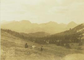
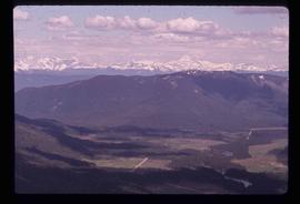
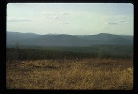
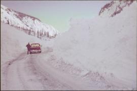
Man stands beside pickup truck on highway, hills in background.
Image depicts four individuals sitting on a log, possibly somewhere near the Hansard Bridge, B.C. The individuals are UNBC faculty members Gail Fondahl, Tracey Summerville, Greg Halseth and an unidentified individual. The slide is labelled: "Hansard Bridge UNBC." Map coordinates 54°04'37.7"N 121°50'39.9"W
Image depicts a two-room schoolhouse in Penny, B.C.
Photograph depicts a landscape shot of a body of water with two women standing on a forested shoreline in mid-ground with a mountain in the background.
Image depicts the hiking group packing their gear into two vans.
Four unidentified men look on, and portable buildings can be seen in background.
Handwritten annotation on verso reads: “Fairview Opening, Prince Rupert, 1/3/75”.
Image depicts two trucks on a road at an uncertain location.
Image depicts two individuals and two dogs standing by a stream at an uncertain location, possibly somewhere in Bear Glacier Provincial Park. The woman in purple is possibly Sue Sedgwick.
Image depicts two individuals and three dogs standing by a stream at an uncertain location, possibly somewhere in Bear Glacier Provincial Park. The woman in purple is possibly Sue Sedgwick.
Photograph depicts two people standing on a bridge over the Bulkley River by Moricetown.
Image depicts mountains in the background and two unidentified individuals standing on a dirt road in the bottom left corner. The location is uncertain, likely Longworth, B.C.
Image depicts two unknown individuals standing near a waterfall somewhere near Mt. Robson.
Image depicts two unidentified individuals speaking to each other in the doorway of what appears to be a mobile home. The location is uncertain.
Image depicts two unknown individuals standing by a glacier somewhere in Mt. Robson Provincial Park.
Photograph depicts two pack horses walking on a snowy trail through the brush of a forested environment.
Photograph depicts two unidentified men walking on a wooden bridge in a forest.
Photograph depicts two unidentified men walking across a large log over water at Knight's Inlet. Handwritten annotations on verso read: “W.C. Baker, Chaplain”; “Knights Inlet, 23 April 1960"
Photograph depicts two unidentified men standing at a snow-covered campsite with three tents and a forest in the background.
Photograph depicts two unidentified men standing on the rocky shoreline along the Peace River. In the background of the image a steep, tree-covered shoreline is visible.
Photograph depicts two men sitting on a staircase of a wooden walkway leading through a forest.
Photograph of two men posing with large surveyor's measuring sticks in a forested area during winter.
Photograph depicts two men on horseback and two fully laden pack horses riding across a grassy slope near a forest. In the background a mountain range is visible. The location of photo is between Wapiti Lake and Red Deer Valley.
Photograph depicts two men on horseback and a full laden pack horse riding across a grassy slope with a forested mountain range in the background. The location of photo is between Wapiti Lake and Red Deer Valley.
Photograph depicts two unidentified men on a wooden bridge that leads through a heavily wooded area.
Photograph depicts two unidentified men walking on a wooden bridge in a forest.
Photograph depicts two unidentified men, one with binoculars in hand, stand on a snowy mountain peak in search of game. Snowy mountain peaks visible in the background.
Handwritten caption beside this photo reads: "Cutting Fire Wood". Photograph depicts two men on either side of large log using chain saw in wood clearing. A small snow-covered building can be seen in background.
Handwritten caption above this photo reads: "Cutting Fire Wood". Photograph depicts two men on either side of large log using chain saw in wood clearing. A third man is watching them from behind the saw. A wood pile and small snow-covered building can be seen in background, as well as what is believed to be a caterpillar bulldozer.
Photograph depicts two unidentified men cooking on a fire at a camp site with a forest visible in the background.
Image depicts two men on the hiking trail near Mt. Robson.
Photograph depicts two large snowbanks flanking a walkway with houses visible in the background.
Image depicts two dogs and a person walking on a path through the woods somewhere in Carp Lake Provincial Park.
Grass in foreground, trees in background. Photograph speculated to have been taken in Nass Valley, B.C.
Image depicts two campers at an uncertain location, possibly somewhere near Meldrum Creek, B.C.
Trees on mountain base visible in background.
Photograph depicts a view of Tutizzi Lake in the summer near Jack Baker's cabin.
Image depicts a small section of Turner Lake, with what is most likely Glacier Mountain in the distance; they are located in South Tweedsmuir Park, B.C.
Image depicts the White Pass Train entering a tunnel in the mountain side.
Image depicts a view of Tumuch Lake Valley, south-east of Raven Peak.
Image depicts a view of the scenery in Tumbler Ridge, B.C.
Hand coloured photograph of the surrounding lands and many residential buildings encompassing the Tsimshian village of Lax Kw'alaams (previously called Port Simpson). Printed annotation on recto reads: "Indian Village, Port Simpson, B.C."
Image depicts two unknown individuals at the Tsilcoh Falls, north of Fort St. James and somewhere near Pinchi Lake Road.
Image depicts the Tsilcoh Falls, north of Fort St. James and somewhere near Pinchi Lake Road.
Image depicts the Tsek'enhe cemetery at McLeod Lake.