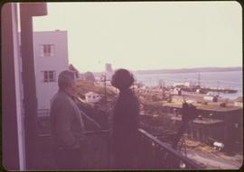
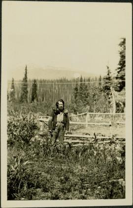
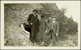
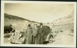
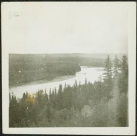
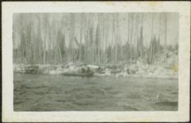
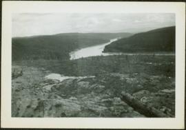
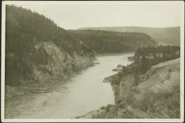
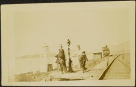
Men stand beside traffic light by the merge of two railway tracks. Shed and train car stand in midground, water and opposite shore in background.
Photograph depicts two unidentified men at high elevation on mountain. Trucks and tanks visible in background, hose (possibly of air track drill) in right foreground. Mountain range in background.
Photograph depicts two unidentified men on road or mining bench at high elevation on mountain, valley in background.
Handwritten annotation on recto of photograph: "Bill Giachino & 'Sam' June 1970 / #4 / 74% / by Tom Kiefer".
Photograph depicts two men believed to be North-West Mounted Police officers standing on either side of white packhorse. Forest and mountains in background. Photograph may have been taken in Vanderhoof, B.C.
Two men standing beside wheelbarrows with signs that read: “Prince Rupert Transfer Co.” The men appear to be standing on large dock or boardwalk, water and hills in background. Printed annotation on recto reads: “Prince Rupert First Transfer Company.” Handwritten message in pencil on verso is addressed to “Mr. Gordon Penning 1600 Bld. Barclay Vancouver B.C.” Cancelation date on 1 cent Canadian Stamp is dated “Prince Rupert B.C. July 16, 09”.
Image depicts two unknown individuals standing by a glacier somewhere in Mt. Robson Provincial Park.
Image depicts two unidentified individuals speaking to each other in the doorway of what appears to be a mobile home. The location is uncertain.
Image depicts two unknown individuals standing near a waterfall somewhere near Mt. Robson.
Image depicts mountains in the background and two unidentified individuals standing on a dirt road in the bottom left corner. The location is uncertain, likely Longworth, B.C.
Image depicts two individuals and three dogs standing by a stream at an uncertain location, possibly somewhere in Bear Glacier Provincial Park. The woman in purple is possibly Sue Sedgwick.
Image depicts two individuals and two dogs standing by a stream at an uncertain location, possibly somewhere in Bear Glacier Provincial Park. The woman in purple is possibly Sue Sedgwick.
Photograph depicts the profiled image of two saddled horses from Knox McCusker’s pack train; a snow capped mountain range is visible in the background, ca. 1930. Caption on verso reads: “K. McCusker”.
Image depicts two small sheds at an uncertain location. The slide labels them as "Giscome bldgs in Blackburn."
Image depicts two trucks on a road at an uncertain location.
Photograph depicts two boys standing on platform extending into lake. Buildings and fenced areas can be seen on shore in background. Handwritten annotation on recto of mounted slide reads: "boys playing on the lake / Legac".
Image depicts the hiking group packing their gear into two vans.
Photograph depicts two unidentified, young First Nations girls standing hand in hand on a rocky beach. Rail tracks extending from the water to the shore are visible in the lower right corner and in the background. Handwritten annotation on verso reads: “Kingcome Reserve”
Image depicts a two-room schoolhouse in Penny, B.C.
Image depicts four individuals sitting on a log, possibly somewhere near the Hansard Bridge, B.C. The individuals are UNBC faculty members Gail Fondahl, Tracey Summerville, Greg Halseth and an unidentified individual. The slide is labelled: "Hansard Bridge UNBC." Map coordinates 54°04'37.7"N 121°50'39.9"W
Fonds consists of maps, plans, and drawings collected by faculty in the UNBC School of Planning and Sustainability. The majority of these maps reflect the planning history of the City of Prince George and include large format, hand-drawn plans created by the City Planning Department from the 1970s and 1980s. Maps from City of Prince George Official Community Plans are also included.
File consists of notes, clippings, and reproductions relating to research of the Upper Fraser as part of the UNBC Upper Fraser Historical Geography Project. Includes photographs depicting students and professors researching in the Upper Fraser region (Dec. 1999).
File consists of notes and reproductions relating to the Upper Fraser Historical Geography Project done on the East Line and Upper Fraser in collaboration with the University of Northern British Columbia researchers. Includes a CD titled "Kent's Upper Fraser Files" containing Kent's research files for the Upper Fraser project (7 Jan. 2004) and a computer diskette titled "Oral Histories" containing an oral history interview with a woman (2004).
Photograph depicts bridge construction approaching unidentified river on opposite shore, unfinished pier in foreground. Steep riverbank in background.
Photograph depicts many buildings among forest trees on hillside of opposite shore. River in foreground.
Photograph depicts a woman in long coat and hat, standing with men in front of what appears to be a glacier. Four other individuals can be seen in distance on glacier.
Man stands beside pickup truck on highway, hills in background.
Photograph depicts a man seated with bundles and briefcase in front of two small log cabins with sod roofs. What appears to be an elevated log cache stands to left behind cabins, with a ladder raised to its door. Rocky, dry field crosses foreground, mountains visible in background.
Photograph depicts small boat on unidentified river or lake, trees on opposite shore in background.
Buildings can be seen in right background in front of trees, ocean on left.
Woman stands in front of sign that reads "ALASKA / STEWART 237 km / HYDER AK. 240 km / BEAR GLAC. 201 km". Second sign in background indicates restaurant, convenience store, and service centre. Car, road, and highway can be seen in midground; mountains in background. (This woman is also featured in item 2008.3.1.22.13).
Woman stands on road, arm raised to show scale of snowbank in background.
Photograph depicts ship resting almost entirely out of water.
Handwritten annotation on verso reads: "A slight steering problem? Union SS Catala on reef off Port Simpson".
Shows routes and ports of call from Smith Sound to Portland Canal including locations of many canneries and mines now no longer extent.
Photograph depicts wide body of still water, with rapids or small waterfall in bottom right corner. Shore in foreground, trees and hills on opposite shore in background.
Photograph depicts water with bog-like shore and ice floating in foreground. Buildings visible in distance, cliffs in background.
Photograph depicts what appears to be a row of small canoes in still water, opposite shore visible on horizon. Another small boat rests on dock in right foreground.
Photograph depicts a man cooking over campfire, log building and forest in background.
Grass area in foreground, forest and hills in background.
Photograph depicts man smoking pipe in area believed to be a mining location, sandy cliffs in background.
Photograph depicts four men wearing suits and ties, standing in front of mine adit in rocky area, bushes in background. Handwritten annotation on recto of photograph: "1939 H.F. (Bert) Glassey with black hit in middle" (information regarding Glassey believed to be incorrect).
Photograph depicts three men wearing suits and ties, posed in front of car in gravel area believed to be at a mining location. Hauling truck crosses road in midground, cliffs and hills in background.
Photograph depicts aerial view of unknown river winding through forest.
Photograph depicts river in foreground, trees on opposite shore in background. Photo also appears to depict two unidentified individuals on small boat or canoe.
Photograph depicts a river or lake, trees on shore in foreground.
Photograph depicts river winding through hills, cleared area in foreground. Handwritten annotation on recto of photograph: "slid".
Photograph depicts river winding through steep hills.