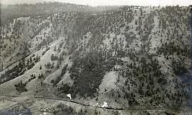
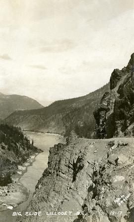
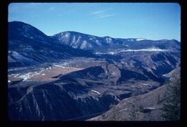
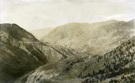
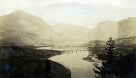
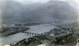
Photograph depicts the "Big Slide" at Lillooet. Also visible are a horse-drawn cart and the Fraser River.
Image depicts the Bridge River near Lillooet, B.C.
Photograph depicts a horseback rider crossing Cayoosh Creek at a log bridge near Lillooet.
Photograph depicts a view of fog over the Fraser River in the Lillooet area.
Image depicts the Fraser River in the Lillooet, B.C.
Image depicts a view of the Fraser River near Lillooet, B.C.
Image depicts the Fraser River near Lillooet, B.C.
Image depicts the Fraser River somewhere in the Lillooet area.
Image depicts the Fraser River near Lillooet, B.C.
Image depicts the Fraser River from the Moran railway point in the Lillooet area.
Image depicts a view of the Fraser River in Lillooet, B.C.
Image depicts a rail road bridge over the Fraser River, possibly somewhere in the Lillooet area.
Image depicts a road leading into a First Nations' Reserve at the head of Harrison Lake.
Photograph depicts a view of mountains, described as the head of Cayoosh Creek near Lillooet, BC.
Image depicts the head of Lillooet Lake.
Image depicts Lillooet, B.C.
Image depicts a view of Lillooet, B.C.
Image depicts two bridges over the Fraser River, located somewhere in Lillooet, B.C.
Image depicts some farmland in Lillooet, B.C.
Image depicts rows of water, possibly being irrigation ditches, somewhere in Lillooet, B.C.
Image depicts a view of the mountains surrounding Lillooet, B.C.
Image depicts a view of the Fraser River and the mountains surrounding Lillooet, B.C.
Image depicts an old church located somewhere in Lillooet, B.C.
Image depicts an area around Lillooet, B.C. It is possibly the Fraser River running through the Moran Canyon.
Image depicts the Lillooet River at the head of Lillooet Lake.
Image depicts the Lillooet River delta at the head of Lillooet Lake.
Image depicts the Fraser River running through the Moran Canyon near Lillooet, B.C.
Image depicts the Moran Canyon near Lillooet, B.C.
Image depicts what is possibly the Fraser River running through the Moran Canyon near Lillooet, B.C.
Photograph depicts a view of the Fraser River, scrub land, and mountains in the Moran Canyon area near Lillooet.
Image depicts the Fraser River near Lillooet, B.C.
Image depicts a view of the scenery near Lillooet, B.C.
Photograph depicts a view of the Pacific Great Eastern Railway bridge across the Fraser River at Lillooet.
Photograph depicts a view of the Pacific Great Eastern Railway bridge across the Fraser River and the nearby Lillooet surrounding area. The photograph shows Lillooet looking up Town Creek Valley. Chinese gold washing activity is visible nearby the bridge.
Photograph depicts a view of a train on the Pacific Great Eastern Railway line approximately 2 miles south of the Pavilion station.