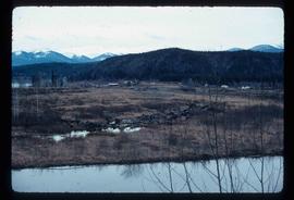
Mostrando 1985 resultados

Archival description
Creek
2012.13.1.31.16 · Item · 1985
Parte de J. Kent Sedgwick fonds

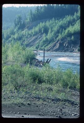
Image depicts a creek near Quesnelle Forks, B.C.

Creek
2012.13.1.41.10 · Item · 2002
Parte de J. Kent Sedgwick fonds

Image depicts a creek near Iron Road North, north of Woodpecker, B.C.

Creek
2012.13.1.41.09 · Item · 2002
Parte de J. Kent Sedgwick fonds

Image depicts a creek near Iron Road North, north of Woodpecker, B.C.

Crestbrook Forest Industries Operations
2012.13.1.122.34 · Item · July 1982
Parte de J. Kent Sedgwick fonds

Image depicts a man attaching a logging trailer to a crane on a wooden structure to stack the trailer on the truck. A Crestbrook Forest Industries sawmill is located in the background.

Crevasse Filling - "Drift Ridge"
2012.13.1.124.06 · Item · 1972
Parte de J. Kent Sedgwick fonds

Image depicts a group of unidentified individuals walking along a crevasse filled ridge somewhere in the vicinity of Smithers, B.C. The slide also labels it as a "drift ridge."

Cross Country Skier
2012.13.1.129.21 · Item · 1989
Parte de J. Kent Sedgwick fonds

Image depicts an unidentified man cross country skiing somewhere on Tabor Mountain in Prince George, B.C.

Cross Country Skiing
2012.13.1.129.03 · Item · 1975
Parte de J. Kent Sedgwick fonds

Image depicts a long line of people cross country skiing somewhere on Tabor Mountain in Prince George, B.C.

Cypress Hill?
2012.13.1.121.09 · Item · July 1970
Parte de J. Kent Sedgwick fonds

Image depicts two unidentified individuals and a van on a farm at an uncertain location, possibly a place called Cypress Hill, with an atmometer and a sunshine recorder.

Dark Image
2012.13.1.60.12 · Item · July 1973
Parte de J. Kent Sedgwick fonds

Image depicts light from an unidentified light-source shining on a long, vertical object of an uncertain nature, though it is possibly a tree. The rest of the image is too dark to make out.

Dawson Creek
2012.13.1.91.01 · Item · Sep. 1974
Parte de J. Kent Sedgwick fonds

Image depicts a road with a guardrail and open fields somewhere near Dawson Creek, B.C.

Demolished House
2012.13.1.22.05 · Item · 1970
Parte de J. Kent Sedgwick fonds

Image depicts the rubble of a demolished house at Island Cache, with several other buildings in the background.

Dilapidated Property for Sale
2012.13.1.87.065 · Item · [between 1975 and 1995]
Parte de J. Kent Sedgwick fonds

Image depicts an old house for sale surrounded by overgrown bushes in Upper Fraser, B.C. Map coordinates 54°07'15.0"N 121°57'02.0"W

Dirt Road
2012.13.1.87.024 · Item · [between 1975 and 1995]
Parte de J. Kent Sedgwick fonds

Image depicts a dirt road leading through numerous trees toward a mountain. The location is uncertain, likely on the way to Longworth, B.C.

Dirt Road
2012.13.1.87.025 · Item · [between 1975 and 1995]
Parte de J. Kent Sedgwick fonds

Image depicts a dirt road leading through numerous trees toward a mountain. The location is uncertain, likely on the way to Longworth, B.C.

Disturbed Ground
2012.13.1.50.117 · Item · 1980
Parte de J. Kent Sedgwick fonds

Image depicts an area of disturbed ground, most likely due to a landslide, at an unknown location.

Disturbed Ground
2012.13.1.50.119 · Item · 1980
Parte de J. Kent Sedgwick fonds

Image depicts an area of disturbed ground, most likely due to a landslide, at an unknown location.