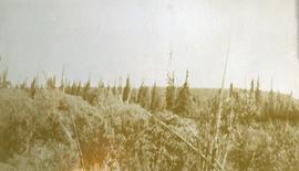
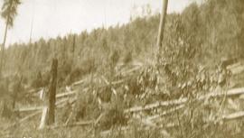
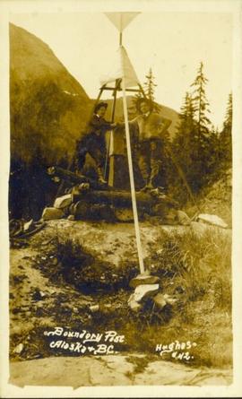
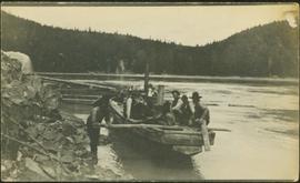
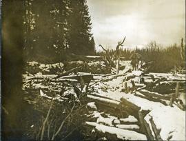
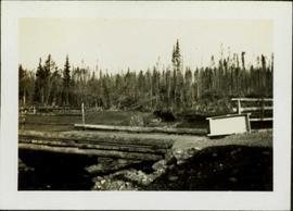
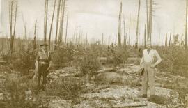
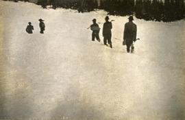
Photograph depicts two men standing in center foreground, forested flat land in background.
Photograph depicts forest growth near Woodpecker Island and Stone Creek.
Photograph depicts forest growth with fallen trees and remnants of a forest fire.
Photograph of two men posing next to a four-legged post erected in the wilderness. Printed annotation on recto reads: "Boundery[sic] Post Alaska & BC. Hughes #42."
Photograph depicts group of men seated on scow carrying unidentified material. One man stands on rocky shore in left foreground, leaning on plank attached to scow. A second scow can be seen behind men. Tree-covered hills on opposite shore in background.
Image depicts what is possibly the Bowron River. The slide is simply labelled "Bowron Canyon."
Image depicts what is possibly the Bowron River from a bridge. The slide is simply labelled "Bowron Canyon."
Image depicts what appears to be a log jam on what is possibly the Bowron River. The slide is simply labelled "Bowron Canyon."
Image depicts Bralorne, B.C.
Image depicts an area of Barlone, B.C. surrounded by trees.
Image depicts a church and a row of houses in Bralorne, B.C.
Image depicts a few boarded-up buildings in Bralorne, B.C.
Image depicts a row of houses in Bralorne, B.C.
Image depicts several houses in Bralorne, B.C.
Image depicts what is possibly an old, rundown mill in Bralorne, B.C.
Image depicts the old sales office of Bralorne Pioneer Mines Ltd. which is now the Bralorne Pioneer Museum.
Photograph depicts the waterfall Brandywine Falls.
Photograph depicts A cluster of boats anchored on the edge of a stream, some men standing on shore. Photograph is dark and blurry.
Photograph depicts a bow of a boat in the foreground. Thick ice on the edges of the river, water with floating ice beyond the boat. Trees lines the shoreline.
Photograph depicts five men carrying shovels, walking through the snow in single file.
Image depicts a bridge under construction in Tumbler Ridge, B.C.
Image depicts a bridge in Prince George, B.C.
Photograph depicts a view of a small bridge and dirt road joining buildings on two sides of a river. Loaded packhorses are traveling down the road. There are mountains in the distance. Survey of 55th parallel.
Photograph depicts a rustic bridge covered in snow leading across a log jam. A horse is walking on the bridge toward the photographer. [55th parallel]
Photograph depicts a trail through log jam built by survey party. [55th parallel]
Image depicts a river in Tumbler Ridge, B.C. The bridge crossing it appears to be either half-missing or incomplete.
Photograph depicts the bridge at Goodacre Pond in Beacon Hill in Victoria, BC. Duck in foreground.
Photograph depicts the bridge at Goodacre Pond in Beacon Hill in Victoria, BC. Swans are swimming in the pond and there is a path and footbridge behind the pond.
Photograph depicts bridge built with wooden planks and poles, with triangles built into its frame. Water rapids in foreground, opposite shore in background behind bridge. This is speculated to be one of the bridges that crossed the Hagwilget Canyon on the Bulkey River since 1859, five kilometres from its confluence with the Skeena River. See items 2009.5.1.69 - 2009.5.1.71.
Photograph depicts a log bridge interrupting a wide dirt road in forest. Distant hills in background. Image has been cropped to an oval shape. Handwritten annotation on verso of photograph: "Fort George - Hazleton Highway Near Burn's Lake".
Photograph depicts a short wooden bridge spanning Dog Creek mid-ground and a stand of trees in the background. There are many Dog Creeks within British Columbia, it is believed this Dog Creek is located just south of Fort St. James, BC. Handwritten photo caption below photograph reads: "Dog Creek".
Image depicts the Bridge River near Lillooet, B.C.
Image depicts the Bridge River No. 1 hydroelectric station on the shore of Seton Lake (rear side of powerhouse).
Photograph depicts Moran standing in front of bridge featuring a sign reading "USE OF BRIDGE AT YOUR OWN RISK / GITWINKSIHLKW BAND COUNCIL". River below, hills on opposite shore in background.
Bridget Moran stands on road, unidentified buildings behind on either side. Lake and hills on opposite shore in background. Photo believed to be taken at Metlakatla Lake, B.C. Building on left speculated to be the St. Paul's Anglican Church Learning Centre.
Profile of Moran, wake visible in water behind her. Opposite shore in background.
Photograph depicts unknown lake. Moran slightly visible in far left. Village can be seen on opposite shore in background.
Photograph depicts three women standing on beach in their Women's Royal Canadian Naval Service uniform. Waves and rocks in background. Handwritten annotation on recto of photograph: "Do you believe this?" Left to right: Bridget Moran, Betty Pincombe (aka 'Chick'), and Grace Boice (aka Tommy).
Photograph depicts three women sitting on beach in their Women's Royal Canadian Naval Service uniform. Purses and shoes lay beside them, large rock stands in background. Handwritten annotation on recto of photograph: "The California 'Beauties' 1946." Left to right: Betty Pincombe (aka 'Chick'), Bridget Moran, and Grace Boice (aka Tommy).
Image depicts an old building, possibly located at the closed Britannia Mine.
The map depicts the biotic regions and forests in British Columbia.
Map depicts the climactic regions of British Columbia which includes the coast, interior, and the northwest.
Photograph depicts a coastal landscape, possibly in northern British Columbia or Haida Gwaii.
Photograph depicts the British Columbia coastal shoreline, possibly near Haida Gwaii.
The map depicts the highest mountains in British Columbia; includes the Rocky Mountains, the Northern and Southern Plateaus, and the Mackenzie Mountain area.
Photograph depicts the British Columbia Parliament Buildings in Victoria, BC.