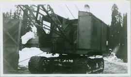
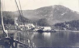
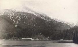
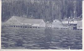
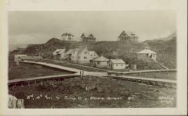
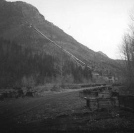
Image depicts the inside of a mine with an unknown individual present. It is possibly the inside of the closed Britannia Mine.
Image depicts the Bridge River No. 1 hydroelectric station on the shore of Seton Lake (rear side of powerhouse).
Image depicts the old sales office of Bralorne Pioneer Mines Ltd. which is now the Bralorne Pioneer Museum.
Image depicts what is possibly an old, rundown mill in Bralorne, B.C.
Photograph depicts body of dragline crane in snowy area, trees, building, and other vehicles in background. A wood door or structure is semi-visible on far left.
Photograph depicts the "Little Current" and other boats at the Prince Rupert marina.
Photograph depicts a hoist and many unidentified boats at the Prince Rupert marina.
Photograph depicts boat on right, cannery on left, dock crossing midground in front of both. Shore in foreground, hills in background.
Photograph depicts an unidentified fishing boat at the Prince Rupert marina.
Photograph depicts a snow-covered forest clearing with six structures and a truck. Buildings have been numbered 1-8 with pen. Original handwritten annotations on verso of photograph are signed by Tom Marsh. Photograph is taped to paper. Typed annotation on recto of paper reads: “1. Bridge over creek. 2. Blacksmith shop. 3. Powerhouse. 4. Headframe over 200’ shaft. 5. Office 6. Water tanks from powerhouse. 7. Bunkhouse. 8. Truck. 9. Cookhouse behind #6 cannot be seen. We were always able to find the cookhouse even though hidden in this picture. Taken about 1935 by Russell Ross, supt. Quesnel Quarts Mine. Tom Marsh, Box 156, Squamish B. C.”
Photograph depicts William (Bill) Storie at location known as Limestone Mountain, southwest of Cassiar, B.C. Photo features profile of Bill, hands in pocket, Cassiar valley and mountains in background. Storie was a renowned prospector in the Cassiar area, and the new school at Cassiar was named for him in 1992.
Photograph of a large explosion on what appears to be a shoreline. Printed annotation on recto reads: "'Big Blast' Prince Rupert. B.C."
Photograph shows a large explosion surrounded by clearcut brush. Some machinery is visible in the foreground. Annotation on recto reads: "Big Blast at Prince Rupert BC Aug 17/08 Allen Photo."
Handwritten caption above this photo reads: "Bert Youngtrom Pile Driver." Photograph depicts Bert standing on top platform of pile driver apparently without safety gear. Forest trees and white tent in background. Tracks made by machinery cross foreground.
Photograph depicts Bert Youngstrom leaning on one of two gas pumps in front of three long buildings. Trees can be seen in background, as well as snow all around. Steel drums an other miscellaneous material surround the buildings. Handwritten captions above and beside this photo read: "Bert Youngstrom" "Shop & Warehouse".
Handwritten caption beside this photo reads: "Bert and Kitchen Staff". Photograph depicts Bert (Youngstrom?) standing close to a woman and young girl on snow in front of unidentified buildings. Forest trees can be seen in background. It is believed that this photo was taken at the camp in Summit Lake, B.C. (see item 2005.3.57).
Item is a photograph of Bert Leboe, MP for Peace River, watching the construction of a trading boat traditionally used in the Peace / Parsnip area. These boats were used to conduct surveys and transport supplies during the construction of the W.A.C. Bennett Dam.
Foreground shows two rocky shores covered in dirt and wood debris, connected by a barely visible bridge. Annotation on recto reads: "Before the Blast Apr. 24th 13"
Image depicts a Beehive Burner along the Nechako on River Road. Map coordinates 53°55'34.1"N 122°44'58.0"W
Photograph depicts a beehive burner at Brownsville Sawmills Ltd. On Olson St. in south Westminster, Surrey. It is on the banks of the Fraser River just below the Patullo Bridge.
Image depicts a bee-hive burner beside a rail-road track at an unidentified mill somewhere in Prince George, B.C.
Image depicts the BCR tracks passing through a mill somewhere near the 100 Mile.
Image depicts a Hydraulic Placer mining location in Barkerville which has been completely deforested.
Image depicts numerous logs that have been stripped of their bark at a saw mill in Prince George, B.C.
Photograph depicts families at Dedrickson’s Camp at Drury Inlet standing on a wharf on baptism day.
Item is a photo of men doing construction with wood.
Item is a photograph of a stack of logs with a crane in the background.
Item is a photograph of men talking in a lumber yard.
Item is a photograph of a man operating a piece of wood cutting machinery.
Item is a photograph of a man on the side of a river fishing with a net.
Item is a photograph of two men swede sawing a log.
Item is a photograph of a man making furniture.
Item is a photograph of a fishing boat with the net deployed with other boats and people on shore.
Item is a photograph of people fishing in a boat with nets.
Item is a photograph of men doing wood construction.
Item is a photograph of a boat under construction.
Photograph depicts a baby seal at C.N. log drop at Cowichan Lake on Vancouver Island.
Photograph depicts samples of Cassiar asbestos.
Photograph depicts snow-plowed road lined with trees, valley and mountain in background. Believed to have been taken from vehicle. Handwritten annotation on recto of photograph: "Approach to Quartz Rock Creek".
Image depicts the Alcan smelter in Kitimat, B.C.
Foreground shows a rocky shore covered in debris. A small crowd is visible along the coastline, and there are foggy outlines of hills beyond the water. Annotation on recto reads: "McRae Bros After the Blast 24th Apr. 13."
Wide angle photograph of a crowd milling around railroad tracks. A large pile of rubble and various buildings are visible on the right side. Annotation on recto reads: "After the Blast 21 Jan 1914 McRae Bros Photo."
Photograph of the bay at dusk. Trees and distant machinery are silhouetted against a cloudy sky and dark waterfront. Annotation on recto reads: "Across the Bay, Prince Rupert, BC No 4466."
Photograph depicts an abandoned coal mine in Coal Creek, 5 miles east of Fernie, BCThe entrance to the mine is unusual and is 2/3rds up the mountainside. The mine was closed in 1959. Flat ground in foreground is littered with at least 100 mine tubs of approximately 3'0' gauge.
Photograph depicts a man standing on the deck of a sailboat with a view of a cannery along the shoreline of Ocean Falls with mountains in the background.
Photograph depicts a cannery in front of a forested mountains with water in the foreground.
Photograph depicts a cannery on pilings with a body of water in the foreground and houses and trees in the background.
Photograph shows two men and a cart full of lumber at a street intersection. Various residential buildings are visible in the background and atop a large clear cut hill. Annotation on recto reads: "3rd, 4th Aves and Fullton St. Prince Rupert. BC. Allen Photo 8/Aug/09."