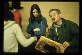
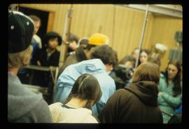
Image depicts a large group of people in a room at an uncertain location in the Peace River Region.
Image depicts numerous individuals who appear to be searching among the rocks on a ledge at an uncertain location in the Peace River Region.
Image depicts several unidentified individuals standing in front of a store selling honey.
Image depicts an unidentified man holding what appears to be a broken screen of honeycombs. The group is likely at an educational event.
Image depicts a view of numerous houses and a ballpark at an uncertain location. It is possibly located somewhere in the Peace River Region.
Image depicts a cabin and several other buildings, possibly located in Hudson's Hope, B.C.
Image depicts a road and numerous buildings in Hudson's Hope, B.C.
Image depicts a street in Hudson's Hope, B.C.
Image depicts what appears to be a Fire Hall in Hudson's Hope, B.C.
Image depicts an old, three-storey building beside a two-storey hotel in Hudson's Hope, B.C.
Image depicts two houses in Hudson's Hope, B.C.
Image depicts a street with a building which is labelled "MacKeigan Enterprises Ltd." in Hudson's Hope, B.C.
Image depicts what appears to be a motel in Hudson's Hope, B.C. The slide is labelled "camp HH."
Image depicts the log building that acts as the public library in Hudson's Hope, B.C.
Image depicts the W.A.C. Bennett Dam in Hudson's Hope, B.C.
Image depicts two individuals at work inside what appears to be a piece of machinery. It is possibly located somewhere in Fort St. John, B.C.
Image depicts a large group of people sitting and eating near a bridge at an uncertain location, though possibly near Hudson's Hope, B.C.
Image depicts a piece of machinery shaped like a large metal cylinder. It is possibly located somewhere in Fort St. John, B.C.
Image depicts an unidentified man in a yellow hat who appears to be speaking to large group of people. It is possibly an educational event.
Image depicts an unidentified man in a yellow hat who appears to be speaking to large group of people and showing them small pieces of wood. It is possibly an educational event.
Image depicts an obstructed view of Moberly Lake, located north of Chetwynd and south of Hudson's Hope, B.C.
Image depicts a delta at Moberly Lake north of Chetwynd and south of Hudson's Hope, B.C.
Image depicts a group of unidentified individuals look through an observatory window at an uncertain location, possibly in Fort St. John, B.C.
Image depicts a group of people throwing a frisbee in a parking lot at an uncertain location, likely in the Peace River Region.
Image depicts the Peace Canyon Dam and generating station under construction on the Peace River.
Image depicts the Peace River, possibly near Clayhurst or Hudson's Hope, B.C.
Image depicts what is possibly the Peace River.
Image depicts a river, possibly the Peace River.
Image depicts what is possibly the Peace River running parallel to a road, possibly Highway 29.
Image depicts the Peace River.
Image depicts the Peace River and visible layers of sediment deposits in the surrounding cliffs.
Image depicts the Peace River, possibly somewhere near Fort St. John, B.C.
Image depicts the Peace River, possibly near Hudson's Hope, B.C.
Image depicts a dam, possibly on the Peace River.
Image depicts a dam on what is possibly the Peace River.
Image depicts a dam and a reservoir of water, possibly on the Peace River.
Image depicts what is possibly the Peace River running next to some farm land at an uncertain location.
Image depicts a large group of unidentified individuals sitting on a hill; what is possibly the Peace River is visible in the background.
Image depicts the W.A.C. Bennett Dam on the Peace River in Hudson's Hope, B.C.
Image depicts a street of shops at an uncertain location somewhere in the Peace River Regional District. A pink and blue building, possibly a theatre, is labelled "Lux."
Image depicts grass burning at an uncertain location in the Peace River Region.
Image depicts a section of forest located somewhere in the Peace River Regional District of B.C.
Image depicts several unidentified individuals and a bridge behind them; it is possibly crossing the Peace River.
Image depicts several unidentified individuals standing on a bridge; it possibly crosses the peace River.