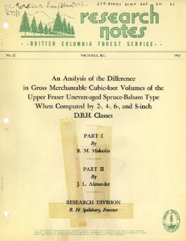
Item is "An Analysis of the Difference in Gross Merchantable Cubic-foot Volumes of the Upper Fraser Uneven-aged Spruce-Balsam Type When Computed by 2-, 4-, 6-, and 8-inch D.B.H. Classes" from the BC Forest Service "Research Notes" series.
File contains a 1997 field tour guide of the Aleza Lake Research Forest, and 1997 and 1998 government publications on research projects conducted at the forest.
File contains articles and government publications on the results of research projects and policies regarding the Aleza Lake Experiment Station with years ranging from 1945 to 1992. Also included are a photocopied 1926 progress report, a 1967 management manual, and guides pertaining to trails and marking stands for cutting.
File contains reports and essays on certain research projects ranging from the year 1924 to 1984. The topics of these research projects include cutting methods, guidelines for marking techniques, and scarification.
Item is a photograph of a copy print that has been reproduced as a slide, resulting in low photographic quality. Location of original photograph unknown.
"After we made the acquaintance of several girls living in Aleza Lake village, they would be invited to come to the camp on a Sunday to enjoy the music. Social events were infrequent, so they did not complain about having to travel three miles by rail and then walking another three-quarters of a mile on a foot trail that was sometimes quite muddy." -- quote from Cedric Walker in "An Early History of the Research Branch, British Columbia Ministry of Forests and Range" (p. 48)
File contains Aleza Lake Research Forest weather records from 1927 to 1934 and 1928 to 1933.
File consists of documents, radiograms, and correspondence regarding various administrative issues ranging from costs, living conditions, timber sales, research projects, and queries from the public. Much of this correspondence is between Tim Decie, Forester in Charge of Aleza Lake, and R.P Silsbury, Head of the Research Division between the years of 1953 and 1967. Also included are contracts and receipts from 1964, documents regarding the closure of the Aleza Lake Experiment Station, and meeting minutes.
File contains 1991 regeneration data of permanent sample plots and a 1992 work term study report on the significance of the basal area on regeneration factors.
File contains 1996 charts of permanent sample plot remeasurements.
File contains photocopies of survey notes from 1954.
Item is a 3.5" floppy labelled "Aleza Lake Stem Map Data – AutoCAD Release 14 – Northline 1998". Floppy contains the following file: mofcopy.dwg.
Item is a photograph of a copy print that has been reproduced as a slide, resulting in low photographic quality. Location of original photograph unknown.
File contains proposal updates and project expenditure lists.
File contains photocopies of seedling measurement tables.
File contains original tables for soil measurements, a related photocopied draft report, and related photocopied handwritten notes.
File contains reports on soil rehabilitation projects and related correspondence, photocopied tables of soil measurements, and reports on machinery costs when tilling.
File contains reports on soil rehabilitation project and related correspondence, photocopied tables of soil measurements, and photocopied pages of ledgers with diagrams and notes.
File contains climate data of soil and air temperatures, correspondence relating to climate studies, original and photocopied receipts for items related to the study, and computer generated graphs.
File consists of chainsaw-cut stump data in selected plots for June and July 1993 and May 1994.
File contains road reconstruction project reports, photocopies of invoices and work orders, records of daily costs, photocopies of hired equipment daily time reports, related correspondence, and maps.
Item is a computer print-out of PSP data from Aleza Lake Research Forest.
File contains official government reports on tree types, correspondence regarding research proposals, and working plans.
Large scale map shows Aleza Lake Research Forest permanent sample plot 112. Includes information about live and dead trees and their species (spruce, balsam, birch, douglas fir). Also includes remeasurement history. Plot 112 was established in 1926 and is an unlogged, old growth, uneven aged, spruce-balsam stand.
Large scale map shows Aleza Lake Research Forest permanent sample plot 103. Includes information about live and dead trees and their species (spruce, balsam, birch, douglas fir). Also includes remeasurement history. Plot 103 was established in 1926 and is an unlogged, old growth, uneven aged, spruce-balsam stand.
File contains typed file notes and charts of remeasured experimental plots, as well as a floppy disk
File contains research project reports and charts of remeasured permanent sample plots.
File contains handwritten journal lists of remeasured permanent sample plots and charts of remeasured permanent sample plots.
File contains charts consisting of the remeasurements of the basal area and cut stump data in permanent sample plots.
Map reflects boundaries for the Aleza Lake Experiment Station, permanent sample plots, timber sales locations, and the Ecological Reserve.
Maps reflect reserve boundary, roads, trails, 20 feet contour intervals, air photo centre, declination, swamps, and mile post.
Map reflects forest type boundary line, bogs and swampy non-forested areas, creeks, lakes, rivers, tree species labels of spruce, balsam, and birch, stand descriptions, historical timber sale boundaries, stand history symbol, gravelled secondary roads, unimproved old roads, management compartment boundary, research forest boundary, ecological reserve boundary, and old growth emphasis areas.
File contains various documents pertaining to the history of the Aleza Lake Experiment Station, correspondence regarding various administrative issues and research projects ranging from 1972 to 1996, field notes, 1996 meeting minutes, memoranda containing details on the management and preservation of the Aleza Lake Research Forest, various reports on research projects, 1987 permits, field notes, a 1970 working plan, and 6 colour photographs of the Aleza Lake Garbage Dump.
File contains plot summaries of selected permanent sample plots, correspondence regarding field courses, records of management committee meetings from 1991 and 1990, documents and correspondence pertaining to the re-opening of the Aleza Lake Research Forest, partial cutting summaries, research proposals and studies, cost and revenues documents, a 1961 biography on Percy Barr, charts covering remeasurements of permanent sample plots, hand written correspondence from 1990 discussing the history of marking crews, and a brief history of the Aleza Lake Experiment Station.
Map commissioned from Ministry of Forests Prince George Region from Madrone Consultants shows an Aleza Lake Research Forest TRIM Base Map. Map is 4 of 6. Map shows the following: roads, old roads, buildings, rail line, transmission line, definite streams, intermittent streams, indefinite streams, marshes, swamps, lakes, wooded area boundaries, intermediate contour lines (20m intervals), and index contour lines (100m intervals).
File contains trail guide brochures, a 1931 original copy of the Aleza Lake Experiment Station statement of its purpose and development, and other forest related brochures and books.
File contains a trail guide, a report on potential trail building, and related maps.
Map commissioned from Ministry of Forests Prince George Region from Madrone Consultants shows Aleza Lake Research Forest terrain themes. Map is 6 of 6. Map shows the following types of terrain units: typic, slope, percipitous, gullied, hummocky, rocky, alluvial, and organic. Ecosystem classification and mapping by Oikos Ecological Services Ltd.
Map commissioned from Ministry of Forests Prince George Region from Madrone Consultants shows Aleza Lake Research Forest Terrain Resource Inventory Mapping (TRIM). Depicts roads, area boundaries, swamps, streams, marshes, contour lines and index lines.
Map commissioned from Ministry of Forests Prince George Region from Madrone Consultants shows Aleza Lake Research Forest site series classification. Shows ecosystem types that encompass the SBSwk1 Subzone of the Aleza Lake Research Forest.
Map commissioned from Ministry of Forests Prince George Region from Madrone Consultants shows Aleza Lake Research Forest Research Trials and Permanent Plots. Map is 2 of 6. Map shows permanent plot locations, historical timber sales areas, demonstration areas, and research plots.
File contains an original informational brochure on ecological reserves in British Columbia and correspondence relating to the transfer of the Aleza Lake Research Forest to a university research forest.