2006.20.9.30
·
Item
·
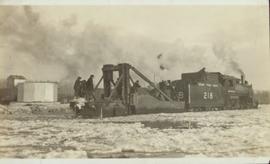
December 1921
Part of Northern BC Archives Historical Photograph Collection
Front view of several men working on Grand Trunk Pacific train 218 in the winter. Handwritten annotation in pencil on verso of postcard reads: “Prince George, B.C., Dec. 1921 yard & main line.”