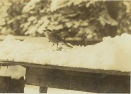
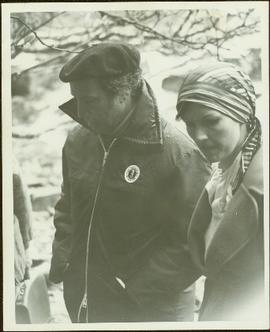
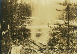
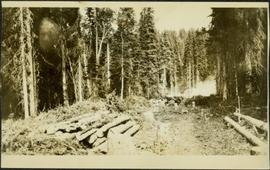
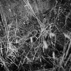
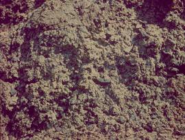
Photograph depicts a close-up view of a snake.
Photograph depicts a close-up of a bird on a snow-covered ledge with trees in the background.
Photograph depicts exposed asbestos fibre in talus.
Photograph is one of 13 images printed from digital format on a CD-R featuring members of a group referred to as 'Terracites' (see item 2009.6.1.697) pictured in the gardens; see also items 2009.6.1.698 - 2009.6.1.710.
Photograph is one of 13 images printed from digital format on a CD-R featuring members of a group referred to as 'Terracites' (see item 2009.6.1.697) pictured in the gardens; see also items 2009.6.1.698 - 2009.6.1.709.
Handwritten annotation on verso reads: “With the boss at Kivsta, Q.C.I.: May 1976, 13,000 yrs. carbondated habitation in the same location-- The real Charlottes and his counter culture protection in the rain, mist, moss and dense forest of the Haida”.
Photograph is one of 13 images printed from digital format on a CD-R featuring members of a group referred to as 'Terracites' (see item 2009.6.1.697) pictured in the gardens; see also items 2009.6.1.698 - 2009.6.1.710.
Grass in foreground, trees in background. Photograph speculated to have been taken in Nass Valley, B.C.
Photograph is one of 13 images printed from digital format on a CD-R featuring members of a group referred to as 'Terracites' (see item 2009.6.1.697) pictured in the gardens; see also items 2009.6.1.698 - 2009.6.1.710.
Close up photograph of a large residential building in a freshly clear cut area. To the right of the main building is the church and an unidentified commercial building. Annotation on recto reads: "Prince Rupert, BC 1660."
Photograph depicts a close up of tree regrowth at an old burn site. Fallen logs piled on top of each other are seen in the clearing between the areas of regrowth.
File consists of newspaper clippings and excerpted articles from various B.C. newspapers and magazines regarding the Nechako-Alcan controversy and the Kemano Completion Project. Also includes issues of the Rivers Defense Coalition newsletter and the Telkwa Foundation Newsletter.
Cassiar Asbestos Corporation Ltd opened a second mine in 1967 at what became the one-industry town of Clinton Creek, Y.T. File contains photographs depicting different areas of operations at Clinton Creek. Locations include the mine, plant, town, tailings pile, main office, the 40 Mile River, and surrounding area. Town photos depict the grocery store, cafeteria, medical clinic, school, auditorium residential area, Connell Street and power house. File also includes aerial photographs and images depicting forest fighting, photographers capturing the tailings pile, asbestos samples, mining machinery, staff offices, and operations in the mill, lab, and garage.
Additional photographs integrated into file depict Clinton Creek's surrounding area, and three slides of a tailing pile explosion believed to be Clinton Creek.
Image depicts a view of the scenery near Clinton, B.C.
Image depicts a climbing either up or down a rock face.
Image depicts a camper passing under an overhang as it drives along a narrow road near a cliff; located somewhere near Bralorne, B.C.
Image depicts a camper parked on the side of a narrow road along a cliff as another car approaches; located somewhere near Bralorne, B.C.
Photograph depicts tree stumps in forest clearing of the railway right-of-way.
Photograph depicts stumps and log piles in forest clearing of the railway right-of-way.
Photograph depicts men walking among stumps and log piles in forest clearing of the railway right-of-way.
Photograph depicts smoke, stumps and log piles in forest clearing of the railway right-of-way.
Slide depicts a cleared area in a forest, likely at the Aleza Lake Experiment Station.
Image depicts a clearing at Island Cache.
Photograph depicts cleared area of forest, vehicle tracks visible in the mud, and a large dirt area in midground.
Slide depicts a cleared area at the Aleza Lake Experiment Station with plant regeneration.
Image depicts a highway, and a section of mountain in the background which is bare due to clear-cut logging. It is possibly somewhere near Prince George, B.C.
Image depicts a logging area, and a section of mountain in the background which is bare due to clear-cut logging. The slide is also labelled "logging show." It is possibly somewhere near Prince George, B.C.
Image depicts the Clayhurst Ferry on the Peace River.
Footage of clay cliffs, winter scenery that show snow and ice on trees, and birds, maybe jays, eating crab apples.
Location is believed to be the Chilcotin area.
File consists of drafts of "Circulating Gendered Knowledge: Catharine Parr Traill's Colonial Science Lessons, 1836-1895" and forms and correspondence regarding publication.
File consists of draft of "Circulating Gendered Knowledge: Catharine Parr Traill's Colonial Science Lessons, 1836-1895" and 5 overhead transparencies with coloured images.
Photographs are panoramas taken from the Churchill BC Forest Service Lookout, located at latitude 54°04' and longitude 122°16'. The photographs were bound together and include a transparent grid that was intended to be used for locating forest fires.
Image depicts a church on a hill somewhere in Seton Portage, B.C.
Photograph depicts three men with fishing gear. Trees and mountains in background. Left to right: Plato Malezemoff (holding fish), Jack Christian, Tam Zimmermann.
Photograph depicts three men fishing from shore. Water and trees in background. Left to right: Jack Christian, Plato Malezemoff, Tam Zimmermann.
Photograph of a person chopping down firewood in a forest. Printed annotation on recto reads: "Chopping Fire-Wood, near Fort Simpson, 1118." Handwritten annotation on verso reads: "55 Avenell Road, N. 29-2-'08 I wanted to write you a letter, but have had suck a lot to do, I find there isn't time before Prayer meeting; and as I haven't been able to go to P.M. for the last three weeks, I am sure you won't mind just for this once. Here is a p.c. of Canada which I promised you; don't you think it is pretty? Things are going on pretty well now; mother is better & Daisy- well, I never saw SO much improvement in anyone in one short week. As much love as if this were the longest letter I have ever written you, from Effie." Postcard is addressed to: "Mis J.G. Grafton "Belmont" Tividale Road, Tipton, Staffs." Verso is affixed with a British halfpenny green stamp and canceled with a postmark that reads: "Highbury S.O. 915 PM Fe 29 08."
Footage of chipmunk eating. Location of filming is unknown.
File consists of a published copy of Canadian Technical Report of Fisheries and Aquatic Sciences No. 1728, entitled "Chinook Salmon Studies in the Nechako River: 1980, 1981, 1982".
File consists of a copy of an Aluminum Company of Canada Kemano Completion Hydroelectric Development Technical Memorandum by Envirocon entitled "Chinook Salmon Spawning, Incubation and Emergence Studies in the Nechako River, B.C. During 1980-1981".
File consists of report entitled "Chinook Salmon (Oncorhynchus tshawytscha) Fry and Smolt Enumeration/Marking Project, Nechako and Quesnel/Horsefly Rivers, B.C." by W.R. Olmsted, P.W. Delaney, T.L. Slaney and G.A. Vigers of EVS Consultants for DFO.
File consists of a draft copy of an Aluminum Company of Canada Kemano Completion Hydroelectric Development Technical Memorandum by Envirocon entitled "Chinook Salmon Fry Density in Relation to Depth, Velocity, Substrate and Cover in the Nechako River".
File consists of a photocopy of "Nechako River Chinook Salmon Escapements Estimates" and a copy of discharge-escapement data for BC rivers.
File consists of a photocopy of an Envirocon graphs and tables, possibly copies of overheads used in a presentation entitled "Chinook Salmon by Life Cycle Stage".
Image depicts the Chimney Lake Lodge.