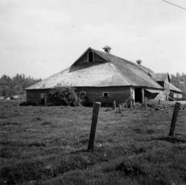
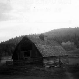
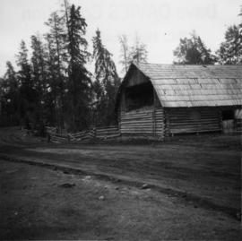
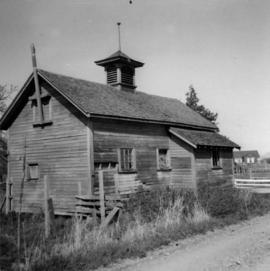
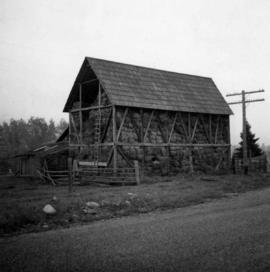
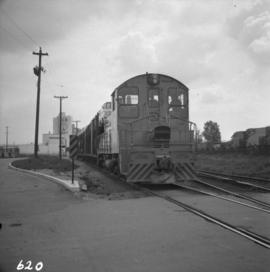
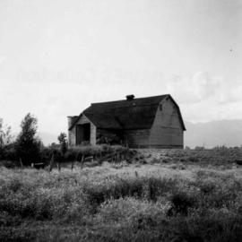
Photograph depicts a barn in the Upper Fraser Valley, west of the Vedder crossing and southwest of Atchelitz.
Photograph depicts a barn advertised for rent on Liverpool Rd. in South Westminster. Barn later half demolished on April 17, 1966.
Photograph depicts a barn located in Aspen Grove.
Photograph depicts a barn attached to Watch Lake Lodge, a dude ranch.
Photograph depicts a barn at Port Guichon, 1 mile west of Ladner, Delta.
Photograph depicts a barn at Lund, a village 12 miles north of Powell River. This building overlooks the harbour.
Photograph depicts a barn of the Glenwalker Ranch. Built in 1890-1910.
Photograph depicts a barn at Darfield, near Barriere, about 35 miles north of Kamloops. The English timbered cottage developed from this architectural form.
Photograph taken at Barkerville.
Photograph taken on the Banks and Vernonia tourist rail line in Oregon.
Photograph depicts a bandstand at English Bay in Vancouver, B.C.
Photograph depicts ballasting re-laid new track at the Pacific Great Eastern yards in North Vancouver, beside the Vancouver Wharves Ltd.
Photograph depicts a ballast wagon awaiting demolition at repair shed of the B.C. Electric Railway in New Westminster. The car was built in 1948.
Photograph depicts part of a ballast removal and cleaning special train at the CN Kamloops Junction.
Photograph depicts a ballast packing machine found at the CN Kamloops Junction.
Photograph depicts ballast cars at Squamish, near government wharves and chemical plant. They were built by the Western Wheeled Scrapper Co. in Aurora, Illinois and do not have a date.
Photograph taken at the defunct Okanagan Landing which was a rail/water transfer point from 1892 to 1940. A buggage trolley from the site still existed.
File consists of material regarding baggage and express services for rail passengers. Predominantly consists of photocopy reproductions, excerpts from books, and clippings from periodicals. Includes information regarding baggage wagons, freight weight rates, freight houses, and the Canadian Pacific Express Company.
Photograph depicts a baby seal at C.N. log drop at Cowichan Lake on Vancouver Island.
Photograph depicts an AVRO 504K fighter and biplane rainer of the RCAF, dated 1919.
Photograph depicts a wood and fabric AVRO 504K fighter, built in 1919. It was first developed in Britain in 1913. Now powered by Clerget Rotary. The fighter was used by the RCAF as a biplane trainer until 1928. This type was also used as crop duster, stunt machines, etc.
Photograph depicts avenger torpedo bombers that were purchased in 1958 and were owned by Skyway Air Sevices of the Abbotsford Airport. There were 14 avengers owned at the time the photograph was taken.
Photograph depicts an auto special at New Westminster, travelling west to McPherson Ave. industrial estate in south Burnaby.
File consists of research material regarding automobile carriers. Predominantly consists of photocopy reproductions, excerpts from books, and clippings from periodicals.
Photograph depicts a boom tug called "Atlas Captain" that was brought in for refitting, adjacent to a smalll boat repair yard. It was loaded on a CN gondola car and then removed by a derrick crane.
Postcard depicts the summit of the Selkirk Range. Board in the right foreground says "Rogers Pass 1 Mile."
Photograph taken on the CNR Okanagan Branch, Mile 21, east of a tunnel near Monte Creek. Dated 1938. Captured at the base of a deep embankment that may have resulted from a washout.
Postcard depicts Albert Canyon.
Photograph depicts the 1966 Armistice Day Parade at Victory Square, Vancouver. An RCMP detachment is found on the east side of the square. Looking north on Cambie Street.
Photograph depicts the ferry from Campbell River approaching the Quathiaski Cove slip on Quadra Island.
File consists of ten annual reports of the Railway Department of the Province of British Columbia for the years 1946-1950, 1953-1954, 1956-1958.
Photograph depicts the annual Bath-Tub Race that took place in Nanaimo. Visible is a competitor preparing for the start. There were 106 entries in that year.
Photograph depicts the annual Bath-Tub Race that took place in Nanaimo. Visible are rescue and patrol boats that were about to set out.
File consists of research material regarding issues with animals on railway tracks, which predominantly consist of photocopy reproductions, excerpts from books, and clippings from periodicals. Includes incidents involving elephants, moose, cattle, snakes, bears, elk, dogs, beavers, ospreys, and others.
Photograph depicts an old anchor that had been fished out of Coal Habour, Vancouver. One flulke was bent in towards the shank. Image captured outside the office of Kanata Marine Ways Ltd. (1965).
Photograph depicts one of the entries in the Nanaimo-Vancouver Bath Tub Race. Thre were 2112 entires and there was 32 mile crossing. Only 46 reached the finish line, of which this was one.
File consists of research material regarding VIA Rail's link with Amtrak, connecting Vancouver, BC with Seattle and Portland. Predominantly consists of photocopy reproductions, excerpts from books, and clippings from periodicals. Includes Amtrak schedules for the Seattle/Vancouver route, "By Train to Seattle, Again: The Inaugural of the Mount Baker International" by Nicklason; and "Safe at any Speed: Amtrak asks FRA for Talgo Waiver".
Photograph depicts the last lighthouse on the mainlain about a mile south of Ucuelet. It was believed to be the Amphitrite Point Light House.
Postcard depicts an area along the Thompson River, towards the Fraser Canyon. Looking left, downstream. Westbound CPR freight is visible. Short train by any standards in the 1980s and 1990s.
Photo depict a disused concentrator of the Granby Mining Company Ltd. Located 5 miles southwest of Princeton and 8 miles east of Copper Mountain ore workings, which are also largely disused. The building of the concentrator commenced in 1917 and the first ore was reduced in October, 1920. Ore cars from workings via the CPR spur entered the snow shed that is visible on the left. Rail track was lifted in 1957.
File consists of two issues of "All Aboard!", the onboard magazine of the White Pass & Yukon Railway, from the years 2005 and 2008.
Photograph depicts the Alexandra Bridge in the Fraser Canyon. It is closed to wheeled traffic and has a grid iron deck. Photo looks east.
Photograph depicts the Alexandra Bridge in the Fraser Canyon. It is closed to traffic but is possible to drive a vehicle across but the road is blocked on the east bank. The bridge is in good condition. Photo looks east.
Photograph depicts the Alexandra Bridge in the Fraser Canyon. The view is looking northeast and depicts the Fraser River running downstream to the right of the photo. There is First Nations salmon net pole in the bottom left-hand corner.
Photograph depicts the Alexandra Bridge in the Fraser Canyon, about 20 miles north of Hope. Photo looks to east bank.
Photograph depicts Alexandra Bridge that crossed the Fraser Canyon.
Photograph depicts the Albion Ferry on the Fraser River, as it approaches a ferry slip at Fort Langley.
Photograph taken on the Alberni-Tofino/Ucluelet logging public road on Vancouver Island. This stretches view was aimed towards the east and Kennedy Lake.
Photograph depicts Alberni St. in the west end of Vancouver. It is directly opposite the Vehicle Testing Station, in the 1700 block. The view in the photo is looking east.