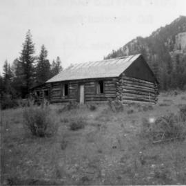
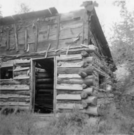
Photograph depicts an abandoned cabin about 100 yards from the Fraser River on Bridge River road, about 2 miles out of Lillooet.
Photograph depicts a cattle shed located 3 miles east of Pavilion Lake, which is 15 miles northeast of Lillooet. It may have been a settler's cabin at one time.
Photograph depicts a church that was built of shaped logs on the territory of the Tsal'alh Nation on the road leading to Seton Lake. Church was derelict, but still held pews, plastic flowers and small shrines.
Photograph depicts a disused cabin that was perhaps abandoned in the late 1950's.
Photograph depicts the Moha "ghost" vilage, 20 miles west of Lillooet, at the fork of Bridge and Yalako Rivers. It used to be a gold mining village. About 8 houses/cabins were left standing, but none were occupied. Displayed is one that had 2 ft. thick walss to waist height, as shown.
Photograph depicts a log cabin that was inhabited by an older aboriginal man who is visible in the window. The cabin was perhaps 100 years old.
Photograph depicts a liquor store and church on Main St. in Lillooet, B.C.