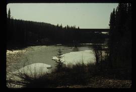
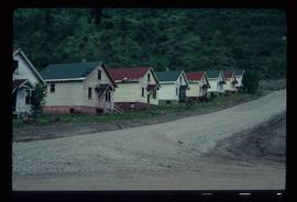
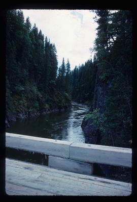
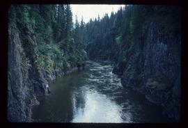
Image depicts Burns Lake, B.C.
Image depicts bunkhouse, restaurant and store in Sinclair Mills, B.C. Map coordinates 54°01'17.4"N 121°40'53.0"W
Image depicts the upper end of the Bullion Pit in Likely, B.C.
Image depicts an old, half-collapsed house in Likely, B.C.. The slide labels it as "Bullion house."
Image depicts a stretch of road through the Bulkley Valley.
Image depicts a section of forest in the Bulkley Valley.
Image depicts a view of Bulkley Valley.
Image depicts the Bulkley River near Moricetown, B.C.
Image depicts numerous unknown individuals standing by the Bulkley River near Moricetown, B.C.
Image depicts a small group of people standing near the Bulkley River at Moricetown, B.C.
Image depicts the Bulkley River.
Image depicts a row of buildings in Upper Fraser, B.C. with the store (titled "Paradise") with a Pepsi sign. Map coordinates 54°07'09.1"N 121°56'47.0"W
Image depicts several old buildings in a field, one of which has a caved-in roof, in Newlands, B.C. Map coordinates 54°06'28.2"N 122°12'01.0"W
Image depicts numerous buildings and a dock on the shore of Haida Gwaii, B.C..
Image depicts a vehicle parked beside a small, wooden house in Upper Fraser, B.C. Map coordinates 54°07'05.7"N 121°56'38.9"W
Item is an original 1968 map depicting British Columbia and its reliefs, including hills, valleys, and mountains across the province. The map was published by the British Columbia Department of Lands, Forests and Water Resources.
File consists of notes and reproductions relating to maps and mapping in British Columbia. File primarily consists of resources from the University of Northern British Columbia, the College of New Caledonia, the Prince George Public Library, and printed secondary sources for where to find maps, mapping techniques, how to produce maps, and surveying processes. Includes: "Prince George and District map collection finding aid" typescript document from the Fraser-Fort George Regional Museum and Archives (Oct. 1989).
File consists of notes, clippings, and reproductions relating to the British Columbia Historical Federation (BCHF) conference of 2003. Includes: the 2003 BCHF conference schedule, titled "Work and Society: Perspectives on Northern BC History" (May 2003); "RE: BC Historical Federation Conference" typed letter from the Regional District of Fraser-Fort George to Kent Sedgwick (24 Feb. 2003); and "Organizing Committee Members" typed letter from the City of Prince George to Kent Sedgwick (17 Feb. 2003).
Item is an original map depicting British Columbia published by the National Atlas Information Geographical Services Division.
Item is an original 1970 map of British Columbia with annotations of Kent's travels throughout the province highlighted in yellow. The map was originally published by the Department of Lands, Forests and Water Resources in British Columbia.
Image depicts an old building, possibly located at the closed Britannia Mine.
Image depicts the Bridge River No. 1 hydroelectric station on the shore of Seton Lake (rear side of powerhouse).
Image depicts the Bridge River near Lillooet, B.C.
Image depicts a river in Tumbler Ridge, B.C. The bridge crossing it appears to be either half-missing or incomplete.
Image depicts a bridge under construction in Tumbler Ridge, B.C.
Image depicts a bridge in Prince George, B.C.
File consists of maps and notes relating to the original Prince George city plans by Brett and Hall. Brett & Hall were landscape architects from Boston, MA who designed the original plan for Prince George, including features such as the Crescents neighbourhood. Includes photographs depicting the original plans by Brett & Hall for Prince George (2006).
Image depicts the old sales office of Bralorne Pioneer Mines Ltd. which is now the Bralorne Pioneer Museum.
Image depicts what is possibly an old, rundown mill in Bralorne, B.C.
Image depicts a row of houses in Bralorne, B.C.
Image depicts several houses in Bralorne, B.C.
Image depicts a few boarded-up buildings in Bralorne, B.C.
Image depicts a church and a row of houses in Bralorne, B.C.
File contains slides depicting locations in and around Bralorne, B.C.
Image depicts Bralorne, B.C.
Image depicts an area of Barlone, B.C. surrounded by trees.
Item is an original 1982 map depicting the Bowron River in British Columbia, published by the Province of British Columbia Ministry of Environment.
File contains slides depicting the Bowron Lake Provincial Park.
Image depicts what appears to be a log jam on what is possibly the Bowron River. The slide is simply labelled "Bowron Canyon."
Image depicts what is possibly the Bowron River from a bridge. The slide is simply labelled "Bowron Canyon."
Image depicts what is possibly the Bowron River. The slide is simply labelled "Bowron Canyon."
Item is an original 1980 map depicting Bonaparte Lake in British Columbia, published by the Department of Energy, Mines and Resources in Ottawa.