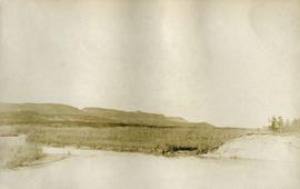
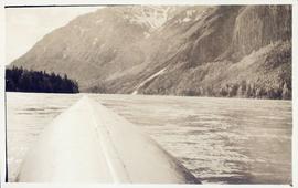
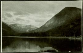
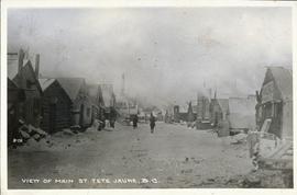
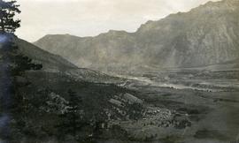
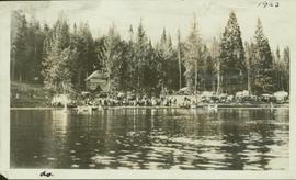
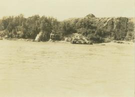
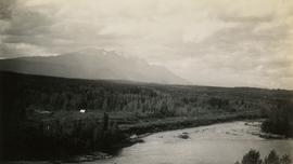
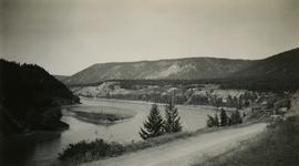
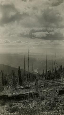
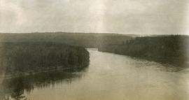
Photograph depicts a view of lot 912 near Nechako River.
Photograph depicts a view of Nechako River near junction of Stuart River.
Photograph depicts a snowy mountain range to the south of Wedge Creek with a forested area at the base.
Photograph depicts a view of a mountainous, tree-covered landscape and valley as seen through a mountain pass.
Photograph depicts Mount Selwyn rising on opposite shore in right midground. River in foreground, mountains in background. Handwritten annotation on recto of photograph: "Mount Selwyn Peace River."
Postcard image of village main street of Tete Jaune
Annotation on slide: "Lucille Mt. from Mt. Teare, Susan Stevenson, July 1994"
No annotation on slide.
Photograph depicts a view of the Lillooet Indian Reserve in the foreground; the town of Lillooet and the Fraser River are visible beyond.
Image depicts a view of the small town of Likely, B.C.
Liberal Party picnic at Six Mile Lake in Prince George, BC
Photograph depicts Lake Placid, NY with tennis courts in foreground. Trip is possibly in relation to the 1980 Winter Olympics in Lake Placid, NY.
Photograph depicts a view of Lake Placid, NY. Trip is possibly in relation to the 1980 Winter Olympics in Lake Placid, NY.
Photograph depicts a view of Lake Placid, NY, shot from hill. Trip is possibly in relation to the 1980 Winter Olympics in Lake Placid, NY.
Photograph depicts a view of Lake Placid, NY. Trip is possibly in relation to the 1980 Winter Olympics in Lake Placid, NY.
Photograph depicts a view of Lake Placid, NY. Several buildings are visible across the lake, including the Lake Placid Pub. Trip is possibly in relation to the 1980 Winter Olympics in Lake Placid, NY.
Photograph depicts unknown lake. Grassy shore in foreground, mountains in background.
Photograph depicts a view of the Hudson's Hope ferry seen from across the river. Behind the ferry, in the background is a rocky cliff face.
Photograph depicts a view of Hudson Bay Mountain taken from the Telkwa water tower. The Monckton survey crew tent, their car, and the railway track is also visible.
Photograph depicts Lheidli T'enneh Nation burial grounds in foreground, Hudson Bay Company buildings in background.
Photograph depicts an unnamed harbour road that runs to the north of , and parallel to Water St. The trackage is connected behind the camera to a CPR depot and at the other end to the mainline. No spurs lead off to the docks. The track is not used but usable.
Image depicts a view of Giscome with a train passing through.
Photograph depicts a creek running through a heavily forested landscape. Handwritten annotation on verso of photograph reads: "View down creek from lower part of Cos' property. Germansen Placer Ltd."
Photograph depicts a creek running through a forested landscape. Handwritten annotation on verso of photograph states: "View up Germansen Creek"
Photograph depicts road at University of Northern British Columbia. Library building stands in center background. Administration and cafeteria buildings can be seen in left background. Accompanying note from Maureen Faulkner: "Walking up to Canada's newest 'U' - ". Photo believed to have been taken on the day Bridget Moran received an Honourary Law Degree.
Photograph depicts a view of Front Street and Quesnel Hotel from Fraser River Bridge in Quesnel. Visible buildings include the Quesnel Hotel Cafe, the Quesnel Hotel, and John A. Fraser & Co. Ltd.
Photograph depicts Lake Constance with Friedrichshafen Germany in the background.
Photograph depicts a view of Fraser River from the Soda Creek hill in October 1936. The town of Soda Creek is barely visible at right.
Photograph depicts a view of Fraser River from the Soda Creek hill in June 1936. Wyness notes that photograph was taken at mile 200, which was approximately 167 miles from Ashcroft.
Photograph depicts a view of the Fraser River from what Wyness calls "Fraser Mountain". There are a number of places named "Mount Fraser" in British Columbia, but the exact location of where this photograph was taken is unclear.
View of town on shore, from above. Boats docked along piers and buildings. Hills visible on either side of water in background.
Handwritten photo captions with arrows pointing to sections of image read: "General Merchandise", "Fort Wrangell Hotel".
Lofty view of South Fort George, river and treed hills in the background. Printed annotation on verso reads: “South Fort George - 1913.” Handwritten message on recto is addressed to “Ethel M. Heurris Norton Maps Bristol County" reads: "11-1-13 an excellent view of south Fort George taken recently. Power Station at cross near water. This does not give all the south residence view. Population approx 1500”.
Lofty view of Fort George, B.C., river and paddle wheeler on right. Treed hills can be seen in background. Printed annotation on verso reads: “Fort George B. C.”
View of Cluster of buildings with treed hill in the background. Printed annotation on verso reads: “NEAR FORT GEORGE B.C.”
Typed caption glued to album page directly below photograph reads: "33. View of Fort Fraser one year ago." Photograph depicts a cleared section of land in the fore and mid grounds, and the wooden framing of a structure under construction in the background. Photographer: Dominion Stock & Bond Corporation.
Handwritten caption above this photo reads: "Earth Cut". Photograph depicts the steep slope of man-made embankment, trees in background. Tracks made my machinery are visible in dirt of the cut.
Photograph depicts the steep slope of man-made embankment. Forest in background, level excavated ground in foreground.
Photograph depicts the steep slope of man-made embankment, trees in background. Tracks made my machinery are visible in dirt of the cut.
Photograph depicts the steep slope of man-made embankment, forest in background at bottom of slope. Small twigs and pant leg of unidentified individual in foreground.
Hand coloured view of early Prince Rupert with row of tents facing large Hotel. Printed annotation in red ink on recto reads: “The Beginning of Prince Rupert B.C.: Grand Trunk Pacific Hotel in foreground”.
Caption describing photograph: "Eaglet Lake, Giscome. Low land lacustrine deposits. Cleared for forage crops and pasture. Willow and alder on right - typical cover prior to clearing. Refer to GBW Film 1 Frame 3 ( 2007.1.30.2.003 )"
Image depicts downtown Prince George taken from across the Nechako River looking south. Map coordinates 53°56'00.0"N 122°44'29.7"W
Photograph depicts a general view of the C.P.R. yards adjacent to Ballantyne Pier in Vancouver. The sheeted units in the middle distance consist of an export train of 11 locies, travelling dear, just brought in by the G.N.R. switcher. The locomotives were built by General Motors, Electro-Motive Division in La Grange, Illinois. For shipment to Korean National Railways, Pusan. Diverted to Vancouver because of the U.S. Pacific Coast long shoreman strike.
Photograph depicts a view of the CPR mainline and siding at Salmon Arm. The view is looking east but the photo was taken from west of the depot. A work train was stored on the siding/spur behind the camera, protected by a metal flag.
Photograph depicts Copper Mountain with forested area at base and grassy area in the foreground.
Image depicts a view of Prince George from City Hall looking northeast along George Street. Includes a back view of the Prince George cenotaph. Map coordinates 53°54'46.3"N 122°44'41.9"W