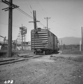
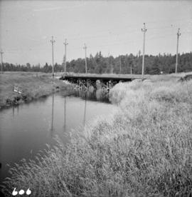
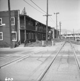
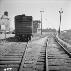
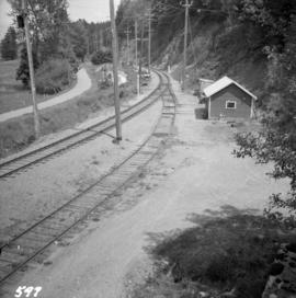
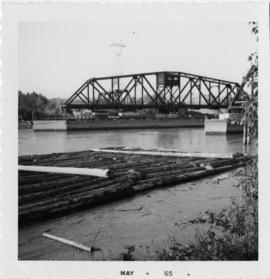
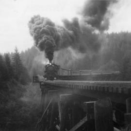
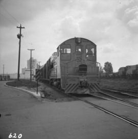
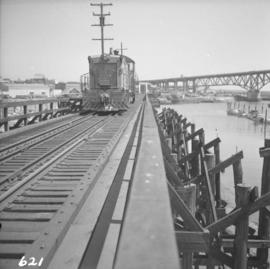
Photograph depicts a B.C. Electric Railway locomotive #902 crossing the False Creek trestle, travelling north.
Photograph depicts a B.C. Electric Railway locomotive #902 and boxcar entering the Kitsilano yards and crossing 2nd Ave., near Fir St. in Vancouver.
Photograph depicts the B.C. Electric Railway in Langley, looking northeast from town grade crossing.
Photograph depicts the B.C. Electric Railway depot at Huntingdon and Sumas, about 20 ft from the U.S.-Canadian border. The view is looking southeast.
Photograph depicts the B.C. Electric Railway crossing on Main St. in Langley, looking southwest.
Photograph depicts the B.C. Electric Railway crossing at Serpentine Creek, 2 miles west of Cloverdale. The view is looking north.
Photograph depicts the B.C. Electric Railway crossing 3rd Ave. with the first intersection at the immediate left. Note the abandoned double trackage at left. The view is looking north.
Photograph depicts the B.C. Electric Railway, looking east from the depot at Cloverdale.
Photograph depicts a view looking northeast of the B.C. Electric Railway from the abandoned Sumas substation at Vedder Mountain.
File consists of documentary photographs taken by David Davies of the BC Electric Railway on Granvile Island, Vancouver.
File consists of documentary photographs taken by David Davies of the B.C.E.R. in British Columbia.
Photograph depicts the B.C. Electric rail bridge crossing the north section of the north arm of the Fraser River from Vancouver to Mitchell Island. The span is always kept open except for rail traffic.
Photograph depicts the B.C Electric rail bridge crossing the south section of the north arm of the Fraser River. The view is looking north from Mitchell Island, which takes steel traffic to and from the Western Canada Steel Ltd.
Photograph depicts B.C. Electric ballast car #3013 standing on the new industrial siding on the northeast side of the Langley depot.
Photograph depicts the Department of Highways ferry named "Nimpkish" that was based in Port McNeill. It maintained a frequent daily triangle run, that travelled from Port McNiell to Sointula, then to Alert Bay. It held a capacity for 16 cars and 150 passengers.
Photograph depicts bascule bridges in the inner harbour of Victoria. Property of EN. In the process of being repaired and painted.
Photograph taken on the Banks and Vernonia tourist rail line in Oregon.
Photograph depicts ballasting re-laid new track at the Pacific Great Eastern yards in North Vancouver, beside the Vancouver Wharves Ltd.
Photograph depicts a ballast wagon awaiting demolition at repair shed of the B.C. Electric Railway in New Westminster. The car was built in 1948.
Photograph depicts part of a ballast removal and cleaning special train at the CN Kamloops Junction.
Photograph depicts a ballast packing machine found at the CN Kamloops Junction.
Photograph depicts ballast cars at Squamish, near government wharves and chemical plant. They were built by the Western Wheeled Scrapper Co. in Aurora, Illinois and do not have a date.
Photograph depicts an AVRO 504K fighter and biplane rainer of the RCAF, dated 1919.
Photograph depicts a wood and fabric AVRO 504K fighter, built in 1919. It was first developed in Britain in 1913. Now powered by Clerget Rotary. The fighter was used by the RCAF as a biplane trainer until 1928. This type was also used as crop duster, stunt machines, etc.
Photograph depicts avenger torpedo bombers that were purchased in 1958 and were owned by Skyway Air Sevices of the Abbotsford Airport. There were 14 avengers owned at the time the photograph was taken.
Photograph depicts an auto special at New Westminster, travelling west to McPherson Ave. industrial estate in south Burnaby.
Photograph depicts a boom tug called "Atlas Captain" that was brought in for refitting, adjacent to a smalll boat repair yard. It was loaded on a CN gondola car and then removed by a derrick crane.
Postcard depicts the summit of the Selkirk Range. Board in the right foreground says "Rogers Pass 1 Mile."
Photograph taken on the CNR Okanagan Branch, Mile 21, east of a tunnel near Monte Creek. Dated 1938. Captured at the base of a deep embankment that may have resulted from a washout.
Postcard depicts Albert Canyon.
Photograph depicts the ferry from Campbell River approaching the Quathiaski Cove slip on Quadra Island.
Photograph depicts the annual Bath-Tub Race that took place in Nanaimo. Visible is a competitor preparing for the start. There were 106 entries in that year.
Photograph depicts the annual Bath-Tub Race that took place in Nanaimo. Visible are rescue and patrol boats that were about to set out.
Photograph depicts an old anchor that had been fished out of Coal Habour, Vancouver. One flulke was bent in towards the shank. Image captured outside the office of Kanata Marine Ways Ltd. (1965).
Photograph depicts one of the entries in the Nanaimo-Vancouver Bath Tub Race. Thre were 2112 entires and there was 32 mile crossing. Only 46 reached the finish line, of which this was one.
Photograph depicts the last lighthouse on the mainlain about a mile south of Ucuelet. It was believed to be the Amphitrite Point Light House.
Postcard depicts an area along the Thompson River, towards the Fraser Canyon. Looking left, downstream. Westbound CPR freight is visible. Short train by any standards in the 1980s and 1990s.
Photo depict a disused concentrator of the Granby Mining Company Ltd. Located 5 miles southwest of Princeton and 8 miles east of Copper Mountain ore workings, which are also largely disused. The building of the concentrator commenced in 1917 and the first ore was reduced in October, 1920. Ore cars from workings via the CPR spur entered the snow shed that is visible on the left. Rail track was lifted in 1957.
Photograph depicts the Alexandra Bridge in the Fraser Canyon. It is closed to wheeled traffic and has a grid iron deck. Photo looks east.
Photograph depicts the Alexandra Bridge in the Fraser Canyon. It is closed to traffic but is possible to drive a vehicle across but the road is blocked on the east bank. The bridge is in good condition. Photo looks east.
Photograph depicts the Alexandra Bridge in the Fraser Canyon. The view is looking northeast and depicts the Fraser River running downstream to the right of the photo. There is First Nations salmon net pole in the bottom left-hand corner.
Photograph depicts the Alexandra Bridge in the Fraser Canyon, about 20 miles north of Hope. Photo looks to east bank.
Photograph depicts Alexandra Bridge that crossed the Fraser Canyon.
Photograph depicts the Albion Ferry on the Fraser River, as it approaches a ferry slip at Fort Langley.
Photograph depicts a water tank car used for fighting line side fires. Propery of Alberni Pacific tourist railway. Sat in a yard in Port Alberni. Formerly owned by Crown Zellerbach of Ladysmith.
Photograph depicts a train commencing its trip in its yard, not at the station, in Port Alberni. Locomotive at the lower/city end (ie formation at the end of the last trip). It, at the time, needed to get to the head-end, so it took the siding.
Photograph depicts an Alberni Pacific tourist railway train.
Photograph depicts an Alberni Pacific Railway locomotive about to uncouple and run around its train. A sawmill station was behind the camera.
Photograph depicts an Alberni Pacific Railway train that was very close the McLean sawmill (opened in 1926, closed in 1965).