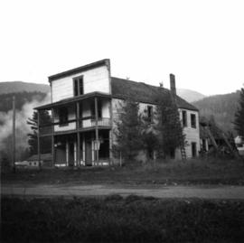
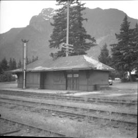
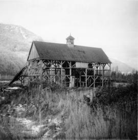
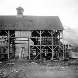
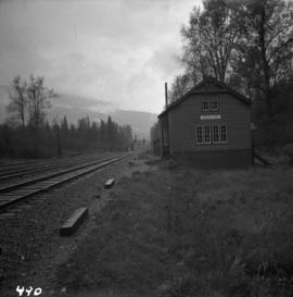
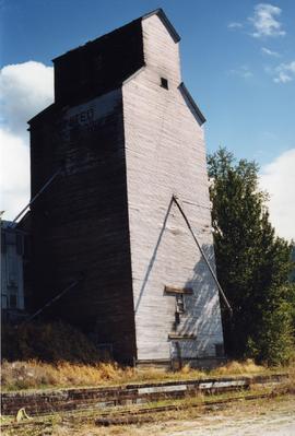
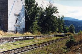
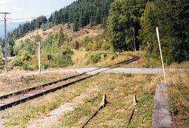
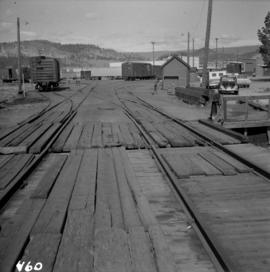
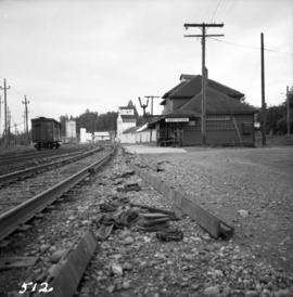
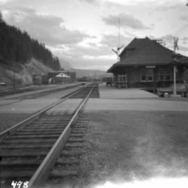
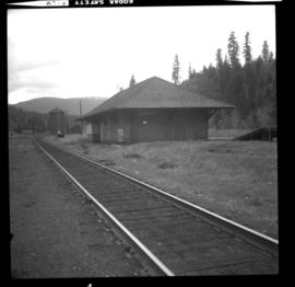
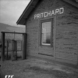
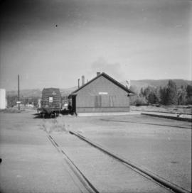
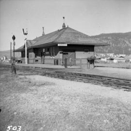
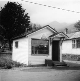
Photograph depicts the Deroche post office that was well patronised for mail and newspaper distribution.
Photograph depicts a derelict shop on what was the Main St. of Slocan City.
Photograph depicts a derelict locomotive shed at Union Bay on Vancouver Island. It is a Canadian Colliery Resources Ltd. shed, last used 15 Aug. 1960. Operations finished that day and disposal of all the equipment followed.
Photograph depicts the derelict Langham Hotel at Kaslo, B.C. on Kootenay Lake.
Photograph depicts a derelict substation on the B.C. Electric Railway at Coghlan, 9 rail miles east of Langley. Though marked "Langley", the building is sited as stated.
Photograph depicts the derelict electricity station of the B.C. Electric Railway at Cloverdale.
Photograph depicts the derelict CPR depot at Hope, part of the former Kettle Valley line. A spur of about 3 miles still exists between the Odlum junction with the main line on the north side of the Fraser River and this depot, and continues southeast to a point near the CNR. It is not abandoned, but little used. The Hope yard has a 47 car capacity.
Photograph depicts a possibly derelict hotel in Slocan City, 25 miles northwest of Nelson. Slocan City was once famous for its silver, lead etc. mines.
Photograph depicts a derelict building on the old Main St in Slocan City, northwest of Nelson.
Photograph depicts a derelict building in Ladysmith on Vancouver Island built approximately between 1900 and 1905.
Photograph depicts a derelict barn displaying frame construction.
Photograph depicts a depot and derelict electricity substation at Coghlan, 9 rail miles east of Langley, looking west.
Photograph depicts the Department of National Defence Armoury headquarters of the British Columbia regiment.
Photograph depicts the demolition of a Great Northern Railway depot in Vancouver.
Photograph depicts the demolished site of Nelson Laundries Ltd. The boiler in the foregorund was having tubes removed by a wrecker. The site was to be occupied by a Ford motor dealer.
Photograph depicts houses being demolished on Beach Ave, West End, Vancouver.
Photograph depicts the Delta Municipal Hall on Main St. in Ladner, B.C.
Photograph depicts the Creston Sawmills Ltd on the CPR line. Here the southern BC CPR mainline passes through the center of trackage, looking eastbound. A chip car is on the spur directly leading from the camera.
Photograph depicts Craigellachie station, a famous spot on the C.P.R. line. The trans-continental line was joined here on November 7, 1885, about 250 yards down the track just beyond the right hand colour aspect signal. The depot house is not manned, used by the line side crews to store equipment. In former days it was a passing point, but there are very few houses in the area now.
Photograph depicts the C.P.R. yards just west of downtown passenger station and in front of Pier B, owned by the C.P.R. The view is looking northwest from Burrard St.
Photograph depicts the rear view of an elevator showing its name. Track was on the far side.
Photograph depicts a grain elevator which Wynndel was famous for.
Photograph depicts a grain elevator that had a 7 car spur to service it. Davies doubted if grain traffic ever moved by rail near Wynndel. Two flat cars appeared to have used the platform to overload machinery and vehicles.
Photograph taken looking north, with a spur in the foreground. It was used by ore mixed freight daily. It was believed that at the bottom of the grade was a junction with a GNR branch that ran from the US border south of Creston to Kootenay Lake (built in 1904, then was hardly used, finally ceased in 1910).
Photograph depicts the C.P.R. wharf-scow approach ramp at Kelowna, looking east. Okanagan Lake is behind the camera.
Photograph depicts a CPR wharf building at Okanagan Landing, Okanagan Lake. It was presumably used as a covered slipway and as a store. It was was now boarded up and the rail track between Vernon and Okanagan Landing was removed in 1940.
Photograph depicts a C.P.R. way-freight at the disused Wellington Depot on the Esquimalt and Nanaimo Railway, 4 miles north of Nanaimo.
Photograph depicts the C.P.R. train station at Kaslo. At one time the line ran between Kaslo and Nakusp, via New Denver. It was lifted in 1915-1920. The trackage now consists of Kootenay Lake slip and about 1 mile of sidings. It is used mainly for oil (incoming) and lumber (outgoing).
Photograph depicts the C.P.R. terminal in Vancouver. A C.P.R. switcher is collecting cars from the "Princess of Vancouver" at about 7 p.m.
Phoyo depicts a CPR swing bridge in Sicamous.
Photograph depicts the C.P.R. summit of the southern transcontinental C.P. line at Crowsnest Pass on the Alberta-B.C. border. The roundhouse is disused. Four men are working on the turntable; it is unclear whether they are rebuilding its eastern face or demolishing it by breaking down one wall to get at the table. The site is 4,453 ft. above sea level and the view is looking south.
Photograph depicts a CPR storehouse at Mission City. It was marked as "Petroleum Store" but in fact was holding speeders and miscellaneous track equipment. It was sited on the north side of the track at the extreme east end of the depot platform.
Photograph depicts the C.P.R. station at Merritt, halfway between Spences Bridge and Brockmere Junction. The line is in active use.
Photograph depicts the C.P.R. station in Abbotsford, looking south.
Photograph depicts the C.P.R. station at North Bend, B.C., from a view looking north.
Photograph depicts the C.P.R. station at Invermere on the Golden-Cranbrook line, looking southwards. It is called the "Lake Windermere Station" built in 1916 of logs. The last mixed passenger train ran in 1962.
Photograph depicts the C.P.R. station at Invermere in the Kootenays. There is a trolley off the track on the road and the way freight switching at the station. Golden is to the left, Cranbrook is to the right, and the station building is at the immediate left.
Photograph depicts the C.P.R. station at Golden, B.C. The view is looking east.
Photograph depicts the CPR Osoyoos station and the arrival of the daily (except Sunday) way freight train from Penticton. The depot is at about mile 36.1.
Photograph depicts the C.P.R. Shuswap Depot east of Kamloops.
Photograph depicts the C.P.R. Savona Depot looking east.
Photograph depicts the CPR line at Brookmere, 30 miles south of Merritt (now mile 108.7 on the Princeton Subdivision). Summit point is at 3200 ft. between Spences Bridge, Hope, and Princeton. The Kettle Valley Railway carved out a railway town in the wilderness in 1914/1915 to hold about 300 people. The men were train crews and track a gangs, particularly for the troublesome Coquihalla route. The photo includes the boarded up depot and the view is looking north.
Photograph depicts the C.P.R. Pritchard depot, 25 miles east of Kamloops. The passenger turnstile is unusual though found elsewhere in this area. The depot is long unused for passengers and is now used by a permanent way gang.
Photograph depicts the CPR Princeton depot. The view is looking east.
Photograph depicts the Pitt River swing bridge in an open position. Apparently, it opened up to half a dozen times a day to allow large pleasure crafts to go through. Photograph taken at high tide when little clearance occurred.
Photograph depicts the C.P.R. pier A.1. (now 12A) at Vancouver, B.C., slightly right of the foot of Thurlow St. It was built in 1890 and it is still in use. The view shows its east face.
Photograph depicts the seaward end of C.P.R. pier A1 (now 12A), showing its rotted condition. The pier was built in 1890 and is still in use except at this outer face. C.P.R. pier B1 is in the background.
Photograph depicts a pier, possibly of the CPR in Nanaimo.