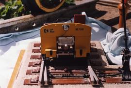
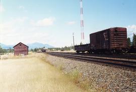
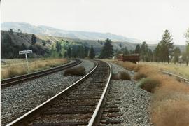
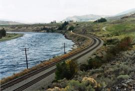
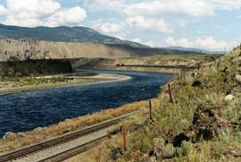
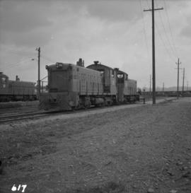
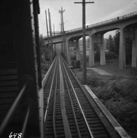
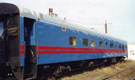
Photograph depicts a CN Track Geometry 'Test" car for Western Canada. Built in 1954 as "Cape Race." In 1983 it was a VIA sleeper/buffet/lounge.
Photograph depicts a track car model (in fact, the base to the lamp shade).
Photograph taken about 2 miles west of Princeton. Depicts track beside the Tulameen River. Taken, looking west, form a ridge holding on the Princeton to Hope highway.
Photograph depicts a tower controlling the C.P.R. grade crossing at Alexander St. in Vancouver, B.C.
Postcard depicts totem poles at Wapla Lake Camp. The lake was the headwaters of the Kicking Horse River.
Photograph depicts a totem pole in its final stages of being carved.
Photograph depicts a disused tool house in Wasa, at the CPR Windermere Subdivision. Davies notes the structure was rarely seen at the time the photograph was taken.
Photograph depicts a tool house in Wasa, at the CPR Windermere Subdivision. Before 1970, the station had siding for 37 cars. Now it had two sidings for a total of 150 cars. Note the old box car with old lettering that was presumably on non-reserve service.
Photograph depicts a tool house on a CNR curve in Armstrong. Not in frequent use.
Photograph depicts Tofino on Vancouver Island. View taken from wharf with a lifeboat on slip.
Photograph depicts the Tofino Airport. It was a former wartime RCAF base built in 1942 for anti-Japanese air patrols. It was now a D.O.T controlled airport.
Photograph depicts the view of the Tilbury rail terminal on the south bank of the south arm of the Fraser River, 1 1/2 miles east of Deer Island Tunnel. S.S. Canora is also in the picture.
Photograph depicts Tilbury dock on the Delta shore of the Fraser River. The stern of the Canadian National Railway (CN) onboard railcar carrier SS "Canora" is about 10ft away, and showing tidal and moving a piece of dock leading to shore.
Photograph depicts what was at one time a passing point, spur, etc. Now, it was only a 'through' track. Disappeared siding held storage for 44 cars.
Postcard depicts the passage through the shoulder of Mt. Stephen.
Photograph depicts three crossing at Second Narrows in Vancouver Harbour. On the left was a new CNR bridge being built. In the middle was exsiting CN track. To the right a high level road bridge is visible.
Photograph depicts three B.C. Electric Railway locomotives on running line to the west of car barn at New Westminster.
Photograph depicts CN track 1 mile east of Walhachin. Looking east. Thompson River running downstream, towards the camera. CPR also goes through Walhachin.
Photograph depicts CN track 1 mile east of Walhachin. Looking east. Thompson River running downstream, towards the camera.
Postcard depicts a "Spectacular sight to be seen while travelling through this Canyon. Many trains rumble past with heavy loads making a grand sight when they twist and turn around corners along the clear blue water of the Thompson River."
Postcard depicts the west portal of the Connaught Tunnel, near Glacier, BCDavies noted the ventilation engine house above the entrance.
Photograph depicts the building for the Vancouver Supply Company located at 25 Alexander St. in Vancouver, B.C. It is at the center of the old downtown and may have been a former fire hall.
Postcard depicts the Van Horne Range, looking west from Field, BC
Postcard depicts the town of Field and Mt. Stephen. Near Yoho National Park in the Canadian Rockies.
Photograph depicts the split of the Great Northern Railway (GNR) (shown) and the Canadian National Railway (CN) tracks, immediately south of the Fraser crossing at New Westminster.
Postcard depicts spiral tunnels near Yoho National Park, BC
Postcard depicts 'The Spiral Tunnels."
Postcard depicts a spiral tunnel near Field B.C. Mount Stephen visible.
Map depicts the route of BC Rail and its connecting rail lines.
Photograph depicts the "Princess of Vancouver" loading at 7 p.m. in Vancouver.
Tourist map of Prince George depicts city area, with annotations by Davies to emphasize locations of rail lines.
Map depicts the province of British Columbia. Includes rail lines and historical notes about the province.
Postcard depicts "The Loop," Glacier, BC
Postcard depicts "The Loop," CPR, Selkirk Mountain.
Postcard depicts "The Loop," CPR Selkirks.
Postcard depicts "The Loop, as this great pear-shaped arc of trestle was known along with the spectacular station and hotel facilities at Glacier were replaced by the Connaught Tunnel in 1916."
Postcard depicts the Kicking Horse Canyon near Yoho National Park.
Postcard depicts the Illecillewaet Valley, near Glacier, BCThe view shows the end of the descent over Rogers Pass, if travelling westerly. The scar in the foreground was believed to be the track between the 1st (Glacier Hotel) and 2nd (Loop Brook) loops.
Postcard depicts the Canadian Pacific Railway line where the Great Divide between BC and Alberta.
Postcard depicts the Golden-Field Highway as seen from high up on the mountain side from a tunnel on the CPR run in the Kicking Horse Canyon.
Postcard depicts 'The Gap," the entrance to the Rockies.
Postcard depicts "Twin Bridges in the Fraser Canyon. The CNR and CPR change sides at this point."
Postcard depicts the Four Tunnels on the CPR line through the Rocky Mountains.
Postcard depicts "The Four Tracks."
Tourist map of Prince George depicts city area, including railway trackage.
Postcard depicts "Canadian Pacific's eastbound, "The Canadian," crosing the Kicking Horse River between Golden and Field B.C. in October 1976. Some of the... trains power through some of North America's most spectacular scenery. The morning has brought the season's first snowfall."
Photograph depicts the Canadian Bank of Commerce in Ladysmith, B.C. on Vancouver Island. Building is estimated to be built between 1901-1905.
Postcard depicts "Canadian Pacific's all Stainless Stel Scenic Dome Streamliner-"The Canadian"-in the Canadian Rockies."
Postcard depicts "VIA Rail Canada Nos. 6456 and 6454 hauling Train No. 1, "The Canadian" between Spences Bridge and Drynoch, British Columbia, on Canadian Pacific's Thompson Subdivision, having been delayed by the need to detour, from its usual route, on Canadian National's Ashcroft Subdivision, seen here across the Thompson River. May 14, 1993."