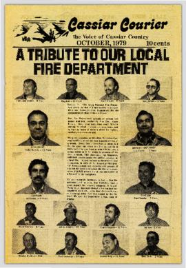
Showing 1034 results

Archival description
1034 results with digital objects Show results with digital objects
2023.2.2.1.2.2 · Stuk · [between 2002 and 2005]
Part of Dr. Paul Sanborn fonds

This document file "Cluculz Creek Fertilization Research Site.pdf" contains a field description and basic characterization data for a representative pedon at the E.P. 886.10 site.

2006.18.6.01 · Bestanddeel · [196-?]
Part of Aleza Lake Research Forest Society fonds

Photographs are panoramas taken from the Churchill BC Forest Service Lookout, located at latitude 54°04' and longitude 122°16'. The photographs were bound together and include a transparent grid that was intended to be used for locating forest fires.