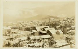
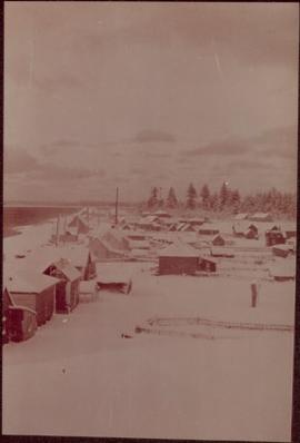
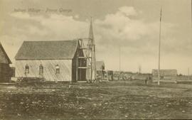
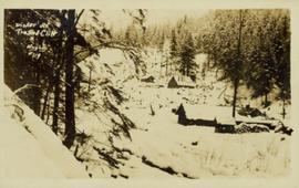
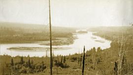
Image depicts a mountain side somewhere along the White Pass railway. The thin ridge along the mountain side is possibly either a highway or part of the railway.
File contains slides depicting locations along the White Pass railway through Alaska, British Columbia, and the Yukon Territories.
Image depicts the White Pass Train crossing over a railway bridge at an uncertain location.
Image depicts the White Pass Train crossing over a railway bridge at an uncertain location in the mountains.
Image depicts the White Pass Train crossing over a railway bridge at an uncertain location.
Trees in foreground, hills in background. Unidentified man stands on far left.
Photograph is one of 11 images taken during a World Health Organization (WHO) trip, Human Rights of Women and Children, Peru, 1990. Possibly affiliated with World Council of Churches, International Ecumenical Delegation to Lima, Peru, 14-25 October 1990. See also items 2009.6.1.505 - 2009.6.1.515.
Rock pile, unknown building, and hills can be seen in background.
Photograph is one of 11 images taken during a World Health Organization (WHO) trip, Human Rights of Women and Children, Peru, 1990. Possibly affiliated with World Council of Churches, International Ecumenical Delegation to Lima, Peru, 14-25 October 1990. See also items 2009.6.1.505 - 2009.6.1.515.
Photograph depicts Wickaninnish Beach, north of Ucluelet on Vancouver Island.
Image depicts an aerial view of Williams Lake, B.C.
Image depicts a view of Williams Lake, B.C.
Image depicts an aerial view of Williams Lake, B.C.
File contains slides depicting places in the area around Williams Lake, Clinton, and the Fraser Canyon.
Image depicts the St. Joseph's Mission in Williams Lake, B.C.
Image depicts the cableway in Willow River, B.C.
Image depicts the cableway, stretching over a river, in Willow River, B.C.
Image depicts the cableway in Willow River, B.C.
Image depicts a group of people somewhere in Willow River, B.C. The man in the plaid shirt and beige cap is identified on the slide as being Lloyd Edwards.
Image depicts a playground in Willow River, B.C. The slide labels it as being a "former hotel site." Map coordinates 54°04'23.7"N 122°28'26.9"W
Image depicts the Willow River General Store. Map coordinates 54°04'23.7"N 122°28'26.9"W
Image depicts a snowy street in Willow River, B.C. with a row of houses. The white building on the end with the Pepsi sign is the Willow River General Store. Map coordinates 54°04'18.3"N 122°28'14.7"W
Image depicts a snowy street in Willow River, B.C. There are several buildings, one is an Esso station and another is labelled as "Red & White Food Store."
Photograph is a printed postcard depicting a few cabins covered in snow near Stewart B.C.
Photograph depicts a four-dog team harnessed to a loaded sleigh. Two people stand near the loaded sleigh on a snowy forest path.
Railroad track, utility poles, field, small building and background hills are visible in image.
Elevated photograph of downtown Prince Rupert covered in snow. Printed annotation on recto reads: "Winter Scene. Prince Rupert. B.C."
Photograph depicts two people and a dog team on a snowy river bank with a narrow passage of open water and a snowy bluff in the background.
Photograph depicts village buildings along shore.
Handwritten annotation on verso reads: "Massett in Winter dress."
Image depicts a river, possibly somewhere in the Wistaria Provincial Park.
Image depicts the old community hall located somewhere in the Wistaria Provincial Park.
Image depicts a woman on a boat, possibly on War Lake.
Photograph depicts a woman sitting on a rock, driftwood in the background.
Image depicts a woman standing on a rocky shore somewhere on Haida Gwaii, B.C.
Unidentified woman stands with umbrella in public area on waterfront. Water crosses midground, opposite shore and mountain in background.
Photograph depicts a woman wearing a Cowichan sweater rowing a boat away from a rocky island with a lighthouse. Handwritten annotation in pencil on verso reads: “Gal in boat wearing Indian sweater knit by my mother Eileen M. Jackson (she also spun the wool) for her brother J.J. Claxton, cook on the Columbia Coast Mission Boat. - S.K. Jackson”
Image depicts an unidentified woman with a camera sitting on the bank of a river.
Image depicts an unknown woman with a camera. Nearby are the skeletal remains of an unknown animal. The location is the upper Fraser Canyon.
Three unidentified women lean over flowing stream in area speculated to be a mining location. Sluiceway appears to be visible in foreground.
Side view of a wooden church, possibly under construction, and other buildings. Printed annotation on recto reads: "Indian Village- Prince George."
Photograph depicts a view looking down from a high forested slope to Woodpecker Island on the Fraser River, BC.
Image depicts the grade for the British Columbia Railway, which was formerly known as the Pacific Great Eastern until 1972. It is located somewhere near the Woodpecker Ranch in Woodpecker, B.C.
Image depicts the grade for the British Columbia Railway, which was formerly known as the Pacific Great Eastern until 1972. It is located somewhere near the Woodpecker Ranch in Woodpecker, B.C. There are two unknown individuals present in the image.
Image depicts a tree line in Woodpecker, B.C.
File contains slides depicting the Woolsey and Place Glaciers.
Image depicts two unknown individuals at the Woolsey Glacier.