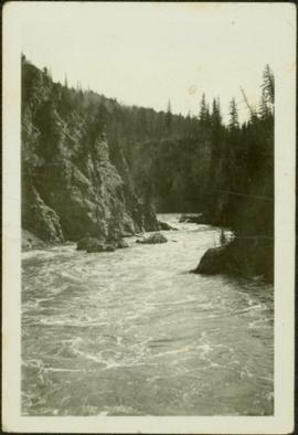
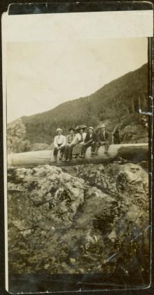
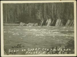
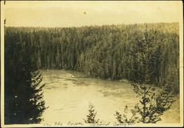
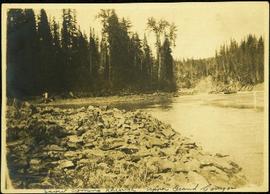
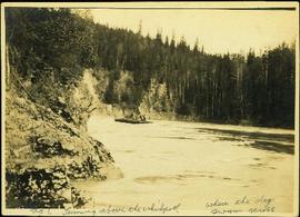
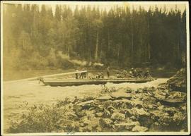
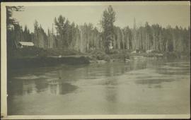
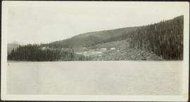
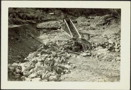
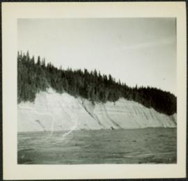
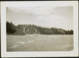
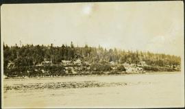
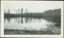
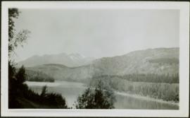
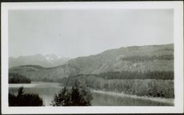
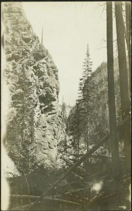
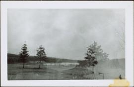
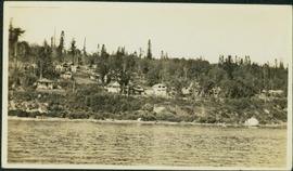
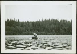
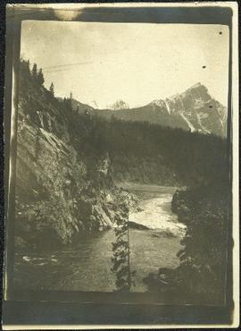
Trees and riverbank cross midground. Single tree in foreground, mountain in background.
Photograph depicts unknown river winding through steep cliffs, trees on either side.
Photograph depicts unidentified river flowing through hills, trees in foreground, mountains in background.
Photograph depicts river winding through range of hills, bridge visible in distance.
Photograph depicts tree-covered cliffs on opposite shore, river in foreground.
Photograph depicts men on river scow, large rock island or peninsula protruding into river behind them. Trees on opposite shore in background, large rock in foreground. Handwritten annotation on verso of photograph: "Grand Canyon. Fraser River. Big Rock.", on recto of copy print: "1911."
Photograph depicts creek barely visible at bottom of steep valley in cliffs. Trees and underbrush in foreground. It is believed that this photograph may have been taken near Mt. Robson. Handwritten annotation on recto of photograph reads: "Sand Creek."
Photograph depicts small log buildings and loaded wagons in cleared dirt area. Building on far left has the sign "POOL HALL" posted on front . Treetops, lumber piles, and hills in background. Mountains can be seen in distance. Handwritten annotation on verso of photograph reads: "Sand Creek. B.C."
Group of eleven men and women stands and kneels in front of fence, field and hills in background. Sarah stands fourth from left, Bert stands on far right. Handwritten annotation on recto of photograph: "Murphy's place ATLIN." Similar group also featured in items 2009.5.2.274 - 2009.5.2.294.
Sarah and Bert stand with unidentified woman in cleared area on hilltop, forest and hills in background.
Sarah Glassey stands behind woman seated on ground, lake and hills in background.
Sarah sits between four men on large tree trunk suspended over canyon in unidentified area, cliffs and hill in background. Man holing Sarah's hand on her left is believed to be a Mr. Murray, also featured in item 2009.5.2.175.
Sarah Glassey stands looking down into what appears to be a camera, forest on hillside in background.
The pair stands on grassy shore, Sarah on right. Trees, water, bridge, and opposite shore visible in background. Handwritten annotation on recto of photograph: "Sarah + Doris." Both woman are believed to be members of group featured in items 2009.5.2.274 - 2009.5.2.291.
The pair stands on grassy shore, Sarah on right. Trees, water, and bridge visible in background. Handwritten annotation on recto of photograph: "Sarah + Vi." Both woman are believed to be members of group featured in items 2009.5.2.274 - 2009.5.2.291.
Photograph depicts men on river scow in distance. Rocks in foreground, trees and cliffs on opposite shore in background. Handwritten annotation on verso of photograph: "Scow in Upper Grand Canon. Fraser River. B.C.."
Photograph depicts men on a scow near opposite shore of river. Treetops in foreground. Photograph taken from above. Handwritten photo caption on verso and recto of this photo reads: "in the lower Grand Canyon".
Photograph depicts men on a scow in distance at bend in river. Unidentified objects or structures on opposite shore in background, rocky shore in foreground. Handwritten photo caption on verso and recto of this photo reads: "Scow coming through upper Grand Canyon".
Photograph depicts men on a scow, maneuvering what is believed to be the Upper Fraser River. Opposite shore in background, close shore in foreground. Handwritten photo caption below this photo reads: "1. Turning above the whirlpool where the dog swam across."
Photograph depicts a crew of 13 men on a scow believed to be maneuvering through the Upper Fraser River at Scow's Last Lap (Scow Rapids), downriver from the Grand Canyon of the Fraser. Trees on opposite shore in background, rocky shore in foreground. Handwritten annotation on recto of photograph reads: "the last lap".
Photograph depicts the rooftops of four wood buildings behind bushes on opposite shore. Forest trees in background. These buildings are speculated to be a Bourchier forestry camp.
Photograph depicts a group of unidentified buildings in what appears to be an industrial area on opposite shore. River or lake in foreground, tree-covered hills in background.
Photograph depicts a large structure in center of mining area in riverbed, equipment and supplies scattered throughout. Buildings and forest in background. Handwritten annotation on verso of photograph: "Spruce Creek, Lower Shovel Workings 6/25/39.", on recto: "Atlin".
Photograph depicts crowd of people in foreground near log fence. More crowds can be seen in distance at base of ski jump on either sides of the run. Jump visible at top of tree-covered hill in background. It is believed that this photograph was taken near the current location of City Hall.
Mountains visible in background.
Photograph depicts a miner spraying enclosed area of river bed with water at high velocity. Cliffs in background.
Photograph depicts water being sprayed from a pipe at high velocity over edge in mining area. Man's leg in foreground, cliffs in background.
Photograph depicts water being sprayed from pipes at high velocity in mining area. Unidentified man in midground, cliffs in background.
Photograph depicts a woman standing among men aboard a sternwheeler with the word "HAZELTON" above its deck. A man speculated to be the captain stands on deck to the left. Tree branches in foreground, opposite shore and mountains in background.
Photograph depicts unidentified river in foreground, trees on cliffs in background.
Photograph depicts rocks protruding from river in distance, trees on cliffs in background.
Photograph depicts unidentified river or lake. Bushes in foreground, hills in distance.
Photograph depicts four men and small cart standing in street, lines of log buildings on either side. Tents can be seen at end of left side of street. First building on left is larger, with the sign "STOPPING PLACE". Trees cross midground, mountains stand in background. Handwritten annotation on verso of photograph reads: "Tete Jaune Cache. B.C."
This photograph album consists of photographs of remote police barracks at Mile 47 and Mile 29; early settlements and/or mercantile stores at Tete Jaune Cache, McBride, Sand Creek, Fort George and South Fort George; Grand Trunk Pacific Railway forestry and railway camps; scows and paddlewheel conveyors on the Fraser River; automobiles; community leisure activities; as well as, images of the Bourchier family. The following South Fort George establishments are identifiable within these photographs: Empress Hotel, Ah Yee General Merchant, German Bakery, Northern Hotel, South Fort George Drug Store & Post Office, St. Michael’s Church, Prince George Hotel, Ford Monarch dealership, Astoria Hotel, and King George V Elementary School. Identified geographic locations featured in these photographs include: Tete Jaune, Upper Fraser, Mile 47, Mile 29, Fraser River, Mt. Robson, McBride, Sand Creek, Glacier Mountain, Moose River, Giscome Portage, Pott Falls, Red Deer River, Grand Canyon, Summit Lake, Canoe Pass, Connaught Hill, Nechako Bridge, and Island Cache.
Bourchier, Alan K.Officers are mounted on three horses standing in water. Fifth horse stands on right, trees on shore in background. Handwritten annotation on recto of photograph: "Jas Tracey, Vanderhoof. Srg. Birch."
Photograph depicts winding river from above, tall trees on either side and mountains in background. Handwritten photo caption on verso and recto of this photograph reads: "Top of Grand Canyon from Portage trail".
Photograph depicts horse and rope in Fraser River. Hill on opposite shore in background.
Photograph depicts trees standing in foreground, river and hills visible in distance.
Photograph depicts men and haul trucks visible in distance on snowy road in tree-covered hills.
Men stand beside traffic light by the merge of two railway tracks. Shed and train car stand in midground, water and opposite shore in background.
Photograph depicts two men believed to be North-West Mounted Police officers standing on either side of white packhorse. Forest and mountains in background. Photograph may have been taken in Vanderhoof, B.C.
Photograph depicts bridge construction approaching unidentified river on opposite shore, unfinished pier in foreground. Steep riverbank in background.
Photograph depicts many buildings among forest trees on hillside of opposite shore. River in foreground.
Photograph depicts a woman in long coat and hat, standing with men in front of what appears to be a glacier. Four other individuals can be seen in distance on glacier.
Photograph depicts a man seated with bundles and briefcase in front of two small log cabins with sod roofs. What appears to be an elevated log cache stands to left behind cabins, with a ladder raised to its door. Rocky, dry field crosses foreground, mountains visible in background.
Photograph depicts small boat on unidentified river or lake, trees on opposite shore in background.
Photograph depicts wide body of still water, with rapids or small waterfall in bottom right corner. Shore in foreground, trees and hills on opposite shore in background.