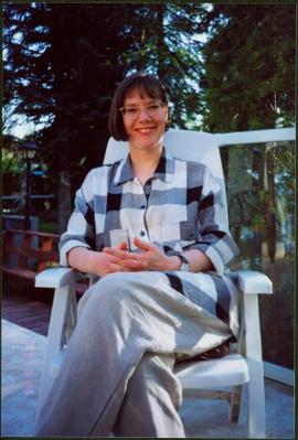
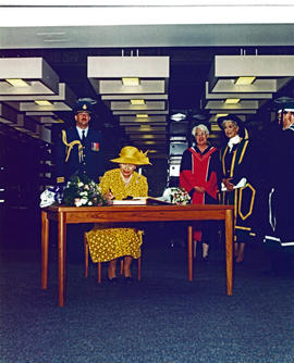
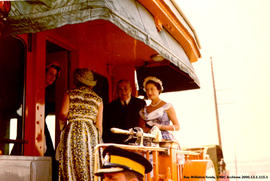
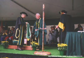
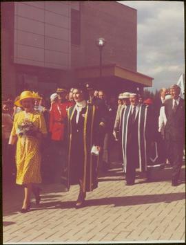
Photograph depicts Bridget Moran's daughter Roseanne sitting in patio chair on deck in backyard. Deck railing in midground, trees in background. Accompanying note from Maureen Faulkner: "Roseanne - elegant." Photo taken on the day Bridget Moran received an Honourary Law Degree from the University of Northern British Columbia in Prince George, B.C.
Water and dock in foreground, trees and cliffs in background.
Handwritten annotation on verso “’Boat Hammond at South Fort Geroge”.
Image depicts a river, possibly the Nechako, in Prince George, B.C. Possibly taken from the Foothills Bridge.
Item is a photograph of Ray Williston receiving an honorary degree at the University of Northern British Columbia from Chancellor Iona Campagnolo.
Item is a photograph of Ray Williston standing beside a plaque at the dedication of the Peace River Power Project Substation bearing his name in Prince George on August 30, 1965.
Slide depicts a burning building at the Aleza Lake Experiment Station on the date it was shut down by the BC Forest Service.
Slide depicts the Ranger Station at the Aleza Lake Experiment Station.
Image depicts the Ramada Hotel in Prince George, B.C.
Photograph depicts railway crossing in front of tent buildings. Dirt road in foreground, forest trees in background. Photograph speculated to have been taken in a construction camp at Prince George.
Photograph taken at the University of Northern British Columbia in Prince George, B.C. Campagnolo and Weller wear full regalia, and RCMP officers can be seen in crowd.
Photograph taken in the Geoffrey R. Weller Library at the University of Northern British Columbia in Prince George, B.C. Officer in uniform stands in background.
Handwritten annotation on verso reads: “Aug 17 - 1994, Opening Day, UNBC, Library".
Image depicts the flows from a pulp mill in Prince George, B.C.
Image depicts the Prince George Public Library from 7th Ave.
Image depicts the Prince George Public Library.
Item is the Proposed Land Use Map, 1978-2012, referred to in By-law No. 3138, the City of Prince George Official Community Plan. The original draft of this map was completed on October 24, 1977. This version of the map was amended in July 1982.
Item is a map depicting proposed land use between 1978 and 2012 in the City of Prince George. This map was drawn for the City of Prince George Community Plan; this particular version of the map was displayed in City of Prince George council chambers through 1979.
Photograph depicts a private rail/road bridge built to serve Northwood Pulp and Timber, Ltd. Crossing Fraser River. Looking west, towards the mill. On private Northwood trackage.
Item is a photograph of Princess Margaret on July 17, 1958 at an event staged in the Prince George railway yards. Alex Moffat dressed as a prospector demonstrates panning for previously salted gold nuggets, which were later given to the Princess.
Item is a photograph of Princess Margaret on the back deck of the Royal train's caboose just prior to her departure from Prince George during her 1958 visit to British Columbia.
Originally mounted on a poster with photographs 115, 115.2, 115.3.
Item is a photograph of Princess Margaret arriving by Canadian Air Forces jet at Prince George. Lieutenant-Governor Frank Ross is walking beside the Princess.
Originally mounted on a poster with photographs 115, 115.2, 115.3.
Item is a photograph of Princess Margaret arriving by Canadian Air Forces jet at Prince George. Lieutenant-Governor Frank Ross is walking beside the Princess.
Originally mounted on a poster with photographs 115, 115.2, 115.3.
Item is a photograph of Princess Margaret with Lieutenant-Governor Frank Ross and Mr. Williston taken on July 17, 1958 after disembarking in Prince George from a Canadian Forces plane.
Wide angle photograph of a forested area with Prince George in the distance. Printed annotation on recto reads: "Prince George, B.C. 1924."
Sloped banks visible across the Nechako River in background. It is believed that this photograph was taken from Connaught Hill. Tree silhouetted in right foreground.
Stern wheeler in river. Handwritten annotation in pencil on verso reads: “Prince George to Tete Jaune” Hand written message in ink on verso is addressed to “Mademoiselle Elisabeth Joliet, Terrguy – Les Dijore Cote a Or France”
Photograph depicts a B.C. Telephone book with a CN bridge crossing the Fraser River featured on its cover.
Image depicts the Four Seasons Leisure Pool, and the Centennial Fountain in Prince George, B.C. Map coordinates 53°54'48.5"N 122°44'49.2"W
Image depicts the Prince George welcome and population sign, with a population of 71,086. Map coordinates 53°53'52.0"N 122°46'08.7"W
Image depicts the Prince George Sawmill from the Northwood Bridge.
Image depicts Prince George Sawmill taken from across the Nechako River looking southwest. Map coordinates 53°56'00.0"N 122°44'29.7"W
Image depicts an aerial view of a Prince George residential section between Highway 97, Carney Street and 10th Ave looking north. Map coordinates 53°54'54.0"N 122°46'00.4"W
Photograph depicts a crane at the Prince George Railway Museum.
Photograph depicts a speeder car at the Prince George Railway Museum.
Photograph depicts tanks at the Prince George Railway Museum.
Photograph depicts the rear of two locomotive cars at the Prince George Railway Museum.
Phoo depicts a train at the Prince George Railway Museum.
Photograph depicts a locomotive at the Prince George Railway Museum.
Photograph depicts a crane at the Prince George Railway Museum.
Photograph depicts a locomotive at the Prince George Railway Museum.
Photograph taken at the Prince George Railway Museum.
Photograph depicts a snow plow at the Prince George Railway Museum.
Item is a photograph of, from left: John G. Prentice of Canadian Forest Products; Peter Bentley of CanFor; Mr. Williston; unknown; Premier W.A.C. Bennett; an unknown representative of Reed Paper and L.L.G. “Poldi” Bentley of Can For.
Image depicts the Prince George Public Library (Bob Harkins Branch). Map coordinates 53°54'43.1"N 122°44'56.4"W
Image depicts the Prince George Public Library (Bob Harkins Branch). Map coordinates 53°54'44.6"N 122°45'01.7"W
Postcard image depicts streetview looking west along 3rd Ave in Prince George, B.C. Storefronts and period automobiles are visible. Handwritten annotation on photographic negative, now visible along bottom of print image reads: "3rd Ave, Prince George B.C. Looking West. HND 41".
Image depicts Prince George near the Airport Road.
Photograph features the hotel on George Street, Prince George BC. Handwritten annotation on verso of photograph reads: "Xmas [1948?]", on recto: "From Mr. & Mrs. Fask Douglas." Poem on verso reads: "May Christmas Joy And all its cheer Be yours throughout A good New Year".
Image depicts the Prince George Hotel.