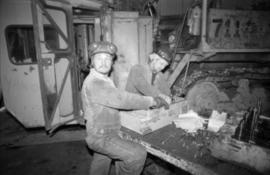
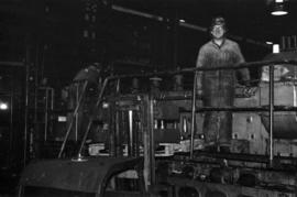
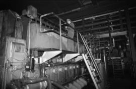
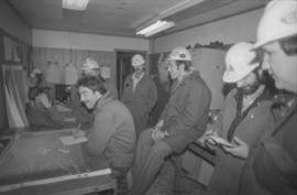
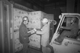
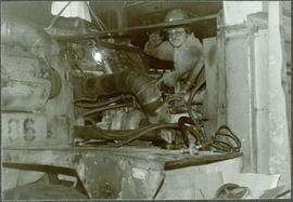
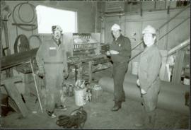
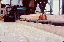
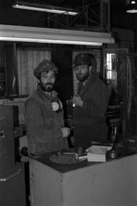
Photograph depicts two men wearing coveralls and hard hats in shop area. Wally Cameron stands on right.
Photograph depicts two unidentified men wearing coveralls, hard hats, and headphones, while working at table in garage. Blasthole drill stands behind them in background.
Photograph depicts two unidentified men in coveralls and hard hats, working in garage. Blasthole drill stands behind them in midground, walls in background.
Photograph depicts Chris Tates seated at table with paperwork in left foreground. David Pewsey stands behind on right, pointing to what appears to the Fibre Loading Schedule. Pewsey was supervisor of the Fibre Storage Shed. Both men wear hardhats. Tates believed to be wearing gold nugget Cassiar ring on left hand.
Photograph depicts Ruston Hornsby diesel engines which turned the generators in the power house on the Cassiar plant. Two unidentified men wearing coveralls can be seen in image.
Photograph depicts two unidentified men standing on Ruston Hornsby diesel engine which turned the generators in the power house on the Cassiar plant.
Photograph depicts unidentified man standing on Ruston Hornsby diesel engine which turned the generators in the power house on the Cassiar plant.
Photograph depicts unidentified man standing in change house located at the new Mine Dry building. This change house utilized baskets which could be lowered under hinged covers, while the previous change house used baskets which could be raised by chains.
Photograph depicts group of seven men in the Engineering/Survey building (former location of old mine dry). Photo believed to have been taken during the weekly meeting in which strategies were discussed for open pit operations (blasting, haulroad, ore and waste zones). Left to right: Danny Demitri, Roger Borsato, Tim Carew, Don Loverin (behind), Tim Williams (seated), Paul Clarke, Paul McRae.
Photograph depicts group of seven men in the Engineering/Survey building (former location of old mine dry). Photo believed to have been taken during the weekly meeting in which strategies were discussed for open pit operations (blasting, haulroad, ore and waste zones). See item 2000.1.1.3.19.217 for similar photo with individuals identified.
Photograph depicts group of six men in upper meeting room of Engineering/Survey building (former location of old mine dry). Left to right: Tim Carew, Stefan Dyk, Mike Pennock, Paul Clarke, John Oughtred, [unknown].
Photograph depicts unidentified man operating forklift on right. Pallets of asbestos fibre sit on trailer in background. Two men with clipboard stand in left foreground (David Pewsey on left, Chris Tates on right, see also item 2000.1.1.3.19.212).
Photograph depicts Darren DeCecco wearing coveralls and hard hat while sitting on a Pacific truck. (Pacifics were used to supply water to mine, remove snow, and supplement ore haul by tramline).
Photograph depicts three men wearing coveralls and hard hats in carpenter shop. Left to right: Jason Clark, Alf Guderjahn, Herbert Pichler (shop tool crib man).
Item is a photograph of a worker operating a Chip-n-Saws.
Photograph depicts a worker holding "On Strike for a Decent Contract" sign during the 1970 U.S.W.A. Local 6536 strike at Cassiar.
Fully loaded logging truck driving along a wood plank logging road. Another road under construction is also visible through forest in background.
Handwritten annotation in pencil on verso reads: “Logging - Giscome B.C. Plank truck road - also road under construction showing sills & cribbing."
Winter landscape scene featuring a man cleaning up a wood pile covered with snow (?). Handwritten caption beside this photo reads: "ALL WINTER 1945 1946 Cleaning of the Wood Pile".
Photograph depicts an unidentified individual wearing a welding helmet, and kneeling behind large bearing cups of one of the Ruston Hornsby diesel engines that turned the generators in the power house on the Cassiar plant. Door, bulletin board, and miscellaneous supplies in background.
Three men can be seen on deck of small boat. Rocky shore in foreground, forest and hills on opposite shore in background.
Handwritten annotations on verso read: "Dad - en route up Nass River on official business. (hence the flag & business suit!)"; "Going up the Nass. Dad (Indian Agent) Cap Barry (Inspect. of Schools) travelling up the Nass River to Aiyansh".
Photograph depicts large swath of dark waste down mountainside to right of valley. The waste dump is believed to be visible at top of swath on right of image. Bench mining visible on the North and South peak in background. Handwritten annotation on recto of photograph: "Oct. 25 / 65 4:25 PM."
Photograph depicts a man and woman standing on what is believed to be an early mining bench. Two men with air track drill can be seen in background, one man father down on left, mountain range in background. Image slightly distorted due to poor quality of negative.
Photograph depicts two men standing in foreground, hull of unfinished ship in background. Construction supplies and materials throughout.
Image of man seated with shovel in mountainous area, loose asbestos fibre in background. This photograph is believed to be either a double exposure of two images, or a print made from two negatives at once. Photo depicts an unidentified man sitting on the south ridge of the Cassiar ore body, where the crusher and rock reject plant would eventually sit. Valley in background appears to depict the "Footwall Road," which was cut into the mountain from the pit to the crusher plant and became the mine's main haul road.
Photograph depicts unidentified man with glasses reclining on blanket, coats hanging behind him. Some type of shelving or roofing can be seen in background. Man is wearing pants, belt, and striped shirt with a pencil in the pocket. It is speculated that this man may be Bert Youngstrom, (see items 2005.3.4 & 2005.3.59).
Two men standing beside wheelbarrows with signs that read: “Prince Rupert Transfer Co.” The men appear to be standing on large dock or boardwalk, water and hills in background. Printed annotation on recto reads: “Prince Rupert First Transfer Company.” Handwritten message in pencil on verso is addressed to “Mr. Gordon Penning 1600 Bld. Barclay Vancouver B.C.” Cancelation date on 1 cent Canadian Stamp is dated “Prince Rupert B.C. July 16, 09”.
Photograph depicts two men standing in snow-cleared area next to firewood pile. Two tent buildings stand behind them, forest trees visible in background. Photograph taken at what is believed to have been a railway construction camp.
Handwritten caption beside this photo reads: "Cutting Fire Wood". Photograph depicts two men on either side of large log using chain saw in wood clearing. A small snow-covered building can be seen in background.
Handwritten caption above this photo reads: "Cutting Fire Wood". Photograph depicts two men on either side of large log using chain saw in wood clearing. A third man is watching them from behind the saw. A wood pile and small snow-covered building can be seen in background, as well as what is believed to be a caterpillar bulldozer.
Photograph depicts unknown men driving bulldozers on edge of mine area at high elevation. Dozers are Internationals, model TD24 (manufactured between 1947 and 1955). Valley and mountain range in background.
Photograph depicts a group of men standing to right of large truck, houses in in background. Boom of crane visible between truck and houses. Trees and power lines also visible.
Image depicts Upper Fraser residential area during demolition of town site. Map coordinates 54°06'51.6"N 121°56'26.3"W
Handwritten photo album caption below this photo reads: "Tower & Adm. Bldg, Ft. Nelson." Photograph depicts long white building with tower raised in middle, ladders and scaffolding in front. Trucks and groups of men in foreground, some on building itself. Power poles in foreground and background.
Zonder titelPhotograph depicts three men standing in dirt area near fire wood. Tent building semi-visible on left, forest trees behind snow pile in background. Handwritten annotation on recto of photograph: "Relief camp at Penny. 100 men - A.K. Bourchier Foreman - Dixon Taylor timekeeper. [Ted Nevan?] purchasing agent - hungry thirties. Construction days. Mile 29 - A.K. Bourchier J.P." Man in middle is believed to be A.K. Bourchier.
Group of men stand on pier by warehouse, looking out at the boat. Treed mountains visible in background.
Handwritten photo caption beside image reads: "Danube".
Image is one of 65 photos documenting a survey of the Canada-Alaska Boundary, Taku River area, May 23 to Oct. 15, 1906.
This particular photo is one of 13 found in original enclosure with the following handwritten annotation: "SOME OTHERS." See also items 2006.20.3.22 - 2006.20.3.34.
Image is one of 65 photos documenting a survey of the Canada-Alaska Boundary, Taku River area, May 23 to Oct. 15, 1906. This particular photo is one of 9 found in original enclosure with the following handwritten annotation: "Pictures of different members of ‘our’ party.” See also items 2006.20.3.57 - 2006.20.3.65.
Photograph depicts two men walking with rope stretched between them close to shore of river, canoe floating behind them. Opposite shore crosses midground, mountains stand in background. Handwritten annotation visible on negative: "Gilroy & [Nellis?] - Kopoka River".
Image is one of 65 photos documenting a survey of the Canada-Alaska Boundary, Taku River area, May 23 to Oct. 15, 1906. This particular photo is one of 9 found in original enclosure with the following handwritten annotation: "Pictures of different members of ‘our’ party.” See also items 2006.20.3.57 - 2006.20.3.65.
River flows through rocky area, mountains visible in background.
Image is one of 65 photos documenting a survey of the Canada-Alaska Boundary, Taku River area, May 23 to Oct. 15, 1906. This particular photo is one of 9 found in original enclosure with the following handwritten annotation: "Pictures of different members of ‘our’ party.” See also items 2006.20.3.58 - 2006.20.3.65.
Photograph depicts two unknown men walking on rocky shore with canoe over their heads. Water and forest in background. Handwritten annotation visible on negative: "[?] portaging canoe".
Image is one of 65 photos documenting a survey of the Canada-Alaska Boundary, Taku River area, May 23 to Oct. 15, 1906.
This particular photo is one of 8 found in original enclosure with the following handwritten annotation: "From main camp up Kopoka River. Scenes with persons in." See also items 2006.20.3.14 - 2006.20.3.21.
Photograph depicts two men paddling in canoe, shore in background. Handwritten annotation visible on negative reads: "Stughes & B_ Lake behind Main Camp Taku River".
Image is one of 65 photos documenting a survey of the Canada-Alaska Boundary, Taku River area, May 23 to Oct. 15, 1906.
This particular photo is one of 13 found in original enclosure with the following handwritten annotation: "SOME OTHERS." See also items 2006.20.3.22 - 2006.20.3.34.
Photograph depicts two men on either side of camera on tripod, flag visible behind them. Mountain range and glacier in background.
Image is one of 65 photos documenting a survey of the Canada-Alaska Boundary, Taku River area, May 23 to Oct. 15, 1906. This particular photo is one of 9 found in original enclosure with the following handwritten annotation: "Pictures of different members of ‘our’ party.” See also items 2006.20.3.57 - 2006.20.3.65.
Photograph depicts two unidentified men standing to right of flag mounted in rock pile.
Image is one of 65 photos documenting a survey of the Canada-Alaska Boundary, Taku River area, May 23 to Oct. 15, 1906.
This particular photo is one of 13 found in original enclosure with the following handwritten annotation: "SOME OTHERS." See also items 2006.20.3.22 - 2006.20.3.34.
Photograph depicts two unidentified men standing to right of flag mounted in rock pile.
Image is one of 65 photos documenting a survey of the Canada-Alaska Boundary, Taku River area, May 23 to Oct. 15, 1906. This particular photo is one of 10 found in original enclosure with the following handwritten annotation: "From [Wahut?]-Azmuth and Koshu.” See also items 2006.20.3.47 - 2006.20.3.56.
Photograph depicts unknown men standing with walking sticks, carrying large bundles on their backs. Water and opposite shore in background, mountains visible in distance. Handwritten annotation visible on negative: "Billy [Gilroy?] & [?] packed for [?]".
Image is one of 65 photos documenting a survey of the Canada-Alaska Boundary, Taku River area, May 23 to Oct. 15, 1906.
This particular photo is one of 13 found in original enclosure with the following handwritten annotation: "SOME OTHERS." See also items 2006.20.3.22 - 2006.20.3.34.
Photograph depicts three unknown men standing in water while pulling loaded canoe by rope. Rocky shore and hills in background. Illegible handwritten annotation visible on negative: "...[K. River]?" (Kopoka?)
Image is one of 65 photos documenting a survey of the Canada-Alaska Boundary, Taku River area, May 23 to Oct. 15, 1906.
This particular photo is one of 8 found in original enclosure with the following handwritten annotation: "From main camp up Kopoka River. Scenes with persons in." See also items 2006.20.3.14 - 2006.20.3.20.
Photograph depicts three men sitting in front of tent structure with log base, trees in background. Believed to be main campsite area (see item 2006.20.3.59).
Image is one of 65 photos documenting a survey of the Canada-Alaska Boundary, Taku River area, May 23 to Oct. 15, 1906. This particular photo is one of 9 found in original enclosure with the following handwritten annotation: "Pictures of different members of ‘our’ party.” See also items 2006.20.3.57 - 2006.20.3.65.
Photograph depicts three unidentified men loading canoe on river shore.
Image is one of 65 photos documenting a survey of the Canada-Alaska Boundary, Taku River area, May 23 to Oct. 15, 1906.
This particular photo is one of 8 found in original enclosure with the following handwritten annotation: "From main camp up Kopoka River. Scenes with persons in." See also items 2006.20.3.14 - 2006.20.3.21.
Photograph depicts miscellaneous items and supplies in front of white tent. Unknown man stands in foreground and a second man can be seen sitting in tent. Stand of trees in background. Handwritten annotation visible on negative: "[?] Oct 13".
Image is one of 65 photos documenting a survey of the Canada-Alaska Boundary, Taku River area, May 23 to Oct. 15, 1906. This particular photo is one of 9 found in original enclosure with the following handwritten annotation: "Pictures of different members of ‘our’ party.” See also items 2006.20.3.57 - 2006.20.3.65.
Photograph depicts two unidentified men climbing down crevice in rocks.
Image is one of 65 photos documenting a survey of the Canada-Alaska Boundary, Taku River area, May 23 to Oct. 15, 1906.
This particular photo is one of 8 found in original enclosure with the following handwritten annotation: "From main camp up Kopoka River. Scenes with persons in." See also items 2006.20.3.14 - 2006.20.3.21.