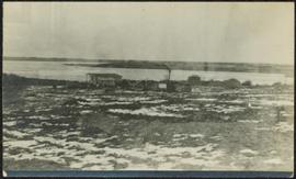
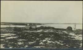
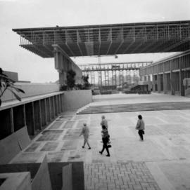
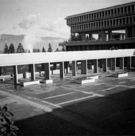
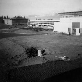
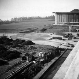
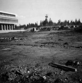
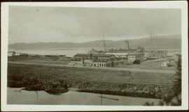
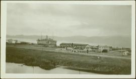
Image depicts a snow gauge at an uncertain location.
Image depicts the CN rail station in Smithers B.C.
Image depicts a view of what appears to be a small town at an uncertain location.
Image depicts a small, abandoned house in Woodpecker, B.C.
Image depicts an aerial view of what appears to be a small farm, possibly in the McGregor Canyon.
Child stands in distance beside tall totem pole. Tree stumps in foreground, forest and mountains in background.
Handwritten annotation on verso reads: "[Sanabati near Upper Queen?] Kasaan Alaska".
Photograph depicts small building speculated to be a house in a farm yard. Frozen water crosses midground, opposite shore in distance.
Photograph depicts a small barn that had just been built within the last 12 months.
Photograph depicts sluice trunk in mining area, men on tall structure in background.
Photograph depicts the sluice gates off the Nicola River, on a ranch at Nicola village, 7 miles northeast of Merritt.
Photograph depicts the Silver Ledge Hotel, Ainsworth Hot Springs, on the west side of Kootenay Lake, north of Nelson.
Image depicts a skier in a costume with a fake sword, somewhere on the Birchleg Ski route on Tabor Mountain in Prince George, B.C.
Image depicts the community of Skidegate on Haida Gwaii.
Image depicts two unidentified individuals examining a tractor meant to delimb trees. It is located in Prince George, B.C.
Photograph depicts crowd of people in foreground near log fence. More crowds can be seen in distance at base of ski jump on either sides of the run. Jump visible at top of tree-covered hill in background. It is believed that this photograph was taken near the current location of City Hall.
Crowd stands in background.
Handwritten annotation on verso reads: “Fall 1978, Kispiox, 2 Poles by Walter Harris”.
Unidentified building stands in midground, water and hill on opposite shore visible in background.
Handwritten annotation on verso reads: “Kispiox”.
Forest in background.
Handwritten notation included with photograph reads: “The ‘Beloved North,’ Skeena Riding (always)”.
Image depicts two totem poles in Skeena Crossing, B.C.
Image depicts Skeena Crossing, B.C.
Image depicts the bus depot in Skagway, Alaska (USA).
Image depicts the old railroad building in Skagway, Alaska.
Image depicts a pair of mannequins in the second story windows of a building, possibly located in Skagway, Alaska.
Image depicts one of the main streets, Broadway, in Skagway, Alaska.
People, boardwalks, and store signs visible in street scene. Printed annotation on recto reads: “6th St. Prince Rupert. B.C.” Handwritten message in ink on verso is addressed to: “Mrs. Loistram Halls Buildings Nicholas St Limerick Ireland”. Verso stamped "PRINCE RUPERT JUN 30 10".
Street scene depicts people, boardwalks, and buildings with store signs. Printed annotation on recto reads: “6th St. Prince Rupert. B.C.” Pencil marking on recto reads: “1912”(incorrect?). Handwritten message on verso in ink is addressed to: “Mrs. Willis Messinger Portland Oregon” Cancelation mark on Canadian 1 cent stamp reads: “Prince Rupert BC MR 11, 12”
Street view of Sixth Street in Prince Rupert BC. A small group of men is shown loitering on the sidewalk. Annotation on recto reads: "Sixth St. Prince Rupert BC." Handwritten annotation on recto is heavily obscured by glued on paper and reads: "Prince Rupert [illegible] 12th 12 Dean Harry! [Illegible] lived here last night after [illegible] pleasent[sic] trip. What do you think of this city since you saw it last. Saw George before I left Vancouver, he looks still the same. Kindest regards to you & wife. Nib [??]." Postcard is addressed to: "Mr H Banker 2732 Arch Ave West Seattle Wash USA." Postcard is affixed with a one cent Canadian stamp. Postmark reads: "Prince Rupert BC PM 2 1 JUN 12."
Photograph depicts "Six Mile House Stable" on the west side of Okanagan Lake.
Photograph depicts the site of a former C.P.R. connection between the mainline into Vancouver and False Creek yards at West Pender St. In Vancouver. The rails are not used but still appear in the street and on the parking lot on the far side. Another parallel set of tracks 30 yards to the east are in daily use.
Photograph depicts Sirdar station belonging to the C.P.R. It is at the south end of Kootenay Lake and 11 miles north of Creston. There is a little used turntable behind the depot. The view is looking south.
Image depicts railway tracks and buildings with a beehive burner on the left. The location is likely Sinclair Mills, B.C. Map coordinates 54°01'17.4"N 121°40'53.0"W
Image depicts a beehive burner covered in snow in Sinclair Mills, B.C. Map coordinates 54°01'17.4"N 121°40'53.0"W
Photograph depicts Simon Fraser University in Burnaby, B.C., 1 week after the official opening.
Photograph depicts Simon Fraser University in Burnaby, B.C., one week after the official opening.
Photograph depicts Simon Fraser University in Burnaby, B.C. The view is looking northeast towards the northwest corner of the Academic Quadrangle.
Photograph depicts Simon Fraser University in Burnaby, B.C. The view is looking northwest from the science complex towards the gymnasium.
Photograph depicts Simon Fraser University in Burnaby, B.C. The view is looking southwest from the mall towards the gym and sports arena.
Photograph depicts Simon Fraser University in Burnaby, B.C. The view is looking east towards the nearly completed water tower from the west inner face of the Academic Quadrangle.
Side perspective street view of Prince Rupert Post Office, as well as neighbouring buildings including the Prince Rupert Bazaar. Printed annotation on recto reads: "Post Office Prince Rupert B.C." Unidentifiable photographer's stamp is on lower right corner.
Shops stand along riverside boardwalk. Storefront sign for R. Cunningham & Sons visible. Many people stand and sit on boardwalk, and canoes and small boats float in water in foreground.
Handwritten photo captions beside image read: "R. Cunningham & Sons - Probably Port Essington", "NW coast canoe".
Photograph depicts a shop on the north side of Main St. in Cumberland on Vancouver, Island.
Image depicts several ships on the water in Prince Rupert, B.C.
Photograph depicts a large ship behind dock buildings. Railroad crosses foreground, hills visible on shore in background.
Handwritten annotation on verso reads: "Pr. Rupert Drydock".
Photograph depicts a large ship behind dock buildings. Railroad crosses foreground, hills visible on shore in background.
Handwritten annotation on verso reads: "Ship in Pr. Rupert dry dock during Great War 1915?".
Photograph depicts a large ship behind dock buildings. Railroad crosses foreground, hills visible on shore in background.
Handwritten annotation on verso reads: "Drydock Prince Rupert".
Image depicts the church after its restoration in Shelley, B.C.