Photograph depicts two men working with air track drill in mine area. Hose and dynamite box in foreground, mountains in background. Handwritten annotation on verso of photograph: "Sept. 1954." This photograph was originally stored inside duotang labeled "CASSIAR ASBESTOS CORPORATION LIMITED PHOTOGRAPHS 1954"; photo caption beneath this image: "Starting New Bench at South end of Deposit."
This file includes two major photographic collections concerning the construction and development of the underground mine at Cassiar, title the McDame Project.
The first collection includes fifteen monthly progress reports documenting the development from July 1988 to December 1989. The progress reports are authored by G. Verret, and were distributed to the executives of Cassiar Asbestos in Vancouver as well officials of the B.C. Government and other creditors of the Corporation. Most images are annotated and dated. Many of the loose photographs are accompanied by an inventory sheet.
Subjects depicted include: the staging area prior to mine development, the initial development of the “Vent Portal”, a jumbo drill working on the mine face, the working face marked for drilling and wired with fuses, a Caterpillar dozer clearing snow after an avalanche, scene of a fire in winter time, complete conveyor sump decline, mining vehicle parked on the “Lay-Down Area” presumably near the portal, the working face of the mine at various stages of development, 1563 portal being slashed, the removal of the overburden for the tramline loading station site, the construction of the transfer tower(s), construction of the stockpile area, the construction of a sedimentation pond, a presumed cave in, construction of footings for the conveyor, construction of the tramline loading terminal station, construction of the crusher building, a slash titled “Breakthrough in Access Ramp”, storage of powder and fuses, a washout in conveyor decline, fog at the portal in -30 degrees Celsius, the 1290 junction flooded, a slab of shotcrete which fell on and injured a miner while shotcreting, shotcrete blasted off walls for repairs, images of the “Hilti-test”, shots showing grade of drift, and structural failures in the 1350 adit.
Locations and structure within the underground mine depicted include: yellow ventilation ducting, ground support including steel screen and shotcrete, steel cables bolted unto ground support, puddles in the adits, the access road to the lay-down area, the exhaust drift, “Fans and Heaters in the 1415 adit”, the 1350 sump, the access ramp to the 1320, the exhaust ramp safety bay, the conveyor decline, the ventilation adit, the 1563 portal, the temporary repair shop at the 1415 portal, junctions of various drifts, the ”Fresh Water Pump & Pumphouse on lower Creek”, the “Ventilation Raise/1563 Platform”, a “Diamond Drill Station” at 6066 North in the underground mine, the “Bridge to the Gravel Pit”, the “Crushing and Screening Plant” in the gravel pit, the ventilation bulkhead in the conveyor decline, and the “Powder Magazine”.
People depicted include Rose Gay and R. Tyne on a tour of the underground mine, a geologist with a rockhammer, a miner identified as A. Jacobs working, contract miners Bruno and Marbel from Canadian Mine Development, and unidentified miners rockbolting, shotcreting, and drilling using jackleg drills.
Vehicle and mining equipment depicted include jeeps, pickup trucks, a front end loader, an unidentified a small unmanned tracked machine with a long arm, scoop trams, a land cruiser, an ore truck with a flat tire, the cone crusher, a “scissor lift”, a mobile shotcrete machine, a new grout pump, a new Boart Jumbo Drill, and a detached bucket half of a 413 ore truck.
The second collection depicts the McDame Project construction in 1986 and 1987.
Content of these photographs includes: various machinery used for excavating and drilling, underground progress of tunneling, supports, wire meshing, rock formations in mine, and exposed asbestos. There are no annotations regarding this photographs.
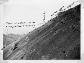
Handwritten annotation below photo on page taped to photograph: "PHOTO #2: Looking N across talus slide of asbestos fibre and serpentine fragments." Handwritten annotation on verso of photograph in blue ink describing sections of photograph which have been pointed to or outlined: "Talus of asbestos fibre & serpentine fragments -->" "Photo #1 -->" "Approx upper contact of serpentine -->".
Photograph depicts snowy mountaintop, wooden shelter and truck in foreground. Corresponding note on accompanying photo description page: "Pictures taken July 2nd, 1952. 1. Picture taken from campsite showing snow on talus."
Handwritten annotation below photo on page taped to photograph: "PHOTO #4 Face of cut 4' wide 3' deep. Showing serpentine fragments in loose asbestos fibre. Assumed to overly serpentine high in fibre veinlets. Frost action."
Handwritten annotation below photo on page taped to photograph: "PHOTO #3 Showing approx. area covered by Asbestos - serpentine float". The approximate area has been outlined in blue ink on verso of photograph. Photo taken from lower level in valley, trees in foreground, outcrop visible in distance.
Handwritten annotation below photo on page taped to photograph: "PHOTO #1: Outcrop of Serpentine showing veinlets of asbestos fibre. Wider veinlets 1/2" - 1"."
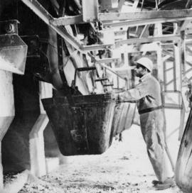
Photograph depicts a man in work clothes and hard hat standing with hands placed on the first of many tram buckets hanging in a line. Steel beam framework of station building rises above him. Handwritten annotation on recto of photograph: "[F1?] LOADING STATION EL. 5800". Photograph was glued to cardboard backing with the annotation: "1962".
File contains images depicting various landslides near Cassiar BC. Set of 20 photographs (with 9 corresponding negative strips) date stamped June 1987 depict landslide near creek and dirt road with a Cassiar company truck. Set of 5 black and white photographs found in envelope marked "D. Stewart" are likely from 1988-1989 and depict a rockslide on the south western side of the pit mine, near the tramline. Album entitled “6200 DUMP SLIDE / SPRING, 1979” contains 34 photographs depicting aerial shots of a massive rockslide on the eastern slope of McDame Mountain, originating from the mine waste dump. Several images from album show greenish water pooling in the toe of the slide.
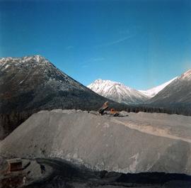
Photograph depicts ore haul truck at dump in mine, driver visible, mountain range in background. Handwritten annotation on recto of photograph: "Kenworth - Model 802 dumping stripping waste at 6565 Elevation", on verso: "1961".
Typed annotation on caption adhered to recto of photograph: "Presentation of Open Pit Mines and Quarries Annual Safety Award by W.K. Kiernan, Minister of Mines, British Columbia to J.G. Berry, General Superintendent, Cassiar Asbestos Corporation. Cassiar Asbestos Corporation won the trophy for the year 1962 with a compensable accident frequency of 7.19." Photograph depicts J.G. Berry shaking hands with Mr. Kiernan as he accepts a plaque from the "DEPARTMENT OF MINES AND PETROLEUM RESOURCES." A man and woman are partially visible at table behind them. Curtains on wall in background.
A black and white photographic print of Iona Campagnolo in the Cassiar mill wearing a ‘VISITOR’ hard hat and overalls. Two unidentified workers provide a tour of the mill and show sample of the asbestos fibres.
Photograph depicts ore haul truck at dump in mine, mountain range in background. Photo also features driver and a second unidentified man standing in front of truck. Handwritten annotation on recto of photograph: "Int. Harvester Payhauler Model 95 dumping stripping waste at 6565 Elevation", on verso: "1961".
Photograph depicts ore haul truck on road in mine area, mountain wall in background. Handwritten annotation on recto of photograph: "Int. Harvester Payhauler Model 95", on verso: "1961".
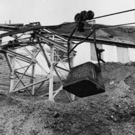
Photograph depicts bucket hanging from tramline in foreground. Support tower stands in midground in front of station building. Another building can be seen at top of mountain in background. Handwritten annotation on recto of photograph: "INCOMING BUCKET #1 STATION". Photograph was glued to cardboard backing with the annotation: "1962".
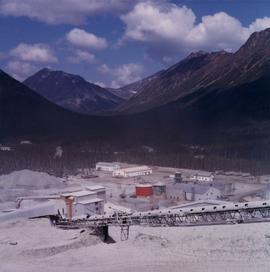
Photograph depicts plant buildings below, tailings pile in foreground. Valley and mountains in background. Handwritten annotation on recto of photograph: "CASSIAR".
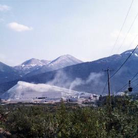
Photograph depicts plant buildings in front of tailings pile in midground. Forest, power line, and tramline in foreground; south mountains in background.
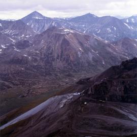
Photograph depicts the West Peak of the Cassiar mine on McDame Mountain. Pit area visible between West Peak and road in foreground. Mine valley and north mountain range in background. Photo speculated to have been taken from a point on or near the South or North Peak.
Photograph depicts crusher plant in centre foreground. Shifter shack and vehicles can be seen in front of pit area. West Peak semi-visible in right midground. Mine valley an northwestern mountain range in background.
The file contains eight photographs depicting close up images of three rock samples, some photographed with a ruler for scale. One of the rock samples is speculated to be obsidian and the other two are likely serpentine. The images where originally found in an envelope titled "ROCKS" and are likely dated around 1991.
Included in this file are an five photographs of rocks on a shelf, which may be asbestos sample rocks. There are five accompanying negatives to these photographs and are likely dated around 1977. The photographs and negatives were found in an envelope labelled "Negatives - CIMM Photos."
Additionally two negative strips of geology maps of Canada. These negatives were found in an envelope labelled "Negatives - CIMM Papers, Mining, Planning, Geology."
Photograph depicts two men standing to left of Fred Murray on balcony of large building or structure speculated to be in the Cassiar valley. Portion of log structure in left foreground, man and hauling trucks on road in background.
File contains portraits and sample photographs of exposed asbestos fibre: in veins of rock outcrops, and loose in talus on McDame Mountain (location of Cassiar mine). Some photographs were printed in Cassiar's Annual Reports, with labels and descriptions.
Photograph depicts the North peak of McDame mountain in the earlier stages of strip mining, South peak unmined in background. Quonset and other shops visible in left foreground, unknown building built into mountainside in right foreground.
Photograph depicts dump truck under power lines and tramlines on gravel road. Buckets hang on line, mountains in background.
Photograph depicts red truck dumping waste at what is believed to be the tailings pile at the Cassiar plant. Small building and unidentified individual in bottom left foreground, valley and mountains in background. Photo caption next to printed copy of image in 1953 Annual Report: "Stockpile of 80,000 tons of Ore at Mill."
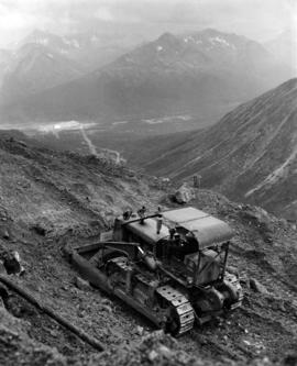
Photograph depicts unknown man driving bulldozer near edge of mine area at high elevation. Dozer is an International model TD24 (manufactured between 1947 and 1955). Valley and mountain range in background.
Photograph depicts unknown man driving bulldozer on edge of mine area at high elevation. Mine road can be seen below leading to Cassiar plant in background on left, townsite visible on right. South mountain range in distance. Handwritten annotation on verso of photograph: "1961".
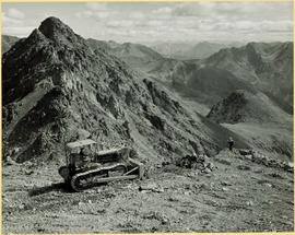
Photograph depicts unknown man driving bulldozer on edge of mine area at high elevation. The dozer is an International model TD24 (manufactured between 1947 and 1955). A second man stands on edge of cliff, directing driver. Mountain range in background.
Photograph depicts unknown man driving bulldozer on edge of mine area at high elevation. The dozer is an International model TD24 (manufactured between 1947 and 1955). A second man stands on edge of cliff, directing driver. Expansive mountain range in background.
Photograph depicts unknown man driving bulldozer in foreground. Shop area in background, numerous haul trucks and dozers throughout. Old mine garage can be seen in center behind dozer, and the mine's West Peak rises on right behind shop buildings. Mountain range in background. Handwritten annotations on recto of photograph: "Cassiar Asbestos Corporation Limited. Cassiar B.C. Mining asbestos ore elevation approx 6000 ft. above sea level. McDame mountain, Northern British Columbia"; "Toronto Set"; "D - 336"; "-4 1/2 -". What appears to be framing measurements are annotated on verso.
Six metal storage cases containing primarily slides depicting drill core sections in wooden storage trays. Cases contain inventories of slide images as well as annotations which document the year, drill hole number, and the length along the drill hole from which core sections are taken. In addition to the documentation of drill core sections, the cases contain slides depicting the following subjects: “Representative samples” of drill core fragments, drill core fragments in perspective, “physical characteristics” of the drill cores and the storage trays, the pit mine, a worker in a plaid shirt, close up shots of the geology of the working face, and images annotated “SHOTS OF JADE BOULDER CORE J5-J1”. Five slides originally filed separately and stamp dated “Jul. ‘73” depict what is speculated to be employees working on the diamond drilling project include 2 images annotated ‘R. Dickin Aug ‘72’, ‘I. Oliver Aug ‘73’, ‘S. Zimmer Aug ‘73’, and ‘core shack ’73’. The cases contain 234 7x7cm slides and at least 8 5x5 cm slides which are duplicates of the remaining images. The file also contains a slide strip containing several 7x7 cm slide images.
Photograph depicts two pick hammers laid in asbestos fibre. Annotations on note glued to recto of photograph: "ASBESTOS"; "Detail view of asbestos talus. Early test pit near top of showing. Western slope." Areas of image have been labeled "A" and "B". Photo caption under printed copy of image in 1952 Annual Report: "A - Asbestos fibre partially opened by frost action. B - Serpentine rock originally containing the asbestos fibre."
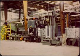
File contains photographs documenting the construction of Cassiar's new mill building. Photos depict early excavation, foundations, framework, construction of all seven stories, sheeting, siding, and roof tarring. Also included are photos depicting the large model of the mill, as well as construction work done on the tramline. Photos taken inside the mill depict flooring work, and milling machinery including feed chutes, screens, fans, wheelabrators, control panels, electrical panels, conveyor systems, vacuum systems, and the fan-driven air system that transported the fiber. Many photos depict construction workers, building supplies, worksites, and equipment including cranes, bulldozers, tractors, hauling trucks and trailer flatbeds. Some photos depict aerial views from the new mill and feature the plantsite, tramline, mine road, mountains, and valley.
Photo depicts workers at construction site of Cassiar's new mill building.
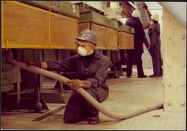
Photograph depicts Zora Ivanovska in safety gear, vaccuming asbestos dust from "hall screen" in mill (slanted vibrating tables with varying mesh sizes, used to separate different lengths of fibre). Mill General Foreman Tony Pinto is visible on far right, with unidentified man.
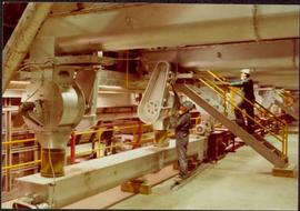
Photograph depicts part of the vacuum dust control and removal system in the Cassiar mill building. Unidentified man can be seen at rotary air-lock, in which heavy blown dust would collect before dropping to plenum conveyor resting just above floor. From here, the dust would eventually be expelled at the tailings pile outside of the mill. Second unidentified man can be seen climbing steps in background. This section of the mill was located above the lab.
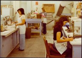
Photograph depicts three women wearing white aprons while conducting tests on asbestos fibre in lab area, miscellaneous equipment throughout room.
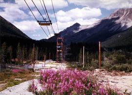
Photograph depicts ore cars on cables running between tramline towers. Flowers in foreground, mine valley and McDame mountain in background. Tramline ran through mine valley, between loading station (2000.1.13.19.197) in mine and dump station at mill on plantsite (2000.1.1.3.19.124)
Photograph depicts mine area. Switchback road and higher benches in background. Blasthole drills, track shovels, and ore haulage trucks can be seen on level in foreground and higher bench in background. Mountains visible in distance. Benches in background speculated to be located on the mine's West Peak.
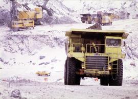
Photograph depicts machinery in snowy area of mine. Euclid ore haulage truck in foreground, cassiar pickup truck visible in lower area in midground. Blasthole drill in front of track shovel in left background, Wabco ore haulage truck visible behind other machinery in right background.
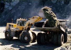
Photograph depicts shovel in excavation area of mine, loading ore haulage truck believed to be a Wabco "haul pak".
Photograph depicts palletizer machinery, where bags of asbestos fibre were shrink-wrapped and made ready for shipping pallets. Palletizer was located near shipping (believed to be in mill building). Unidentified man visible in machinery on far left.
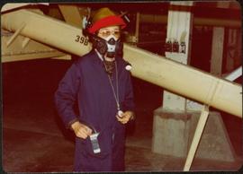
Photograph depicts woman wearing safety gear in second floor of mill building, holding unidentified instruments. Helen Joseph took air quality tests in the working areas and town (see item 2000.1.1.3.19.147).
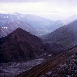
Photograph depicts exposed asbestos fibre in talus.
Fonds consists of textual, photographic, cartographic, electronic and promotional films/video recordings related to the mining operations of Cassiar Asbestos Mining Corporation (CAMC) and creation of Cassiar townsite. CAMC records primarily consist of records related to mining operations including construction, engineering, daily mining operations, administration of CAMC, tallies of extractions, labour and union activities, corporate events and visits by dignitaries. Townsite records are primarily visual representations of townsite construction, including the creation of health, education and community services including Cassiar's private hospital, school, library, as well as townsite images. Photographs include documentation of natural and man-made landscapes within the Cassiar region of Northern BC. Other holdings include a near complete run of Cassiar's community newspaper.
Cassiar Asbestos Corporation Ltd.A set of 13 maps showing approximate waste extraction areas for different benches during certain months of 1972. Extraction dates are included accompanied by estimated total tonnages for each planned extraction area. All plans are hand drawn using colored pencils, lead and black ink. Approximate calculations of extraction tonnages are included within certain months. Numerical bench markers are included. Total tonnages from the previous year and previous surveys are included within certain plans.
Photographs depict aerial views of the Cassiar townsite, plantsite, tailings pile, mine road, bench and pit mine, mine buildings (tramline loading station, crusher, shop, and garage), and surrounding mountain range. Here "aerial" refers to photos depicting a large area and taken from the air or from a high point of elevation.
The Cassiar Asbestos Corporation and townsite records encompass a massive archival holding of approximately 1,600 bankers boxes. A box level inventory was created by student employees of the archives over a 15-year period. This inventory is provided here for access purposes only and its accuracy cannot be guaranteed.
In 1952 the Cassiar Asbestos Mining Corporation constructed an asbestos open-pit mine and mill and created a town site for its workers that became the town of Cassiar, British Columbia, 50 miles south of the Yukon border, and 80 miles north of Dease Lake. For 40 years Cassiar was a thriving asbestos mining town with a population at its peak of about 2500, with production statistics for 1989, recording over 60 million tonnes of ore mined, producing a billion dollars of new wealth. In 1989 Cassiar added an underground mine to the site, and despite attempts to run it profitably, in 1992 the entire mine closed partially due to the global market decline in the demand for asbestos, resulting in the closure of the town, and the move of its workers and families out of Cassiar. An auction was held to sell off all the mining equipment, townsite infrastructure, its buildings, people’s residences and the site was bull-dozed, with many houses burned to the ground. Today little remains in this remote area of Northern British Columbia to mark Cassiar’s industrial, economic or social history.
In 1992 the University of Northern British Columbia acquired the holdings of CAMC and the Cassiar townsite recognizing its potential for academic research, as the records could provide insight into natural resource industry extraction operations in Northern BC from mid to late 20th century, illustrative of ‘boom & bust’ industries, and to provide context to the development of the Cassiar Asbestos Mining Corporation and the history of the ‘life’ of a one-industry company town. The holdings document mining operations by CAMC and of the town site of Cassiar, originally consisting of the equivalent of 1800+ bankers’ boxes, including records on construction, engineering, operations, administration of CAMC, tallies of extractions, labour and union activities, corporate events and visits by dignitaries (including Prime Minister Trudeau who visited CAMC’s northern operations unit in Clinton Creek in 1968 and M.P. Iona Campagnolo in 1978). As CAMC was owner of both the mine and the Cassiar town, the company provided municipal services (i.e. sewer, water, and electricity) for its workers and their families. The archived municipal records document townsite construction, including the creation of health, education and community services such as Cassiar’s private hospital, school, library, community centre, hockey arena, and retail store. The holdings also include extensive visual documentation of natural and man-man landscapes within this remote and scenic area of Northern British Columbia. The formats of the archival holdings are diverse consisting of textual, photographic, cartographic materials, electronic records, films, promotional video-recordings, and a near complete run of the Cassiar community’s print newspaper.
File contains photographs featuring members of the Board of Directors of Cassiar Asbestos Corporation Ltd., which was formed on the 17th of May, 1951. Cassiar's forerunner was a company named Conwest, formed in 1534, a consolidation of two companies owned by Fred Martin Connell and his brother W. Harold Connell. The first board of directors included the Connell brothers, George Armstrong, John E. Kennedy, Charles & Arthur Mortimer, and Charles Rainforth Elliot (chartered accountant and secretary-treasurer of Conwest & Cassiar). Directors depicted in this file include F.M Connell, Harold Connell, Charles Elliot, John E. Kennedy, George Armstrong, Ken A. Creery, John Drybrough, Tam Zimmermann, George Washington Smith (president of Bell Asbestos Mines), Nick Gritzuk, Jack Christian (general manager, president, and CEO). Other individuals depicted include Fred Murry, Andre Beguin, Plato Malozemoff from Newmont Mining (co-founder of Cassiar with F.M. Connell), Alfred Lloyd Penhale (founder and CEO of Asbestos Corporation of Canada Ltd.), C.B. Brown, Pierre Marcotte, Francis Parker Smith (brother of George Smith), Bill Oughtred, Bill Johnson, and a Mr. Janitsch. File also includes a portrait of an unidentified director of Cassiar from Turner and Newall in England, taken at the corporate club in Toronto. Group portraits were taken at the Cassiar Valley, the office building, "House 130," fishing outings, and at formal events in unidentified locations.
Photograph depicts two blasthole drills on bench in mine, old garage visible in centre background. Snow-covered mountain range in background.

