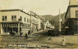
File consists of notes, clippings, and reproductions relating to Kent Sedgwick's guest lecture at the University of Northern British Columbia on Prince George. Includes: "Situating Prince George" handwritten lecture notes by Kent Sedgwick (2006) and "Geography of British Columbia" university syllabus (2003). Also includes a CD-R "Situating P.G". containing Kent Sedgwick's notes and photographs (Mar. 2006).
Photograph depicts Siwash Rock in Stanley Park British Columbia.
People, boardwalks, and store signs visible in street scene. Printed annotation on recto reads: “6th St. Prince Rupert. B.C.” Handwritten message in ink on verso is addressed to: “Mrs. Loistram Halls Buildings Nicholas St Limerick Ireland”. Verso stamped "PRINCE RUPERT JUN 30 10".
File contains slides depicting places around and between Skagway, on the Alaska border, Atlin and Miles Canyon.
Image depicts one of the main streets, Broadway, in Skagway, Alaska.
Map depicts Chilkoot Inlet, Port Chilkoot, Taiya Inlet, Skagway, Tagish Lake, Golden Gate, and Graham Lake.
Image depicts the bus depot in Skagway, Alaska (USA).
Image depicts the Skeena River at Hazelton, B.C.
Image depicts Skeena Crossing, B.C.
Image depicts two totem poles in Skeena Crossing, B.C.
Forest and mountain visible in background.
Image depicts the Skeena River.
Image depicts the Skeena River at Hazelton, B.C.
Image depicts the Skeena River, as well as a stretch of highway that appears to be under construction.
Image depicts the Skeena River somewhere near Prince Rupert, B.C.
Photograph depicts crowd of people in foreground near log fence. More crowds can be seen in distance at base of ski jump on either sides of the run. Jump visible at top of tree-covered hill in background. It is believed that this photograph was taken near the current location of City Hall.
Image depicts the community of Skidegate on Haida Gwaii.
Photograph depicts a dock and building near the water. A few buildings are being constructed on some newly cleared land nearby.
Image depicts a skier in a costume with a fake sword, somewhere on the Birchleg Ski route on Tabor Mountain in Prince George, B.C.
Image depicts a vehicle and a large group of skiers somewhere on Tabor Mountain in Prince George, B.C.
Image depicts numerous skiers and skis that are standing upright in in the snow on Tabor Mountain in Prince George, B.C.
Image depicts numerous skiers on the Birchleg Ski route on Tabor Mountain in Prince George, B.C.
Image depicts numerous skiers cross-country skiing on a trail through trees on the Birchleg Ski route on Tabor Mountain in Prince George, B.C.
Image depicts the slopes of Tabor Mountain in Prince George, B.C.
Image depicts a slough area while on approach to Bowron Lake.
Image depicts a few unknown individuals canoeing in a slough area while on approach to Bowron Lake.
Image depicts a slug on the forest floor somewhere on Haida Gwaii.
Image depicts what is likely a slump slide at an unknown location.
Image depicts an unknown individual standing near what is most likely a slump slide at an uncertain location.
Image depicts two unknown individuals standing near what is most likely a slump slide at an uncertain location.
Image depicts an unknown individual standing next to what appears to be a slump type of landslide at an unknown location.
Image depicts an aerial view of a section of land, likely near the Fraser River, that is possibly either a slump or part of a mining operation. The slide is labelled "slump or mining."
Image depicts the location of a slump type of landslide at Moose Heights, north of Quesnel, B.C.
Child stands in distance beside tall totem pole. Tree stumps in foreground, forest and mountains in background.
Handwritten annotation on verso reads: "[Sanabati near Upper Queen?] Kasaan Alaska".
Photograph of a small creek traveling through several rocky embankments.
Image depicts an aerial view of what appears to be a small farm, possibly in the McGregor Canyon.