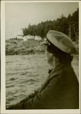
Photograph depicts an unidentified woman (Public Health Nurse?) looking back over the water towards some buildings and a lighthouse on a rocky shore (Pine Island?).
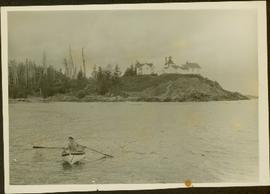
Photograph depicts a woman wearing a Cowichan sweater rowing a boat away from a rocky island with a lighthouse. Handwritten annotation in pencil on verso reads: “Gal in boat wearing Indian sweater knit by my mother Eileen M. Jackson (she also spun the wool) for her brother J.J. Claxton, cook on the Columbia Coast Mission Boat. - S.K. Jackson”
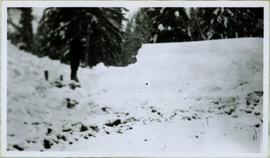
Winter landscape scene featuring a man cleaning up a wood pile covered with snow (?). Handwritten caption beside this photo reads: "ALL WINTER 1945 1946 Cleaning of the Wood Pile".
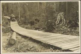
Fully loaded logging truck driving along a wood plank logging road. Another road under construction is also visible through forest in background.
Handwritten annotation in pencil on verso reads: “Logging - Giscome B.C. Plank truck road - also road under construction showing sills & cribbing."
Postcard depicts a "4-4-0 woodburning locomotive at Shuswap Station, east of Kamloops, at the turn of the century. The completion of the CPR across the Continent, guaranteed B.C.'s entry into Cinfederation, as well as reg economic and cultural connection to the East."
Photograph depicts a wooden and abandoned building, the roof caving in and the sides tarnishing. Photograph taken in an unknown location.
Photograph depicts a wooden and abandoned building, the roof caving in and the sides tarnishing. Photograph taken in an unknown location.
Photograph depicts a wooden and abandoned building, the roof caving in and the sides tarnishing. Photograph taken in an unknown location.
Photograph depicts a wooden and abandoned building, the roof caving in and the sides tarnishing. Photograph taken in an unknown location.
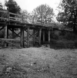
Photograph depicts a wooden bridge crossing a stream on the north side of Vedder Mountain near Belrose.
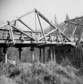
Photograph depicts a wooden bridge over the Salmon River near Sayward, near Kelsey Bay, North Vancouver Island.
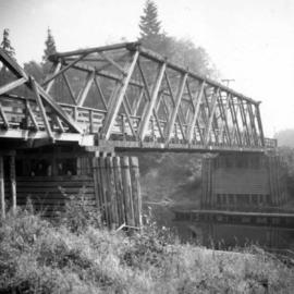
Photograph depicts a wooden bridge over the Salmon River near Sayward, near Kelsey Bay, on North Vancouver Island.
Photograph depicts a wooden building, presumably at the Fort St. James historic site.
Photograph depicts a wooden building, presumably at the Fort St. James historic site.
Photograph depicts a wooden building presumably at the Fort St. James historic site.
Photograph depicts a wooden building presumably at the Fort St. James historic site.
Photograph depicts a wooden building presumably at the Fort St. James historic site. The photograph is close up to the building, depicting an open door and the wooden panels along the building.
Photograph depicts a wooden building presumably at the Fort St. James historic site. The photograph is close up to the building, depicting an open door and the wooden panels along the building.
Photograph depicts a wooden building presumably at the Fort St. James historic site.
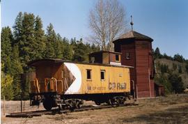
Photograph depicts a CPR preserved wooden caboose, dated 1947, and a water tank with 2 spouts.
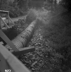
Photograph depicts a wooden pipeline carrying irrigation water in the Similkameen Valley, near Ashnola and Keremeos.
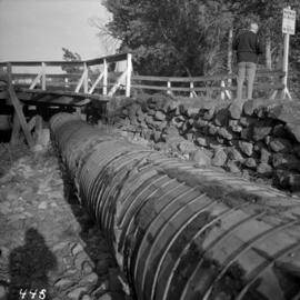
Photograph depicts a wooden pipeline carrying irrigation water, about to be carried across the Similkameen River by being slung underneath a truss bridge. The pipeline is near Ashnola, west of Keremeos.
Photograph depicts the base of a wooden canoe on a wheeled cart, presumably at the Fort St. James historic site.
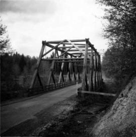
Photograph depicts a wooden truss bridge in north Washington, probably somewhere east of Everett.
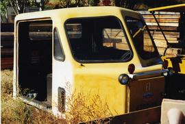
Photograph depicts a Woodings Rail car owned by Kettle Valley Steam (Heritage) Railway. Davies noted that it was a rare example to have seen in B.C. at the time. It was believed to have been a type that was favored by the CPR.
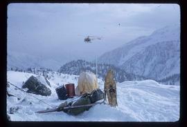
Image depicts a helicopter flying over the Woolsey Glacier.
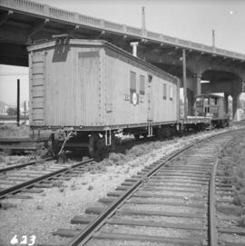
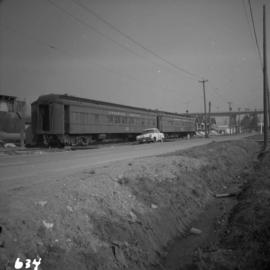
Photograph depicts a work car, flat car, and ex-electric stock snow plow at the B.C. Electric Railway Kitsilano workshop yards in Vancouver.
Photograph depicts a work crew train on the B.C. Electric Railway trackage, just south of the north arm crossing of the Fraser River on Lulu Island. The crews are working on re-routing the track to Steveston at this point.
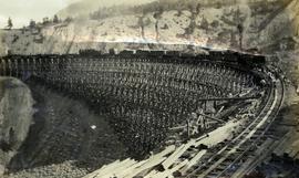
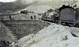
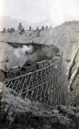
Photograph depicts a Pacific Great Eastern Railway work train on a trestle located near Sallus Creek in the area around Lillooet, Fountain, and Pavilion. The work train appears to be carrying railway ties. Railway workers work on the track behind the train with piles of unused rail ties nearby.
Photographs 2020.08.68, 2020.08.69, and 2020.08.70 are three views of track laying on the Sallus Creek trestle. These form a sequence: 2020.08.68, 2020.08.70, 2020.08.69 in order as track laying proceeds from the South end of the trestle toward the North end. The piece of equipment at the North end of the train in all three images is a track laying machine that lifted a piece of rail and delivered it to the workmen ahead of the machine. "Canadian Railway and Marine World" reported that track had been laid to 14 miles North of Lillooet by July 30, 1915 (CR&MW , Sept 1915, p341, c2). 14 miles North of Lillooet is approximately 20 rail lengths beyond the North end of this trestle, leading to a "best estimate" of late July 1915 as the date for this photograph.
The ca. 1921-1927 “PGE Bridge List” from the notebook of William H. Hewlett (1914-1968) references a Mile 13.7, 14 Mile Creek, frame trestle, 905 ft. long, 182 ft. high, 61 spans of 14.8 feet in the Lillooet Subdivision. A “PGE Track Profile” drawing shows this trestle was on a 1.55% grade and a 12 degree left hand curve. While the drawing had been revised at least twice (with an unknown date for the most recent revision), the pre-“Lillooet Diversion of 1931" mileage figures confirm that the 1915 “Mile 13.7" was in agreement with a more recent hand written note “Sallus Creek”. The trestle appears to have gone by the names "14 Mile" trestle, "13.7 Mile Trestle", and "Sallus Creek" trestle.
Photograph depicts a Pacific Great Eastern Railway work train on a trestle located near Sallus Creek in the area around Lillooet, Fountain, and Pavilion. The work train appears to be carrying railway workers and a load of rails.
Photographs 2020.08.68, 2020.08.69, and 2020.08.70 are three views of track laying on the Sallus Creek trestle. These form a sequence: 2020.08.68, 2020.08.70, 2020.08.69 in order as track laying proceeds from the South end of the trestle toward the North end. The piece of equipment at the North end of the train in all three images is a track laying machine that lifted a piece of rail and delivered it to the workmen ahead of the machine. "Canadian Railway and Marine World" reported that track had been laid to 14 miles North of Lillooet by July 30, 1915 (CR&MW , Sept 1915, p341, c2). 14 miles North of Lillooet is approximately 20 rail lengths beyond the North end of this trestle, leading to a "best estimate" of late July 1915 as the date for this photograph.
The ca. 1921-1927 “PGE Bridge List” from the notebook of William H. Hewlett (1914-1968) references a Mile 13.7, 14 Mile Creek, frame trestle, 905 ft. long, 182 ft. high, 61 spans of 14.8 feet in the Lillooet Subdivision. A “PGE Track Profile” drawing shows this trestle was on a 1.55% grade and a 12 degree left hand curve. While the drawing had been revised at least twice (with an unknown date for the most recent revision), the pre-“Lillooet Diversion of 1931" mileage figures confirm that the 1915 “Mile 13.7" was in agreement with a more recent hand written note “Sallus Creek”. The trestle appears to have gone by the names "14 Mile" trestle, "13.7 Mile Trestle", and "Sallus Creek" trestle.
Photograph depicts a Pacific Great Eastern Railway work train on a trestle located near Sallus Creek in the area around Lillooet, Fountain, and Pavilion. The work train appears to be carrying railway ties.
Photographs 2020.08.68, 2020.08.69, and 2020.08.70 are three views of track laying on the Sallus Creek trestle. These form a sequence: 2020.08.68, 2020.08.70, 2020.08.69 in order as track laying proceeds from the South end of the trestle toward the North end. The piece of equipment at the North end of the train in all three images is a track laying machine that lifted a piece of rail and delivered it to the workmen ahead of the machine. In this photograph, the machine is at the current end of track and is ready to advance the next length of rail."Canadian Railway and Marine World" reported that track had been laid to 14 miles North of Lillooet by July 30, 1915 (CR&MW , Sept 1915, p341, c2). 14 miles North of Lillooet is approximately 20 rail lengths beyond the North end of this trestle, leading to a "best estimate" of late July 1915 as the date for this photograph.
The ca. 1921-1927 “PGE Bridge List” from the notebook of William H. Hewlett (1914-1968) references a Mile 13.7, 14 Mile Creek, frame trestle, 905 ft. long, 182 ft. high, 61 spans of 14.8 feet in the Lillooet Subdivision. A “PGE Track Profile” drawing shows this trestle was on a 1.55% grade and a 12 degree left hand curve. While the drawing had been revised at least twice (with an unknown date for the most recent revision), the pre-“Lillooet Diversion of 1931" mileage figures confirm that the 1915 “Mile 13.7" was in agreement with a more recent hand written note “Sallus Creek”. The trestle appears to have gone by the names "14 Mile" trestle, "13.7 Mile Trestle", and "Sallus Creek" trestle.
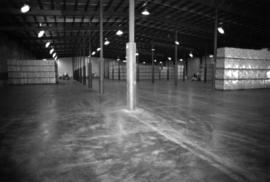
Photograph depicts pallets of fibre bags in shipping area (believed to be in mill building).
Photograph depicts pallets of fibre bags in shipping area (believed to be in mill building).
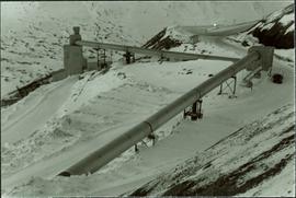
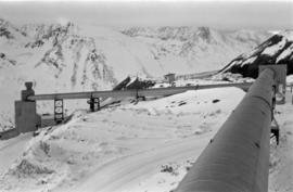
Photograph depicts tramline conveyors in centre of image (located west of mine). Conveyors ran from crusher plant to the tramline loading station. Building on left believed to be the crusher reject plant. Water truck can be seen by transfer building on far right (truck was used to thaw propane tank when necessary). Mine valley in background.
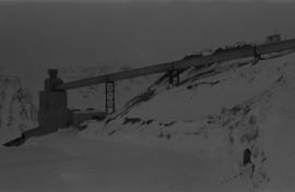
Photograph depicts tramline conveyor (located west of mine). Conveyor ran from crusher plant to tramline loading station. Mine valley and northwestern mountain range in background.
Photograph depicts tramline conveyor in centre of image (located west of mine). Conveyor ran from crusher plant to tramline loading station. Building on left believed to be the crusher reject plant. Mine valley and northwestern mountain range in background.
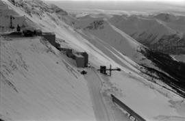
Photograph depicts crusher buildings in left foreground, located west of mine on McDame Mountain. Southeast mountain range in background.
Photograph depicts Darren DeCecco wearing coveralls and hard hat while sitting on a Pacific truck. (Pacifics were used to supply water to mine, remove snow, and supplement ore haul by tramline).
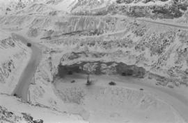
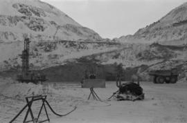
Photograph depicts the Cassiar mine on McDame Mountain. Blasthole drills and ore haulage trucks visible below in open pit and on switchback road.
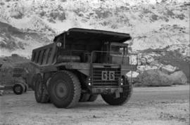
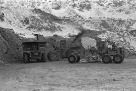
Photograph depicts a Euclid ore haulage truck in foreground. Shovel and unidentified caterpillar machine can be seen in background.
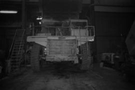
Photograph depicts what appears to be a Euclid ore haulage truck at entrance of building speculated to be the truck dumping station at crusher plant in mine.
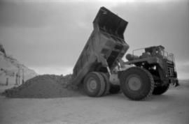
Photograph depicts a Euclid ore haulage truck dumping material on pile in left foreground.
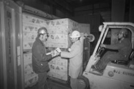
Photograph depicts unidentified man operating forklift on right. Pallets of asbestos fibre sit on trailer in background. Two men with clipboard stand in left foreground (David Pewsey on left, Chris Tates on right, see also item 2000.1.1.3.19.212).
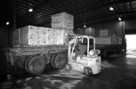
Photograph depicts unidentified man operating forklift. Pallets of asbestos fibre sit on trailer in background. Believed to have been taken in shipping area of mill building.
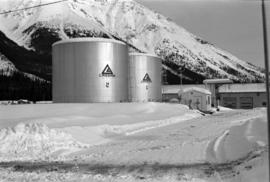
Photograph depicts two large tanks with Cassiar logo on front, labeled "1" and "2". Road in foreground, garage in background. Mountain base also visible in background.
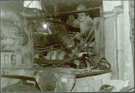
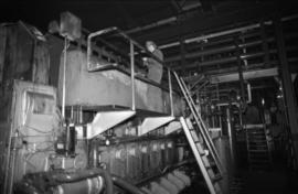
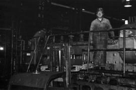
Photograph depicts unidentified man standing on Ruston Hornsby diesel engine which turned the generators in the power house on the Cassiar plant.
Photograph depicts two unidentified men standing on Ruston Hornsby diesel engine which turned the generators in the power house on the Cassiar plant.
Photograph depicts a shovel loading what appears to be a Euclid ore haulage truck on left. Unidentified Caterpillar machine in foreground.
Photograph depicts blasthole drill on left, bulldozer in centre, and shovel loading ore haulage truck in background. Second haul truck is semi-visible on far right. Hose equipment can be seen in foreground.
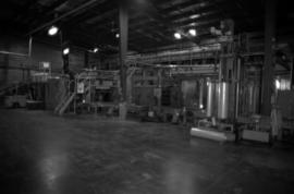
Photograph depicts palletizer machinery, where bags of asbestos fibre were shrink-wrapped and made ready for shipping pallets. Palletizer was located near shipping (believed to be in mill building).
