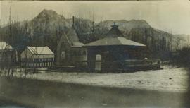
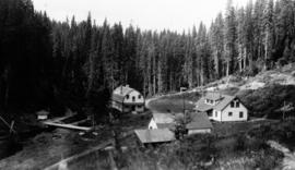
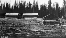
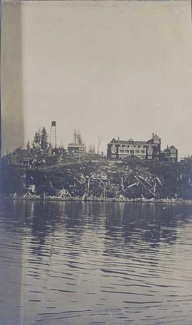
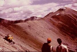
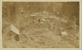
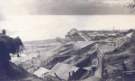
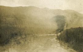
Image depicts numerous buildings and a dock on the shore of Haida Gwaii, B.C..
Photograph depicts two large buildings across street in foreground, van visible on left.
One featured building might be a church structure.
Photograph copy print contains the following writing on verso:
British Columbia Archives and Records Service Visual Records Unit
Negative No. H-5387
GR 1348
B.C. Forest Service : The Young Men's Forestry Training Plan
September 1, 1935
Photograph depicts a possible storage and coal shed, and toilets located on the west side of track about a quarter mile north of the McCulloch depot building. McCulloch depot is located at mile 76.6 on the Carmi Subdivision.
Photographer's photo number R878. No caption on back of photograph to glean further information. Title provided based on contextual information from related photographs and documents.
Image depicts several old buildings in a field, one of which has a caved-in roof, in Newlands, B.C. Map coordinates 54°06'28.2"N 122°12'01.0"W
Image depicts a row of buildings in Upper Fraser, B.C. with the store (titled "Paradise") with a Pepsi sign. Map coordinates 54°07'09.1"N 121°56'47.0"W
Photograph depicts buildings looking north of the Empress Hotel on Douglas Street in Victoria, BC. The Belmont is on the right and the Customs Building on the left.
Photograph depicts small buildings sited on the north side of the tracks and just west of the Mission City CPR depot. They are all in use and well cared for.
Photograph depicts buildings of the former Vancouver-Lansdale ferry. They appeared to now be used by Kingcome Navigation Co. as well as other businesses.
Typed caption glued to album page directly below photograph reads: "25. Building on Block 152." Photograph depicts two wooden buildings situated on a cleared section of land. Photographer: Dominion Stock & Bond Corporation.
Photograph depicts three buildings and a water tower on top of a deforested hill with water in the foreground.
Photograph is a printed postcard depicting scattered small buildings and a tent. Trees have been removed from the area around the buildings and many stumps remain.
Photograph depicts a wooden building under construction and piles of wood planks on the shoreline.
Image depicts the Bulkley River.
Image depicts the Bulkley River near Moricetown, B.C.
Image depicts numerous unknown individuals standing by the Bulkley River near Moricetown, B.C.
Image depicts a small group of people standing near the Bulkley River at Moricetown, B.C.
Photograph depicts the Bulkley River and rocky bank with a red-roofed house set behind.
Photograph depicts the aftermath of the flooded Bulkley River near Moricetown.
Photograph depicts a view looking down on the Bulkley River, forested banks on both sides of the river, high mountains in the distance.
Colour-coded map depicts lands surveyed as alienated, available for purchase or lease under Taxation Act, or reserved. Depicts land district boundaries, land recording divisions, triangulation stations, telegraph/telephone lines, communities, bodies of water, and transport routes.
Image depicts a section of forest in the Bulkley Valley.
Image depicts a view of Bulkley Valley.
Image depicts a stretch of road through the Bulkley Valley.
Image depicts a bulldozer and truck in an unknown location.
Photograph depicts man believed to be Bob Baxter on bulldozer by large framework structure in snow. House stands in background as well as a truck with "CITY OF PRINCE GEORGE" visible on its passenger door. Handwritten annotation on recto of photograph: "Civic centre 1948."
Photograph depicts a person operating a bulldozer to clear a path through the snow in a forested landscape.
Photograph depicts a bulldozer clearing land for road making north of Stuart Lake.
Photograph depicts a bulldozer convoy freighting supplies into camp in winter.
Photograph depicts a bulldozer driving down a shallow ditchline with a forested area in the background.
Photograph depicts a bull dozer driving down a gravel road through a forested landscape.
Photograph depicts a bulldozer in a winter landscape pulling sleds loaded with large pipes and steel drums potentially heading for the mines for assembly.
Photograph depicts a distance perspective of a bulldozer pulling sleds loaded with large pipes and steel drums potentially heading for the mines for assembly.
Photograph depicts a bulldozer pulling sleds loaded with large pipes and steel drums potentially heading for the mines for assembly.
Photograph depicts a bulldozer pulling sleds loaded with large pipes and steel drums potentially heading for the mines for assembly. Close up of 2004.8.1.57
Photograph depicts the front end of a bulldozer being operated by an unidentified man in front of a forested background.
Photograph depicts man driving bulldozer in thick forest, small cleared area in foreground.
Slide depicts a bulldozer clearing ground, likely at the Aleza Lake Experiment Station.
Bulldozer visible to left of road in distance, mountain in background.
Bulldozer works along talus slope in top right of image. Photograph believed to have been taken during an outside exploration trip led by Cassiar's Chief Geologist Bill Plumb.
Photograph believed to have been taken near Kutcho Creek, BC during an outside exploration trip led by Cassiar's Chief Geologist Bill Plumb. Bill stands to left of man believed to be Matt Bell in right foreground. Bulldozer works along talus slope in left foreground.
Bulldozer works along talus slope in centre of image. Photograph believed to have been taken near Kutcho Creek, BC during an outside exploration trip led by Cassiar's Chief Geologist Bill Plumb.