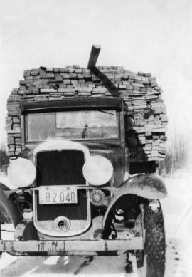
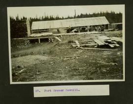
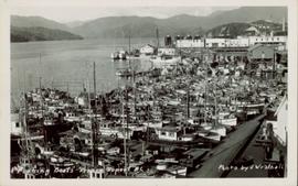
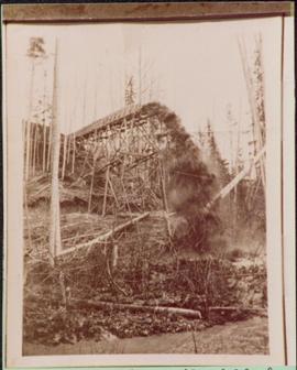
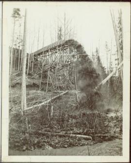
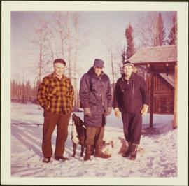
Imprimir vista previa Cerrar

Mostrando 975 resultados

Archival description
975 resultados con objetos digitales Muestra los resultados con objetos digitales
Giscome Sawmill
2012.13.1.87.167 · Item · [between 1975 and 1995]
Parte de J. Kent Sedgwick fonds

Image depicts the mill site at Giscome, B.C. Map coordinates 54°04'19.7"N 122°22'04.7"W

Giscome Sawmill
2012.13.1.87.171 · Item · [between 1975 and 1995]
Parte de J. Kent Sedgwick fonds

Image depicts the mill site at Giscome, B.C. A sign in the foreground reads "Maynard's Industrial Auctioneers." Map coordinates 54°04'19.7"N 122°22'04.7"W

Giscome Sawmill
2012.13.1.87.168 · Item · [between 1975 and 1995]
Parte de J. Kent Sedgwick fonds

Image depicts the mill site at Giscome, B.C. Map coordinates 54°04'19.7"N 122°22'04.7"W

Giscome Sawmill
2012.13.1.87.170 · Item · [between 1975 and 1995]
Parte de J. Kent Sedgwick fonds

Image depicts the mill site at Giscome, B.C. Map coordinates 54°04'19.7"N 122°22'04.7"W

Giscome Sawmill
2012.13.1.87.169 · Item · [between 1975 and 1995]
Parte de J. Kent Sedgwick fonds

Image depicts the mill site at Giscome and its beehive burner. Map coordinates 54°04'19.7"N 122°22'04.7"W

Giscome Houses and Giscome Mill
2012.13.1.87.156 · Item · [between 1975 and 1995]
Parte de J. Kent Sedgwick fonds

Image depicts several houses and the Giscome saw mill in Giscome, B.C. in the background. Map coordinates 54°04'20.9"N 122°21'53.1"W

Giscome - Train Tracks - Before
2012.13.1.87.086 · Item · [between 1980 and 2000]
Parte de J. Kent Sedgwick fonds

Image depicts the Giscome mill site in Giscome, B.C. The bunkhouse is the large building with many windows. A train and railroad tracks are in the foreground. Map coordinates 54°04'17.6"N 122°22'06.1"W

Giscome - Power Poles
2012.13.1.87.098 · Item · [between 1975 and 1995]
Parte de J. Kent Sedgwick fonds

Image depicts the remains of a street of houses in Giscome, B.C. The quarry is slightly visible in the background. Map coordinates 54°04'20.9"N 122°21'53.1"W

Gibraltar - 80 Tonne Truck
2012.13.1.50.094 · Item · [1978?]
Parte de J. Kent Sedgwick fonds

Image depicts an unknown woman standing in front of a truck that either weighs 80 tonnes, or is capable of carrying that much; the slide is simply labelled "80 tons." It is located at the Gibraltar mine site.

Fur Farm at Red Rock Lake, BC
2009.5.2.51 · Item · [ca. 1910?]
Parte de Taylor-Baxter Family Photograph Collection

Photograph depicts two log buildings in fenced area on lake shore, forest trees in background. A man can be seen standing near docking area and small boat pier extending into water in foreground. Handwritten annotation on recto of photograph: "Fur Farm Red Rock Lake". This location is believed to at mile 27, north of Summit Lake.

Fred Youngstrom and Kitchen Staff
2005.3.60 · Item · 1946
Parte de John Hart Highway Photograph Collection

Handwritten caption beside this photo reads: "Fred Youngstrom & Kitchen Staff. 1946." Photograph depicts Fred standing to right of three woman, a young girl, and a dog. The group is standing on the snow-covered front steps of a (kitchen?) building, lumber pile on far right. A large metal triangle is hanging behind Fred. It is believed that this photograph was taken at the camp at Summit Lake B.C. (see item 2005.3.57).

2005.3.58 · Item · [ca. 1945]
Parte de John Hart Highway Photograph Collection

Handwritten caption above this photo reads: "Fred Youngstrom in [church shirt?]" Photograph depicts two men (Fred on left) standing on snow-covered road in front of car with a British Columbia license plate "93-650". A wood pile and long building with porch can be seen in background in front of forest trees. It is believed that this photo was taken at the camp in Summit Lake, B.C. (see item 2005.3.57).

Fort Fraser Sawmill
2004.5.1.21 · Item · ca. 1914
Parte de Fort Fraser historical photograph collection

Typed caption glued to album page directly below photograph reads: "27. Fort Fraser Sawmill." Photograph depicts men standing outside the Fort Fraser Sawmill. Photographer: Dominion Stock & Bond Corporation.

2000.1.1.2.03.04 · Item · 4 July 1964
Parte de Cassiar Asbestos Corporation Ltd. fonds

Handwritten annotation on recto of photograph: "FORMING FOOTING RETAINING WALL JULY 4/64." Photograph depicts construction workers
standing in forms for cement laid against mountain wall on high elevation of construction site. A retaining structure made with wood planks and rebar separates mountainside dirt from cement forms. A front end loader can be seen in midground, near unidentified building. Mountain range in background.

Forestry Heavy Machinery
2012.13.1.122.29 · Item · May 1980
Parte de J. Kent Sedgwick fonds

Image depicts several pieces of heavy machinery used in forestry. The Coast Inn of the North is seen in the background.

Forestry Heavy Machinery
2012.13.1.122.30 · Item · May 1980
Parte de J. Kent Sedgwick fonds

Image depicts several pieces of heavy machinery used in forestry. The Coast Inn of the North is seen in the background.

Forestry Heavy Machinery
2012.13.1.122.28 · Item · May 1980
Parte de J. Kent Sedgwick fonds

Image depicts an unidentified individual examining a piece of heavy machinery used in the forestry industry. It is located in Prince George, B.C.

Floating Logs, Eaglet Lake?
2012.13.1.87.151 · Item · [between 1975 and 1995]
Parte de J. Kent Sedgwick fonds

Image depicts numerous tree logs floating on a body of water. The location is uncertain, but is likely Eaglet Lake.

Fishing boats in Prince Rupert, BC.
2011.3.3.99 · Item · 5 June 1954
Parte de North Coast & Central BC Postcard Collection

Photograph of many fishing boats in a Prince Rupert harbour. Printed annotation on recto reads: "Fishing Boats Prince Rupert, BC Photo by J. Wrathall." Handwritten annotation on verso reads: "Greetings from British Columbia Ruth and Jim Warner[??]." Postcard is addressed to: "Mr. and Mrs. C. Ott 426 So. Humboldh Denver 9. Colorado U.S.A." Verso is affixed with a 4 cent Canadian stamp. Postmark reads: " Vancouver B.C. Canada. Jun 5 5 PM 1954."

2007.17.1.10 · Item · [ca. 1935]
Parte de James Joseph Claxton Photograph Collection

Photograph depicts a wooden flume funneling water in a forested area. Photo is adhered to paper backing. Original annotations on verso of photo are covered by paper mounting. Typed annotation on recto of paper reads: “First wash for gold by Hixon Creek Cariboo Gold Co. Across Hixon from Quesnel Quartz up the hill. North side of creek 1930’s”

First pile driven at Prince Rupert BC
2009.7.1.246 · Item · 8 June 1906
Parte de Archdeacon W. H. Collison fonds

Pile driver situated on Prince Rupert shoreline. Tents and wooden buildings visible on rocky background. Printed annotations on recto of photograph read: "First pile driven at Prince Rupert BC. June 8 '06."

First Passenger Engine at Prince Rupert
2009.7.1.248 · Item · ca. 1880-1920
Parte de Archdeacon W. H. Collison fonds

Head on shot of steam engine traveling through a pass with mountains in the background. Handwritten annotation in pen on verso reads: "First Passenger Engine to reach Prince Rupert." Annotation on recto reads: "First Passenger Engine at Prince Rupert." Photographer' stamp in bottom right corner of recto reads : "Allen Photo."

Finlay Forks 1
2000.13.1.47 · Item · 1957.
Parte de Ray Williston fonds

Item is a photograph of Finlay Forks trader Roy McGregor, pilot Ian Watt and British resource development designer Percy Gray in March 1957 after the first leg of Grey’s flight over the Rocky Mountain Trench.