Item is a hand drawn and coloured map by the City of Prince George Planning Department depicting existing land use for the Van Bow neighbourhood area.
Item is a hand drawn and coloured map by the City of Prince George Planning Department depicting existing zoning for the Van Bow neighbourhood area. Also includes two hand-drawn mylar overlays for the map; one showing "Opportunities & Constraints" such as housing age and condition and the other showing "Subdivision Activity" over decades of development in the Van Bow area.
Item is a map depicting the Vancouver Carney study neighbourhood area in Prince George.
Item is a map depicting land use in the Vancouver Carney study neighbourhood area in Prince George. Also includes two mylar overlays that show the outlines of "unit 2" and "unit 3" development areas.
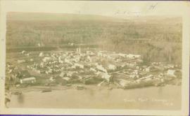
Lofty view of South Fort George, river and treed hills in the background. Printed annotation on verso reads: “South Fort George - 1913.” Handwritten message on recto is addressed to “Ethel M. Heurris Norton Maps Bristol County" reads: "11-1-13 an excellent view of south Fort George taken recently. Power Station at cross near water. This does not give all the south residence view. Population approx 1500”.
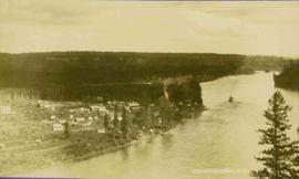
Lofty view of Fort George, B.C., river and paddle wheeler on right. Treed hills can be seen in background. Printed annotation on verso reads: “Fort George B. C.”
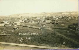
Boardwalk in foreground, buildings and roads in mid ground, cut banks in background. Printed annotation on recto reads: “Prince George. B.C. 1921 by Moore”. Handwritten annotation in ink on verso reads: “The Netchaco river is between the mountain and the city and the C.N.R. runs along the river bank nearest the city. This picture is taken looking north.”
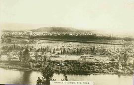
River in foreground, railroad and city in mid ground and hill in background. Printed annotation on recto reads: “Prince George. B.C. 1924”
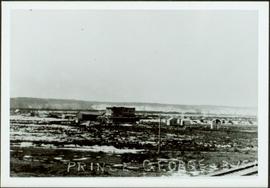
Winter landscape taken from behind railroad track. Cleared land in foreground, buildings in midground, low hills in background.
Handwritten annotation on recto: “PRINCE GEORGE 3-15-14”.
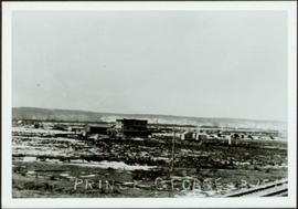
Winter landscape taken from behind railroad track. Cleared land in foreground, buildings in midground, low hills in background.
Handwritten annotation on recto: “PRINCE GEORGE 3-15-14”.
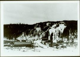
Winter scene with buildings, street, and utility poles. Hill in background.
Handwritten annotation on verso: “South Ft. George 1912”.
This street map of the VLA area in Prince George includes property outlines and street numbers.
Item is a hand drawn and coloured map by the City of Prince George Planning Department depicting the VLA neighbourhood proposed zoning in 1976.
Item is a hand drawn and coloured map by the City of Prince George Planning Department depicting zoning proposed by Prince George Alderman A. Stauble for the VLA neighbourhood.
Item is a hand drawn and coloured map by the City of Prince George Planning Department depicting zoning proposed by the Prince George City Planner for the VLA neighbourhood.
Item is a hand drawn and coloured map by the City of Prince George Planning Department depicting public representations at the VLA neighbourhood zoning hearing that occurred on April 12, 1976.
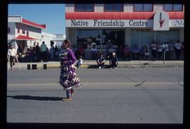
Image depicts a woman, wearing clothes reminiscent of traditional First Nations, who appears to be dancing in the street outside of a Native Friendship Centre in Prince George, B.C. A large crowd is looking on.
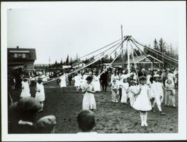
Crowd gathered around young girls holding ribbons anchored to top of pole in centre of image. Buildings stand in background.
Annotation on verso: “Maypole Dance 1927, Prince George."


![Vancouver Carney Study [Existing Land Use]](/uploads/r/northern-bc-archives-special-collections-1/d/8/4/d841cd29016ddb96663d51e137bd7a3b7c4dfe3ec645baca199615e3e4464da3/2023.5.1.21a_-_Vancouver_and_Carney_Study_Area_Existing_Land_Use_JPG85_tb_142.jpg)
