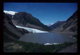
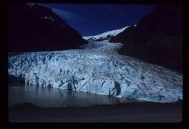
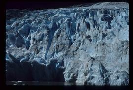
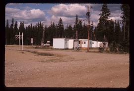
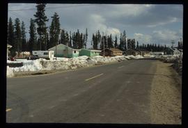
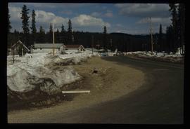
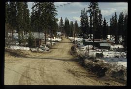
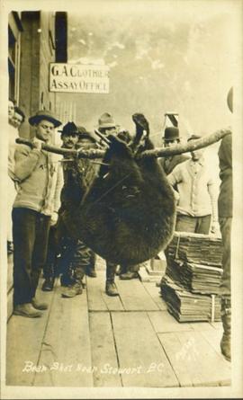
Image depicts a close-up of a cave-like opening in the Bear Glacier.
Image depicts the Bear Glacier in Bear Glacier Provincial Park, as well as what is possibly Strohn Lake.
Image depicts the Bear Glacier in Bear Glacier Provincial Park.
Image depicts a close-up of the Bear Glacier in Bear Glacier Provincial Park.
Image depicts Bear Glacier in the foreground and a mountain in the background, somewhere in Bear Glacier Provincial Park.
Image depicts the Bear Glacier with a cave-like opening.
Image depicts Bear Glacier in the foreground and numerous mountain peaks in the background in Bear Glacier Provincial Park.
Image depicts Sue and Kent Sedgwick with two dogs, standing with the Bear Glacier in the background.
Image depicts Sue Sedgwick with a dog, standing with the Bear Glacier in the background.
Image depicts the Bear Glacier stretching through a mountain range.
Image depicts a dog on a road, and a view of the mountains in Bear Glacier Provincial Park.
Photograph depicts blurry image of a bear among what is believed to be slash piles in the forest. Handwritten caption beside this photo reads: "Supposed to be a bear".
Photograph depicts a bear at the garbage dump of the Gold River logging camp. Five other bears have retreated to the fire weed and blackened tree stumps.
Photograph depicts a man holding a rifle over a dead bear in front of a wooden building. Annotation on verso of photograph states: "Bear killed at Kinsquit(?)"
Image depicts a stand of trees in Bear Lake, B.C.
Image depicts some houses in Bear Lake, B.C.
Image depicts some trailers in Bear Lake, B.C.
Image depicts some houses in Bear Lake, B.C.
Image depicts some houses most likely in Bear Lake, B.C.
Image depicts some buildings along a dirt road, possibly near Bear Lake, B.C.
Image depicts a river, possibly near Bear Lake, B.C.
Image depicts a shack, possibly near Bear Lake, B.C.
Image depicts the Crooked River in the Crooked River Pronvicial Park near Bear Lake, B.C.
Image depicts the curling club and skating rink buildings in Bear Lake, B.C.
Image depicts some houses in Bear Lake, B.C.
Haystacks in a field.
Image depicts a view of Bear Pass, likely from Glacier Highway and somewhere in or near Bear Glacier Provincial Park, located north-east of Stewart, B.C.
Image depicts what is possibly Bear River in the Bear Glacier Provincial Park.
Image depicts the Bear River.
Image depicts what is possibly Bear River in the Bear Glacier Provincial Park.
Image depicts what is possibly Bear River, flowing out from an opening in the Bear Glacier.
Image depicts what is possibly Bear River flowing past what is likely a section of the Bear Glacier.
Image depicts a section of road running through the Bear River Gorge.
Photograph of a group of men gathered outside of "G.A. Clothier Assay Office." Two of the men are carrying a large bear carcass between them on a tree branch. Printed annotation on recto reads: "Bear Shot Near Stewart B.C. Hughes #18."
Photograph depicts the head and skin of a bear on display in front of log building. Trees in background.
Image depicts a snow sculpture of a bear, possibly during the Winter City Conference, in Prince George, B.C. Taken at the Prince George Civic Center. Map coordinates 53°54'45.6"N 122°44'59.6"W
Photograph depicts a man (Mr. McCorkell) sitting down on a pile of logs at Germansen Lake.
Photograph depicts a cove with treed shorelines. Image is hazy. Handwritten annotation below photograph reads, "Beaver Cove. Pulp and sawmills".
Photograph depicts the bow of a boat in the foreground, lake water and low treed hills in the background.
Image depicts the canoe group preparing to canoe on Beaver Pond, which is the start of Kibbee Lake.
Photograph depicts Beaver Trucking located on Kamloops Indian Reserve No. 1 on Tk'emlups te Secwepemc territory, Kamloops, BC. It had been a company since 1990 and received 2 or 3 boxcars weekly loaded with items from Toronto that were then delivered around town. Davies later noted that the business was destroyed by arson in 1997.
Image depicts a field of hay somewhere in Beaver Valley.
Photograph depicts the Beaverdell Bridge, located between Rock Creek and Kelowna, BC
Photograph depicts the CPR Beaverdell depot located at about 35 miles northeast of Osoyoos and at mile 91.4 east of Penticton on the Carmi Subdivision. The traffic here is ore from a local mine, some lumber, and freight for the village. The depot building is in use and has a telegraph. There is also siding capacity for 31 cars. This section was built between 1914 and 1915. The view is looking north.