"The Cassiar Courier" is a newspaper that documents the community and work life of the residents of Cassiar BC. Content includes text and photographs, as well as jokes, comics, and games.
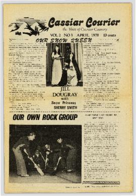
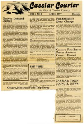
"The Cassiar Courier" is a newspaper that documents the community and work life of the residents of Cassiar BC. Content includes text and photographs, as well as jokes, comics, and games.
This blueprint shows the side profile of the proposed tramway to be built in Cassiar. It includes scale drawings of the crusher building, power house and support structures. The degree of tilt of the support structures are marked down where applicable. The side profile is divided into five sections due to the scaled height in elevation and the lack of drawing space. Annotation written along the leading edge of the blueprint reads "Proposed Tramway Riblet".
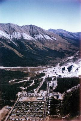
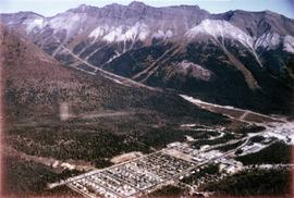
Photograph depicts the Cassiar valley, showing the east end of town in foreground. Plant and tailings pile can be seen in right midground. Photograph speculated to have been taken during the plane ride of an outside exploration trip.
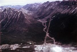
Photograph depicts the Cassiar mine valley in north mountain range. Plant and tailings pile can be seen in right foreground, and the east end of the town is visible in left foreground. Photograph speculated to have been taken during the plane ride of an outside exploration trip.
Photograph depicts the Cassiar town in foreground, mine valley and north mountain range in background. Photograph speculated to have been taken during the plane ride of an outside exploration trip.
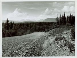
View of snow capped mountains in the distance, vast rolling treed hills in mid ground and a gravel road in the foreground. Road sign indicating severe curve in road situated at the right of the gravel road. Handwritten annotation on verso in pen reads: “Cassiar – Stewart highway”
Stick, boom, and bucket of a "NORTHWEST" cable shovel excavator can be seen left of a steep wall of earth in lower level of construction area. Construction worker is partially visible in foreground on far right. Building materials in background.
Photograph depicts man driving bulldozer in front of framework for Crusher building, view facing into the mountain. Excavated dirt in foreground.
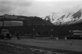
Photograph depicts a building with mountains in teh background. A man wearing a hardhat stands outside.
Photograph depicts a round bucket attached to the main hook line of a crane and suspended over building framework in crusher construction site (crane not visible in image). Men stand around the bucket on high level of crusher building. A dirt road and long building believed to be housing conveyor "B" can be seen in background.
Photograph depicts a round bucket attached to the main hook line of a crane (crane not visible in image) suspended over building framework in crusher construction site. Four construction workers stand around the bucket. Two men can be seen on roof of long building in background believed to be the section of the crusher building which housed conveyor B. Dirt road crosses midground.
Photograph depicts two blasthole drills on bench in mine, old garage visible in centre background. Snow-covered mountain range in background.
Four construction workers stand to left of blasthole drill number "604" among many empty cardboard boxes. Mountain range can be seen in background.
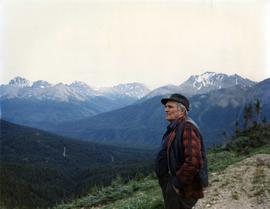
Photograph depicts William (Bill) Storie at location known as Limestone Mountain, southwest of Cassiar, B.C. Photo features profile of Bill, hands in pocket, Cassiar valley and mountains in background. Storie was a renowned prospector in the Cassiar area, and the new school at Cassiar was named for him in 1992.
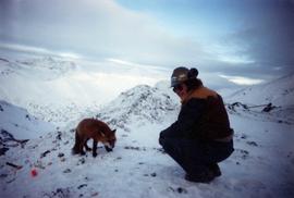
Photograph of man, believed to Bill Pratt, with a fox on top of a mountain.
Photograph depicts benches after strip mining at Cassiar. Drill visible in distance, ore haul trucks on road in foreground.
Photograph depicts benches above open pit at Cassiar mine. Drills and haulpaks visible in centre image.
Handwritten caption beside this photo reads: "Elaborate barricades required due to amount of loose rock falling continuously". Three men work in area confined by barricades made of vertical metal rods and horizontal wood planks. Miscellaneous building material and supplies cover the ground. Rock pile in foreground on right.
Three men work in area confined by barricades made of vertical metal rods and horizontal wood planks (see item 2000.1.1.2.352). Two ladders in foreground, (one being used by construction worker). Lumber and semi-finished walls can be seen at higher level of elevation in background.
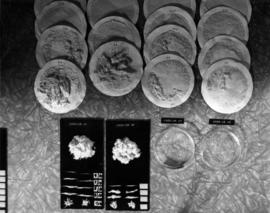
Photograph depicts samples of Cassiar asbestos.
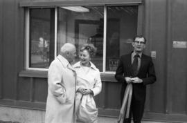
Photograph depicts Alice Gritzuk and two unknown men at a building dedicated by Mrs. Gritzuk.
Typed annotation on caption below photograph: "General Superintendent A.C. Beguin receiving 1965 Safety Award for Open Pits and Quarries in British Columbia from Mr. R.B. Bonar, Dept. of Mines and Petroleum Resources." Photograph depicts A.C. Beguin shaking hands with Mr. Bonar as he accepts a large plaque. Counter bar and curtains in background.
This map depicts a drawn bench plan for the estimated excavated waste for bench 6440 during the first quarter of 1972. Annotated details include the approximate excavated ore tonnages, broken and planned values for the first quarter and revised calculations from previous years values. Planned excavated areas are drawn with different colors.
This map depicts the pit layout and estimated waste extraction areas for 6410 bench. Extraction dates accompanied by its total tonnages are located within each planned area. Certain extraction dates are labeled with bench numbers. Annotated details include extraction dates, approximate total tonnages per area as well as extraction dates, total planned and broken tonnages, total tonnages from December 31, 1970 and numerical bench markers. The hand drawn plan consists of solid lines drawn with green, yellow, orange and lead pencils.
This map depicts the pit layout and estimated waste extraction areas for 6380 bench. Extraction dates accompanied by its total tonnages are located within each planned area. Certain extraction dates are labeled with bench numbers. Annotated details include extraction dates, approximate total tonnages per area as well as extraction dates, total planned and broken tonnages, total tonnages from December 31, 1970 from a survey done in September 1, numerical bench markers as well as a rough colored legend depicting extraction month by color. The hand drawn plan consists of solid lines drawn with green, yellow, red and lead pencils.
This map depicts the pit layout and estimated waste extraction areas for 6350 bench. Extraction dates accompanied by its total tonnages are located within each planned area. Annotated details include extraction dates, approximate total tonnages per area as well as extraction dates, total planned and broken tonnages and total tonnages from December 31, 1970 from a survey done in September 30. The hand drawn plan consists of solid lines drawn with red, green and orange colored pencils.
This map depicts the pit layout and estimated waste extraction areas for 6320 bench for the end of September to October. Extraction dates are included within certain portions of the plan. Annotated details include numerical bench markers, extraction dates, and approximate waste tonnage calculation for October. The hand drawn plan consists of solid and broken lines drawn with red, orange and lead pencils as well as black ink.
This map depicts the pit layout and estimated waste extraction areas for 6320 bench. Extraction dates accompanied by its total tonnages are located within each planned area. Certain extraction dates are labeled with bench numbers. Annotated details include extraction dates, approximate total tonnages per area accompanied by extraction dates, total planned tonnages, total tonnages from December 31, 1971 as well as a rough colored legend depicting extraction month by color. The hand drawn plan consists of solid lines drawn with green, red, orange and lead pencils.
This map depicts the generalized pit layout and estimated waste extraction areas for 6290 bench for the month of October and November. Extraction dates as well as total unbroken tonnages are included within certain portions of the plan. Annotated details include numerical bench markers, extraction dates, total tonnages to be extracted and approximate waste tonnage calculations for October. The hand drawn plan consists of solid and broken lines drawn with red, green, orange and lead pencils as well as black ink.
This map depicts the generalized pit layout and estimated waste extraction areas for 6290 bench for the month of November. Annotated details include numerical bench markers and waste extraction dates. The hand drawn plan consists of solid and dotted lines drawn with green, orange, red, blue and lead pencil.
This map depicts the pit layout and estimated waste extraction areas for 5870 bench for the end of August to November. Extraction dates, approximate extraction tonnages and ore, waste and talus locations are included throughout the plan. Annotated details include numerical bench markers, extraction dates, approximate extraction tonnages, ore, waste and talus locations as well as waste, ore, talus and total tonnage calculations for October. The hand drawn plan consists of solid and broken lines drawn with red, blue, orange and lead pencils as well as black ink.
This map depicts the pit layout and estimated waste extraction areas for 5840 bench for the end of September to November. Extraction dates, approximate extraction tonnages and ore, waste and talus locations are included throughout the plan. Annotated details include numerical bench markers, extraction dates, approximate total tonnages as well as waste and ore tonnage calculations for October. The hand drawn plan consists of solid and broken lines drawn with red, blue, orange and lead pencils as well as black ink.
This map depicts the generalized pit layout and estimated waste extraction areas for benches 5840 and 5870. Annotated details include numerical bench markers as well as extraction dates. The hand drawn plan consists of solid and dotted lines drawn with green and red pencil.
This map depicts the generalized pit layout and estimated waste extraction areas for 5810 bench. Annotated details include numerical bench markers, extraction dates and approximate ore extraction amounts. The hand drawn plan consists of solid and dotted lines drawn with green, orange and lead pencil.
The topographic map shows mine and campsite holdings within the proposed mine site. Asbestos deposits, the tramline and water bodies, such as Troutline Creek, are also included.
Annotations include certain lot titles being crossed out as well as as indication of missing survey information.
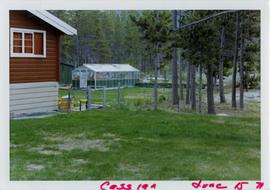
Photograph depicts part of a brown and white building similar to the "Director's Lodge" at Cassiar, B.C. (see items 2000.1.1.3.19.88 and 2000.1.1.3.19.89). Unidentified individuals visible inside greenhouse in fenced back yard. Forest in background. Handwritten annotation on verso of photograph: "Cassiar June 15 71".
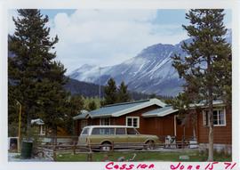
Photograph depicts brown and white building similar to the "Director's Lodge" at Cassiar, B.C. (see items 2000.1.1.3.19.88 and 2000.1.1.3.19.89). Station wagon parked in driveway behind short fence in foreground. Trees in foreground, forest and mountains visible in background. Handwritten annotation on verso of photograph: "Cassiar June 15 71".
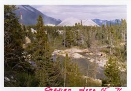
Photograph depicts flowing water believed to be Troutline Creek which ran south of Cassiar, B.C. Tailings pile and plant buildings visible behind forest in midground, northern mountain range in background. Handwritten annotation on verso of photograph: "Cassiar June 15 71".
Photograph depicts flowing water believed to be Troutline Creek which ran south of Cassiar, B.C. Tailings pile and plant buildings visible behind forest in midground, northern mountain range in background. Handwritten annotation on verso of photograph: "Cassiar June 15 71".
Photograph depicts flowing water speculated to be Troutline Creek which ran south of Cassiar, B.C. Forest on opposite shore and mountains in background. Handwritten annotation on verso of photograph: "Cassiar June 15 71".
Photograph depicts flowing water speculated to be Troutline Creek which ran south of Cassiar, B.C. Forest on opposite shore and mountains in background. Handwritten annotation on verso of photograph: "Cassiar June 15 71".
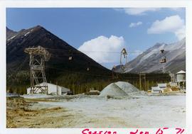
Photograph depicts tramline buckets and tower on plantsite. Vehicles, building materials, and unidentified buildings also visible on plantsite (including what appears to be a water tower). Mountains and valley in background. Handwritten annotation on verso of photograph: "Cassiar June 15 71".
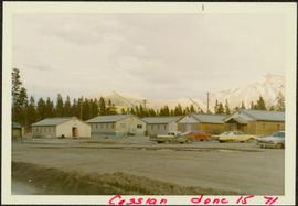
Photograph depicts long bunkhouse buildings located between the Cassiar plant and townsite. They were originally used seasonally by university students, or by new employees on waiting lists for the more accommodating panabode "Winter Bunkhouses" (see item 2000.1.1.3.19.113). These buildings are speculated to be bunkhouses number 86, 87, and 88. Trees cross midground; new mill building, tailings pile, and mountains visible in background. Handwritten annotation on verso of photograph: "Cassiar June 15 71".
Squirrel appears to be sitting on deck furniture of Director's Lodge at Cassiar, B.C. (see items 2000.1.1.3.19.88 and 2000.1.1.3.19.89).
Squirrel appears to be sitting on deck furniture of Director's Lodge at Cassiar, B.C. (see items 2000.1.1.3.19.88 and 2000.1.1.3.19.89).
Squirrel appears to be sitting on deck furniture of Director's Lodge at Cassiar, B.C. (see items 2000.1.1.3.19.88 and 2000.1.1.3.19.89).
Squirrel appears to be sitting on deck furniture of Director's Lodge at Cassiar, B.C. (see items 2000.1.1.3.19.88 and 2000.1.1.3.19.89).
Squirrel appears to be sitting on deck furniture of Director's Lodge at Cassiar, B.C. (see items 2000.1.1.3.19.88 and 2000.1.1.3.19.89).
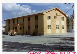
Photograph depicts two-story yellow and orange office building. Unidentified individual stands with garden hose in foreground near what appears to be a lawnmower. Warehouse semi-visible in left background; blue truck and new mill building visible in right background. Handwritten annotation on verso of photograph: "Cassiar Office June 15 71".
