Showing 883 results

Archival description
796 results with digital objects Show results with digital objects
2023.2.2.13.2.57 · Item · 9 Jul. 2007
Part of Dr. Paul Sanborn fonds

This image is part of the return trip sequence of aerial images obtained on the helicopter flight leaving the Klutlan Glacier study site. On the return leg at the end of the day, the flight initially went upvalley to pick up another party. This image was taken after the helicopter turned north to return to base camp.

2023.2.2.13.2.58 · Item · 9 Jul. 2007
Part of Dr. Paul Sanborn fonds

This image is part of the return trip sequence of aerial images obtained on the helicopter flight leaving the Klutlan Glacier study site. On the return leg at the end of the day, the flight initially went upvalley to pick up another party. This image was taken after the helicopter turned north to return to base camp.

2023.2.2.13.2.62 · Item · 9 Jul. 2007
Part of Dr. Paul Sanborn fonds

This image is part of the return trip sequence of aerial images obtained on the helicopter flight leaving the Klutlan Glacier study site. On the return leg at the end of the day, the flight initially went upvalley to pick up another party. This image was taken after the helicopter turned north to return to base camp.

2023.2.2.13.2.11 · Item · 8 Jul. 2007
Part of Dr. Paul Sanborn fonds

This image is part of the outbound sequence of aerial images obtained on the helicopter flight to the Klutlan Glacier study site. The sequence starts from the base camp at the White River crossing on the Alaska Highway and heads south, to a point just upvalley of the debris-covered terminus (approx. 10-15 km from Alaska border), and turning back north to the landing spot on the Generc River floodplain close to the study site (see Fig. 1 in paper).

2023.2.2.13.2.13 · Item · 8 Jul. 2007
Part of Dr. Paul Sanborn fonds

This image is part of the outbound sequence of aerial images obtained on the helicopter flight to the Klutlan Glacier study site. The sequence starts from the base camp at the White River crossing on the Alaska Highway and heads south, to a point just upvalley of the debris-covered terminus (approx. 10-15 km from Alaska border), and turning back north to the landing spot on the Generc River floodplain close to the study site (see Fig. 1 in paper).

2023.2.2.13.2.16 · Item · 8 Jul. 2007
Part of Dr. Paul Sanborn fonds

This image is part of the outbound sequence of aerial images obtained on the helicopter flight to the Klutlan Glacier study site. The sequence starts from the base camp at the White River crossing on the Alaska Highway and heads south, to a point just upvalley of the debris-covered terminus (approx. 10-15 km from Alaska border), and turning back north to the landing spot on the Generc River floodplain close to the study site (see Fig. 1 in paper).

2023.2.2.13.2.17 · Item · 8 Jul. 2007
Part of Dr. Paul Sanborn fonds

This image is part of the outbound sequence of aerial images obtained on the helicopter flight to the Klutlan Glacier study site. The sequence starts from the base camp at the White River crossing on the Alaska Highway and heads south, to a point just upvalley of the debris-covered terminus (approx. 10-15 km from Alaska border), and turning back north to the landing spot on the Generc River floodplain close to the study site (see Fig. 1 in paper).

2023.2.2.13.2.24 · Item · 8 Jul. 2007
Part of Dr. Paul Sanborn fonds

This image is part of the outbound sequence of aerial images obtained on the helicopter flight to the Klutlan Glacier study site. The sequence starts from the base camp at the White River crossing on the Alaska Highway and heads south, to a point just upvalley of the debris-covered terminus (approx. 10-15 km from Alaska border), and turning back north to the landing spot on the Generc River floodplain close to the study site (see Fig. 1 in paper).

2023.2.2.13.2.36 · Item · 8 Jul. 2007
Part of Dr. Paul Sanborn fonds

This image is part of the outbound sequence of aerial images obtained on the helicopter flight to the Klutlan Glacier study site. The sequence starts from the base camp at the White River crossing on the Alaska Highway and heads south, to a point just upvalley of the debris-covered terminus (approx. 10-15 km from Alaska border), and turning back north to the landing spot on the Generc River floodplain close to the study site (see Fig. 1 in paper).

2023.2.2.13.2.44 · Item · 9 Jul. 2007
Part of Dr. Paul Sanborn fonds

This image is part of the return trip sequence of aerial images obtained on the helicopter flight leaving the Klutlan Glacier study site. On the return leg at the end of the day, the flight initially went upvalley to pick up another party.

2023.2.2.13.2.47 · Item · 9 Jul. 2007
Part of Dr. Paul Sanborn fonds

This image is part of the return trip sequence of aerial images obtained on the helicopter flight leaving the Klutlan Glacier study site. On the return leg at the end of the day, the flight initially went upvalley to pick up another party.

2023.2.2.13.2.54 · Item · 9 Jul. 2007
Part of Dr. Paul Sanborn fonds

This image is part of the return trip sequence of aerial images obtained on the helicopter flight leaving the Klutlan Glacier study site. On the return leg at the end of the day, the flight initially went upvalley to pick up another party. This image was taken after the helicopter turned north to return to base camp.

2023.2.2.13.2.56 · Item · 9 Jul. 2007
Part of Dr. Paul Sanborn fonds

This image is part of the return trip sequence of aerial images obtained on the helicopter flight leaving the Klutlan Glacier study site. On the return leg at the end of the day, the flight initially went upvalley to pick up another party. This image was taken after the helicopter turned north to return to base camp.

2023.2.2.13.2.60 · Item · 9 Jul. 2007
Part of Dr. Paul Sanborn fonds

This image is part of the return trip sequence of aerial images obtained on the helicopter flight leaving the Klutlan Glacier study site. On the return leg at the end of the day, the flight initially went upvalley to pick up another party. This image was taken after the helicopter turned north to return to base camp.

2023.2.2.13.2.63 · Item · 9 Jul. 2007
Part of Dr. Paul Sanborn fonds

This image is part of the return trip sequence of aerial images obtained on the helicopter flight leaving the Klutlan Glacier study site. On the return leg at the end of the day, the flight initially went upvalley to pick up another party. This image was taken after the helicopter turned north to return to base camp.

2023.2.2.13.2.18 · Item · 8 Jul. 2007
Part of Dr. Paul Sanborn fonds

This image is part of the outbound sequence of aerial images obtained on the helicopter flight to the Klutlan Glacier study site. The sequence starts from the base camp at the White River crossing on the Alaska Highway and heads south, to a point just upvalley of the debris-covered terminus (approx. 10-15 km from Alaska border), and turning back north to the landing spot on the Generc River floodplain close to the study site (see Fig. 1 in paper).

2023.2.2.13.2.20 · Item · 8 Jul. 2007
Part of Dr. Paul Sanborn fonds

This image is part of the outbound sequence of aerial images obtained on the helicopter flight to the Klutlan Glacier study site. The sequence starts from the base camp at the White River crossing on the Alaska Highway and heads south, to a point just upvalley of the debris-covered terminus (approx. 10-15 km from Alaska border), and turning back north to the landing spot on the Generc River floodplain close to the study site (see Fig. 1 in paper).

2023.2.2.13.2.22 · Item · 8 Jul. 2007
Part of Dr. Paul Sanborn fonds

This image is part of the outbound sequence of aerial images obtained on the helicopter flight to the Klutlan Glacier study site. The sequence starts from the base camp at the White River crossing on the Alaska Highway and heads south, to a point just upvalley of the debris-covered terminus (approx. 10-15 km from Alaska border), and turning back north to the landing spot on the Generc River floodplain close to the study site (see Fig. 1 in paper).

2023.2.2.13.2.34 · Item · 8 Jul. 2007
Part of Dr. Paul Sanborn fonds

This image is part of the outbound sequence of aerial images obtained on the helicopter flight to the Klutlan Glacier study site. The sequence starts from the base camp at the White River crossing on the Alaska Highway and heads south, to a point just upvalley of the debris-covered terminus (approx. 10-15 km from Alaska border), and turning back north to the landing spot on the Generc River floodplain close to the study site (see Fig. 1 in paper).

2023.2.2.13.2.48 · Item · 9 Jul. 2007
Part of Dr. Paul Sanborn fonds

This image is part of the return trip sequence of aerial images obtained on the helicopter flight leaving the Klutlan Glacier study site. On the return leg at the end of the day, the flight initially went upvalley to pick up another party.

2023.2.2.13.2.53 · Item · 9 Jul. 2007
Part of Dr. Paul Sanborn fonds

This image is part of the return trip sequence of aerial images obtained on the helicopter flight leaving the Klutlan Glacier study site. On the return leg at the end of the day, the flight initially went upvalley to pick up another party. This image was taken after the helicopter turned north to return to base camp.

2023.2.2.13.2.55 · Item · 9 Jul. 2007
Part of Dr. Paul Sanborn fonds

This image is part of the return trip sequence of aerial images obtained on the helicopter flight leaving the Klutlan Glacier study site. On the return leg at the end of the day, the flight initially went upvalley to pick up another party. This image was taken after the helicopter turned north to return to base camp.

2023.2.2.13.2.59 · Item · 9 Jul. 2007
Part of Dr. Paul Sanborn fonds

This image is part of the return trip sequence of aerial images obtained on the helicopter flight leaving the Klutlan Glacier study site. On the return leg at the end of the day, the flight initially went upvalley to pick up another party. This image was taken after the helicopter turned north to return to base camp.

2023.2.2.2.7 · File · 1996-2005
Part of Dr. Paul Sanborn fonds

Data sets associated with the Arocena & Sanborn 1999 regional soil mineralogy study:

  • S234FINL.XLS [data report for mineral horizons from MoF Analytical Chemistry Laboratory, June 20 1996]
  • S235FINL.XLS [data report for organic horizons from MoF Analytical Chemistry Laboratory, June 20 1996]
  • SAMPLIST.XLS [conversion table for sample numbers used in MoF lab data reports]
  • Fe Al extractions.xlsx [assembled from lab data report by L. Arocena for oxalate & dithionite extractions; pyrophosphate extraction data from MoF lab]
  • MINSTUDY.XLS [consolidated lab data for organic & mineral horizons, except for BaCl2 exchangeable cations]
  • MINCEC.XLS [BaCl2 exchangeable cations & Morgan’s extraction for organic & mineral horizons]
2023.2.2.1.3.8 · File · 2003-2010
Part of Dr. Paul Sanborn fonds

Data sets for the Sulphur stable isotope tracer study (E.P. 886.15) include:

  • 03-095 UNBC PS-For.xls Particle size analyses (Kenneth Creek 0-20 & 20-40 cm)
  • 03-096 UNBC PS-For.xls Particle size analyses (Holy Cross 0-20 & 20-40 cm)
  • 082037.xls XRF elemental analysis (Holy Cross pedon)
  • 082038.xls XRF elemental analysis (Kenneth Creek pedon)
  • 084996.xlsx XRF elemental analysis (HC & KC parent materials)
  • EP 886 15 S isotope data (2001-2005) - foliage_completed (Feb 18).xls Pine foliage d34S (total S & total SO4-S)
  • EP 886.15 2003 Foliage & Soil Chemistry Summary.xls
  • EP 886.15 Foliar Analyses (selected) 2001-2006.xls Total N & S, SO4-S
  • EP 886.15 Holy Cross & Kenneth Creek 2005 foliage.xls
  • EP 886.15 Holy Cross & Kenneth Creek 2006 foliage.xls
  • EP 886.15 Holy Cross 2001 FH (S516FINL).xls
  • EP 886.15 Holy Cross 2001 Foliage (T727FINL).xls
  • EP 886.15 Holy Cross 2001 Litter (S515FINL).xls
  • EP 886.15 Holy Cross 2001 Mineral Soil (0-20 cm) (S507FINL).xls
  • EP 886.15 Holy Cross 2002 Foliage (T785FINL).xls
  • EP 886.15 Holy Cross 2003 FH (S642FINL).xls
  • EP 886.15 Holy Cross 2003 Foliage (T836FINL).xls
  • EP 886.15 Holy Cross 2003 Litter (S641FINL).xls
  • EP 886.15 Holy Cross 2003 Mineral Soil (0-20 cm) (S643FINL).xls
  • EP 886.15 Holy Cross 2004 FH (S702FINL).xls
  • EP 886.15 Holy Cross 2004 Foliage (T904FINL).xls
  • EP 886.15 Holy Cross 2004 Litter (S701FINL).xls
  • EP 886.15 Holy Cross 2004 Mineral Soil (0-20 cm) (S703FINL).xls
  • EP 886.15 Kenneth Creek 2001 FH (S521FINL).xls
  • EP 886.15 Kenneth Creek 2001 Foliage (T727FINL).xls
  • EP 886.15 Kenneth Creek 2001 Litter (S520FINL).xls
  • EP 886.15 Kenneth Creek 2001 Mineral Soil (0-20 cm) (S508FINL).xls
  • EP 886.15 Kenneth Creek 2001 Mineral Soil (20-40 cm) (S509FINL).xls
  • EP 886.15 Kenneth Creek 2002 Foliage (T785FINL).xls
  • EP 886.15 Kenneth Creek 2003 FH (S645FINL).xls
  • EP 886.15 Kenneth Creek 2003 Foliage (T837FINL).xls
  • EP 886.15 Kenneth Creek 2003 Litter (S644FINL).xls
  • EP 886.15 Kenneth Creek 2003 Mineral Soil (0-20 cm) (S646FINL).xls
  • EP 886.15 Kenneth Creek 2003 Mineral Soil (20-40 cm) (S647FINL).xls
  • EP 886.15 Kenneth Creek 2004 FH (S705FINL).xls
  • EP 886.15 Kenneth Creek 2004 Foliage (T905FINL).xls
  • EP 886.15 Kenneth Creek 2004 Litter (S704FINL).xls
  • EP 886.15 Kenneth Creek 2004 Mineral Soil (0-20 cm) (S706FINL).xls
  • EP 886.15 Kenneth Creek 2004 Mineral Soil (20-40 cm) (S707FINL).xls
  • EP 886.15 Sample Inventory.xls Listing of MoF Lab Job No.'s
  • Fertilizer March 2003.xls d34S data for commercial fertilizer S sources
  • hc_2002.xls Initial (2002) pine tree measurement data - Holy Cross
  • kc_2002.xls Initial (2002) pine tree measurement data - Kenneth Creek
2023.2.2.1.1.2 · File · 1988-1990
Part of Dr. Paul Sanborn fonds

During a year away from studies in 1987-88, Dr. Paul Sanborn developed a successful grant proposal to the Science Council of BC (SCBC) to pursue a postdoctoral project with Dr. Tim Ballard in relation to sulphur-deficient soils in BC and prescribed fire. This project built on an existing broadcast burning study conducted by Macmillan Bloedel Ltd. near Port Alberni on Vancouver Island, led by Bill Beese (later at Vancouver Island University). Dr. Sanborn's work addressed sulphur forms and amounts in the soils at these sites, and the chemical processes influencing sulphur availability in relation to prescribed fire.

Only one part of this work was eventually published:
Sanborn, P.T. and T.M. Ballard. 1991. Combustion losses of sulphur from conifer foliage: Implications of chemical form and soil nitrogen status. Biogeochemistry 12: 129–134. https://doi.org/10.1007/BF00001810

The remainder of the work was documented in this Project Completion Report to SCBC, dated February 28, 1990, and entitled "Effects of Prescribed Fire on Sulphur in Forest Soils".

Thirty-four data files were selected for archival retention. There is some redundancy of content among these, with some formatted for incorporation as tables in the report appendices, and others containing some of the same data, but set up as input files for a statistics program. These account for almost all of the data listed in the Project Completion Report appendices. No glossary of variable names is provided, but these should be identifiable by referring to the Report.

2023.2.2.1.2.3 · File · 2002-2005
Part of Dr. Paul Sanborn fonds

Data sets associated with the Cluculz retrospective study (E.P. 886.10):

  • 082036.xls -- Elemental analysis (XRF) for mineral horizon samples from profile at Cluculz EP 886.10 site
  • CLUCINC.xls -- Summary chemical properties for composite samples in aerobic incubation
  • Cluculz Ck 2002 Foliar Analysis.xls -- Analyzed for individual single-tree plots
  • Cluculz Ck 2002 Forest Floor.xls -- Forest floor mass data
  • Cluculz composite list (2003 samples).xls -- Composite groups (3 original samples in each) used for organic & mineral soils
  • Cluculz composite list (incubation experiment).xls -- Composite groups (3 original samples in each) used for organic & mineral soils
  • Cluculz composite list for incubations (2003 samples).xls -- Composite groups (3 original samples in each) used for organic & mineral soils
  • Cluculz Creek S mineralization - initial fractions (2).xls -- S fractions - organic & mineral soil composites
  • Cluculz Creek S mineralization - initial S fractions.xls -- S fractions - organic & mineral soil composites
  • Cluculz Creek S mineralization (IC).xls -- S mineralization data for aerobic incubation - organic & mineral soils
  • Cluculz foliar and soil data.xls -- Chemical properties of foliage, composite forest floors, composite mineral soils
  • Cluculz pH.xls -- pH - organic & mineral soil composites
  • Cluculz S fraction graphs.xls -- S fractions - organic & mineral soil composites
  • Elemental Analysis of Standard by XRF (2005).xls -- Published & XRF analysis of CANMET TILL-1 soil standard (used in Cluculz XRF analysis)
2023.2.1.01 · File · 1981-2001
Part of Dr. Paul Sanborn fonds

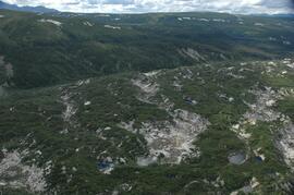
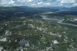
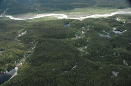
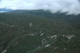
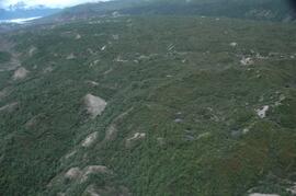
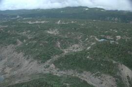
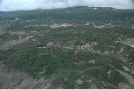
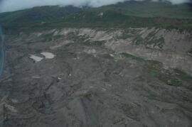
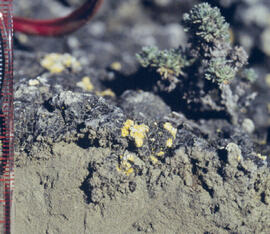
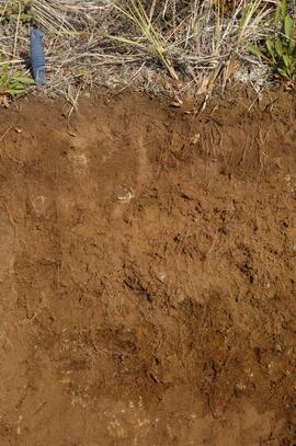
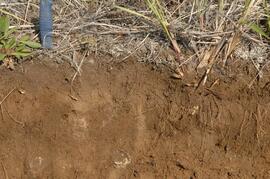
Research on the ecological functions of coarse woody debris (CWD) in forests, and techniques for inventorying CWD, were major topics for forest ecologists and soil scientists during Paul Sanborn's years with BC Forest Service research program (1991-2002).

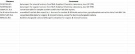
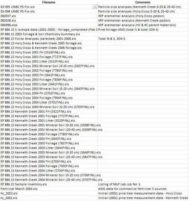
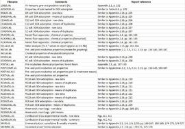
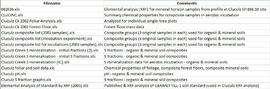
File of documents consists mostly of unpublished internal and consultant reports, workshop summaries & handouts, and government publications (BC, Canada, USA). Methods-related documents may have been drafts which were superseded later by published manuals. In some cases, the document has a memo or email attached which provides some additional context.

Includes the following items:

BIOFOR Resource Consultants. (n.d.) Methodology for developing coarse woody debris photo guides. [consultant report to Ministry of Forests, Research Branch]

Brown, J.K., T.E. See. 1981. Downed dead woody fuel and biomass in the northern Rocky Mountains. General Technical Report INT-117. USDA Forest Service.

Clark, D.F., P.J. Burton, J.A. Antos. 1995. A comparative study employing different methods for inventory of coarse woody debris. Symbios Research and Restoration, Smithers, BC. September 30, 1995.

Ellis, R. 1996. Summary of the coarse woody debris workshop, Cowichan Lake Research Station, April 11-12, 1996. [Incl. handouts by A. Mackinnon, S.W. Taylor & J.V. Parminter]

Ember Research Services Ltd. 1997. CWD/Fuel calculator user’s guide. October 1997.

Hermanek, H. 2001. The distribution and description of CWD in the SBSmk1 and IDFdm2 zones of British Columbia. Work term report, Biology Co-op Program, University of Victoria.

Lajzerowicz, C. 2000. Coarse woody debris: what are we leaving in British Columbia. Examining TRENDS. ET2000-02. Northern Interior Vegetation Management Association.

Lajzerowicz, C. 2000. Coarse woody debris: what are the changes following harvesting in Alberta. Examining TRENDS. ET2000-03. Northern Interior Vegetation Management Association.

Lloyd, R. 2001. A comparison of coarse woody debris in harvested and unharvested sites in the SBSmc2: First-year report, March 2001. Prepared for: Houston Forest Products.

Mackinnon, A. 1996. What kind of CWD measurements are MOF research ecologists using? [handout at CWD Workshop, April 11-12, 1996]

Mackinnon, A., J. Parminter. 1996. Natural landscape patterns and processes. Notes from a meeting at Cowichan Lake Research Station, April 10, 1996.

Marshall, P.L. 1999. Using line intersect sampling to determine the volume of odd-shaped pieces of coarse woody debris: an explanation of the Vegetation Resources Inventory formula. Contract report to: Ministry of Forest, Vancouver Region. February 1999.

Marshall, P.L., G. Davis, V.M. LeMay. 2000. Using line intersect sampling for coarse woody debris. Forest Research Technical Report, TR-003. Vancouver Forest Region.

Ministry of Forests, Resources Inventory Branch 1999. Pilot study for dead tree information on growth and yield permanent sample plots.

Parminter, J. 1994. Correction factors and the measurement of coarse woody debris. Research Branch, Ministry of Forests. March 11, 1994.

Parminter, J. 2001. Natural disturbance research and project summaries. Cowichan Lake Research Station meeting, April 10, 1996.

Parminter, J. 2001. Procedures for measuring CWD volume in spot accumulations, landing piles and strip accumulations.

Parminter, J. 2001. CWD extensive pilot program – sampling of CWD in cutblocks.

Robson Valley Enhanced Forest Management Pilot Project. 2001. Field data collection protocol manual: coarse woody debris survey 2001. [attached covering email from B. Rogers]

Rogers, B. 2001. Robson Valley Enhanced Forest Management Pilot Project, Coarse Woody Debris Assessment Phase I: Working Plan 2001. Prepared for: Ministry of Environment, Lands and Parks. March 3, 2001.

Snag Protocol Team. 2000. Northern region snag management protocol: January 2000. USDA Forest Service, Northern Region.

Taylor, S.W., J.V. Parminter. 1996. Effects of broadcast burning on coarse woody debris in British Columbia. [handout at CWD Workshop, April 11-12, 1996]

Graham, R.T. et al. 1994. Managing coarse woody debris in forests of the Rocky Mountains. Research Paper INT-RP-477. Intermountain Research Station, USDA Forest Service. Available online at: https://www.fs.usda.gov/research/treesearch/24829 (accessed March 2023)

Harmon, M.E., J. Sexton. 1996. Guidelines for measurements of woody debris in forest ecosystems. Publ. No. 20. U.S. LTER Network Office. Available online at: https://andrewsforest.oregonstate.edu/pubs/webdocs/reports/detritus/publications/Guidelines%20for%20Measurements%20of%20Woody%20Detritus%20in%20Forest%20Ecosystems.pdf (accessed March 2023)

Rogers, B. 2002. Robson Valley Enhanced Forest Management Pilot Project, Coarse Woody Debris Assessment Phase III: Final Report. Prepared for: Ministry of Environment, Lands and Parks. Available online at: https://www.env.gov.bc.ca/omineca/documents/cwd_2002_reportf.pdf (accessed March 2023)

Stevenson, Susan K. (March 1999). Biodiversity assessments at silvicultural systems sites, summer 1998. Prepared for: Prince George Forest Region, BC Ministry of Forests, Prince George BC. 16 p. + 16 p. graphs

Taylor, S.W. 1997. A field estimation procedure for downed coarse woody debris. Technology Transfer Notes. No. 2, August, 1997. Available online at: https://publications.gc.ca/site/eng/409169/publication.html (accessed March 2023)

2023.2.2.1.2 · Sub-subseries · 2001-2005
Part of Dr. Paul Sanborn fonds

During Dr. Sanborn's years with the Ministry of Forests research program (1991-2002), he worked on forest fertilization research with silviculturist Rob Brockley (retired; formerly at Kalamalka Research Station, Vernon, BC). Brockley’s work in the 1980s and early 1990s had documented the widespread pattern of sulphur deficiencies across the BC interior, and the superior response of managed stands to fertilization treatments involving sulphur (S) and nitrogen (N) rather than nitrogen alone.

To progress farther, different methods for understanding the fate of sulphur fertilizers in forests and soils were needed. Sanborn contacted the stable isotope group at the University of Calgary which had done important work on the fate of pollutant sulphur emitted by oil and gas extraction and processing in Alberta, using natural abundances of sulphur stable isotopes as a tracer. This was the beginning of a collaboration with Dr. Bernhard Mayer of the University of Calgary, and also with his German soil scientist colleague, Dr. Joerg Prietzel (Munich Technical University).

The research team engaged in the Cluculz retrospective study (E.P. 886.10) for the BC Ministry of Forests.

An ancillary project involved resampling (2002 - foliage, 2003 - soil) of a previously fertilized (1990) installation (E.P. 886.10) south of Cluculz Lake in order to compare the longer-term effects of different fertilizer sulphur forms on soil and foliage chemical properties. Results were published as a journal article and a Ministry of Forests Extension Note:

Sanborn, P.T., J. Prietzel, R.P. Brockley. 2005. Soil and lodgepole pine foliar responses to two fertilizer sulphur forms in the Sub-Boreal Spruce zone, central interior British Columbia. Can. J. For. Res. 35 (10): 2316-2322. https://cdnsciencepub.com/doi/abs/10.1139/x05-138

Sanborn, P. and R. Brockley. 2005. Sulphur deficiencies in lodgepole pine: occurrence, diagnosis, and treatment. Ext. Note 71. B.C. Min. For., Res. Br., Victoria, B.C. https://www.for.gov.bc.ca/hfd/pubs/docs/en/En71.pdf

2023.2.2.1.2.2 · Item · [between 2002 and 2005]
Part of Dr. Paul Sanborn fonds

This document file "Cluculz Creek Fertilization Research Site.pdf" contains a field description and basic characterization data for a representative pedon at the E.P. 886.10 site.

2023.2.2.13.2.07 · Item · 8 Jul. 2007
Part of Dr. Paul Sanborn fonds

This image is part of the outbound sequence of aerial images obtained on the helicopter flight to the Klutlan Glacier study site. The sequence starts from the base camp at the White River crossing on the Alaska Highway and heads south, to a point just upvalley of the debris-covered terminus (approx. 10-15 km from Alaska border), and turning back north to the landing spot on the Generc River floodplain close to the study site (see Fig. 1 in paper).