Document is a research installation layout map for the Kenneth Creek site of the Sulphur stable isotope tracer study (E.P. 886.15).
Ministry of Forests E.P. 886.13 was established by silviculture researcher Robert Brockley between 1992 and 1999, and consisted of 8 installations across the interior which shared the same experimental design. Five involved lodgepole pine and three involved interior spruce. Complete descriptions of the site characteristics, experimental treatments, and early results are given by:
Brockley, R.P. and D.G. Simpson. 2004. Effects of intensive fertilization on the foliar nutrition and growth of young lodgepole pine and spruce forests in the interior of British Columbia (E.P. 886.13): Establishment and progress report. Technical Report 018. B.C. Ministry of Forests., Research Branch, Victoria, B.C. http://www.for.gov.bc.ca/hfd/pubs/Docs/Tr/Tr018.htm
The key difference between E.P. 886.13 and other lodgepole pine fertilization studies in the BC interior was the inclusion of two treatments involving annual fertilizer applications; see Brockley and Simpson (2004) for full details.
Early tree responses to the fertilization treatments at two lodgepole pine installations, including Kenneth Creek, were presented in:
Amponsah, I.G., P. G. Comeau, R.P. Brockley, and V.J. 2005. Effects of repeated fertilization on needle longevity, foliar nutrition, effective leaf area index, and growth characteristics of lodgepole pine in interior British Columbia, Canada. Canadian Journal of Forest Research 35: 440 – 451. https://doi.org/10.1139/x04-200
Prior to his retirement, Brockley published a comprehensive report on the results of the lodgepole pine installations in this study:
Brockley, R.P. 2010. Effects of intensive fertilization on the foliar nutrition and growth of young lodgepole pine forests in the British Columbia Interior: 12-year results. Technical Report 058. B.C. Ministry of Forests and Range., Forest Science Program, Victoria, B.C. http://www.for.gov.bc.ca/hfd/pubs/Docs/Tr/Tr058
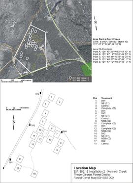
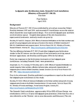
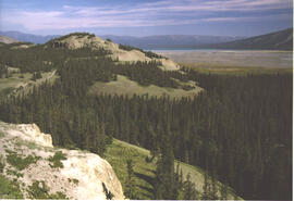
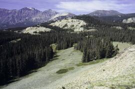
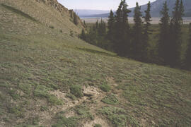
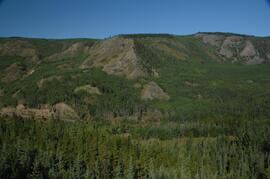
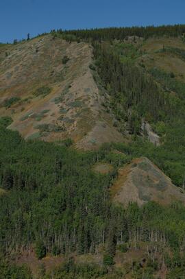
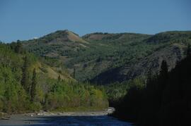
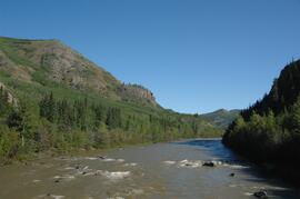
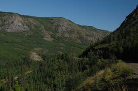
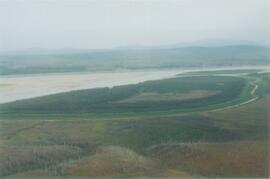
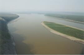
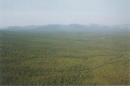
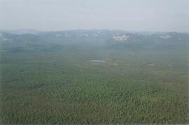
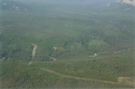
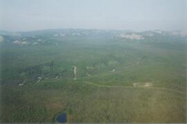
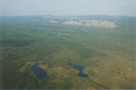
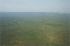
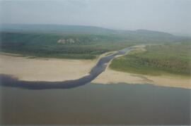
The Kenneth Creek installation, approximately 60 km ESE of Prince George, was established in 1993 in a 10-year-old lodgepole pine plantation. [Note that this site is also referred to as the "Bowron" site in some documents and filenames.] The site was located on a flat glacial outwash terrace with fairly uniform deep sandy soils, and was extensive enough that it later hosted one of two installations of E.P. 886.15 established in 2001. (See https://search.nbca.unbc.ca/index.php/2023-2-2-1-3.) The Kenneth Creek site was attacked by mountain pine beetle in 2006, resulting in at least 80% tree mortality. In 2013, the stand was levelled in order to enable replanting.
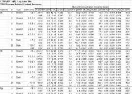
Dr. Paul Sanborn's involvement in this study addressed three aspects of soil and nutrient cycling responses to the fertilization treatments:
- mineral soil and forest floor nutrient stocks, (Sub-subseries 2023.2.2.15.1)
- litterfall amounts and chemical composition, and, (Sub-subseries 2023.2.2.15.2)
- litter decomposition. (Sub-subseries 2023.2.2.15.3)
The BC Ministry of Forest's EP 1148 Long-term Soil Productivity (LTSP) study addresses two key factors— soil porosity and site organic matter—that potentially limit tree growth and site productivity in the timber-harvesting land base and that can be affected by forestry operations.
A spinoff study was conducted in the late 1990s by the Ministry of Forests research soil scientists responsible for the three LTSPS installations in the Sub-Boreal Spruce zone: Paul Sanborn (Log Lake, Prince George Forest Region), Marty Kranabetter (Topley, Prince Rupert Forest Region), and Bill Chapman (Skulow Lake, Cariboo Forest Region). The objective was to estimate the potential nutrient losses resulting from differing levels of woody biomass removal in the LTSPS treatments.
Final results were published in:
Sanborn, P., M. Kranabetter, and B. Chapman. 2000. Nutrient removals in woody biomass: preliminary estimates from the Sub-Boreal Spruce Long-Term Soil Productivity Study. LTSPS Research Note #LTSPS-04. Prince George, Prince Rupert, and Cariboo Forest Regions, B.C. Ministry of Forests. 6 p. https://www.for.gov.bc.ca/hfd/pubs/Docs/Ltsps/Rrn004.htm
Includes the following data sets:
- LOGLBIOM.XLS [element concentrations for diameter classes of branches and bole cookies of sample living trees, Log Lake LTSPS site]
- Log Lake Biomass Nutrient Summary (1996).xls [mean values for element concentrations by species and diameter class]
- Skulbiom.xls [element concentrations for diameter classes of branches and bole cookies of sample living trees, Skulow Lake LTSPS site]
- Skulow Lake Biomass Nutrient Summary (1996).xls [mean values for element concentrations by species and diameter class]
- Toplbiom.xls [element concentrations for diameter classes of branches and bole cookies of sample living trees, Topley LTSPS site]
- Topley Biomass Nutrient Summary (1996).xls [mean values for element concentrations by species and diameter class]
This born-digital "Lucille Mountain soils" document provides a description and basic data for the Lucille Mt. pedon.
The eastern flank of the Mackenzie Mountains has a complex history of multiple glaciations by both the Laurentide and Cordilleran ice sheets, recorded in thick sequences of glacial sediments that were documented at 3 locations (Katherine Creek, Little Bear River, Inlin Brook) by:
Duk-Rodkin, A., R.W. Barendregt, C. Tarnocai, and F.M. Phillips. 1996. Late Tertiary to late Quaternary record in the Mackenzie Mountains, Northwest Territories, Canada: stratigraphy, paleosols, paleomagnetism, and chlorine-36. Canadian Journal of Earth Sciences 33 (6): 875-895. https://doi.org/10.1139/e96-066
Of the 3 sites, the exposure on Inlin Brook, a tributary of the Keele River, was the least well-documented, so in summer 2004 Dr. Paul Sanborn joined a field party of the Geological Survey of Canada (GSC) based at Tulita, NWT, and was given helicopter support to visit Inlin Brook (August 5-8). A brief visit was also made to the Little Bear River site.
On August 9-10, Sanborn joined Alejandra Duk-Rodkin (GSC) and Rene Barendregt (U Lethbridge) in helicopter-assisted field work at sites in the Franklin Mountains and elsewhere east of the Mackenzie River.
Photograph depicts the Mackenzie Valley and the Franklin Mountains. Pipeline is visible.
Photograph depicts the Mackenzie Valley and the Franklin Mountains.
This born-digital document consists of field observations for Mackenzie Valley sites N04-06 to -08, Aug. 9-10.
During the 1980s, Agriculture Canada pedologists Scott Smith (retired from Summerland Research Station, formerly based in Whitehorse) and Charles Tarnocai (retired from Central Experimental Farm, Ottawa) had a large field program which addressed the trends in soil development in the central Yukon. Across this region, particularly between Whitehorse and Dawson City, the land surfaces and surficial deposits vary greatly in age due to the differing extents of glaciations over the past ~2 million years.
Tarnocai and Smith shared the unpublished data and soil samples from this work with Dr. Paul Sanborn, and this resulted in a student project published as:
Daviel, E., P. Sanborn, C. Tarnocai, and C.A.A. Smith. 2011. Clay mineralogy and chemical properties of argillic horizons in central Yukon paleosols. Canadian Journal of Soil Science 91: 83-93. https://doi.org/10.4141/cjss10067
This data set consists of transcribed data from lab data sheets, showing McQuesten-Dawson City paleosol data from the Tarnocai and Smith 1983 AAFC Yukon Paleosol Study. The data set includes chemical and particle size data for Tarnocai & Smith samples, as determined by the Ag Canada lab. Note that the “Site” column indicates the NTS topographic map sheet (e.g. 115P/13) for the sampling locations.
Undated 2-page memo to Dave [Carter?] [from Scott Smith?] with review comments on a draft manuscript; attached to a draft table with basic characterization data for 3 paleosol sequences at the Lost Chicken mine (profile numbers 91010, 91011, & 91013)
At the Kenneth Creek installation (Ministry of Forests E.P. 886.13), forest floors and mineral soils were sampled on 3 occasions: 1996 (by Brockley), 1999 (by Sanborn), and 2005 (by Sanborn). In addition, bulk density measurements and geochemical analyses were conducted for selected depths on the "Bowron" pedon previously published in the mineralogical study by Arocena and Sanborn (1999); this pedon was sampled on the southeastern edge of the installation beside the main access trail.
The 1996 sampling (2 years after treatments began) involved forest floors and 0-15 cm depth mineral soils, sampled at 10 random points in each plot; there were no measurements of forest floor mass or mineral soil bulk density.
The 1999 and 2005 sampling was more intensive, and included forest floor mass and mineral soil bulk density measurements, as well as a greater depth of mineral soil sampling (0-20 cm; 20-40 cm). Note that the mineral soil bulk density measurements were not repeated in 2005; 1999 values were used in subsequent analyses.
Results from the 2005 soil sampling were published along with those from the Crow Creek (spruce) installation in:
Brockley, R.P. and P.T. Sanborn. 2009. Effects of repeated fertilization on forest floor and mineral soil properties in young lodgepole pine and spruce forests in central British Columbia. Technical Report 052. B.C. Ministry of Forests., Research Branch, Victoria, B.C. http://www.for.gov.bc.ca/hfd/pubs/Docs/Tr/Tr052.htm [Note that this publication included mineral soil data only for the 0-20 cm depth.]
Includes the following data sets:
- 084996.CSV [whole-rock elemental analyses for < 2 mm fractions of C horizon of Kenneth Creek (KC) ( = “Bowron”) reference pedon; also includes data for C horizon of Holy Cross (HC) pedon related to E.P. 886.15 documented in https://www.for.gov.bc.ca/hfd/pubs/Docs/Tr/Tr020.htm ]
- 99-479ps.xls [particle size analysis (pipette method) data for plot composites of 1999 mineral soil samples by 0-20 cm and 20-40 cm depths]
- Kenneth Creek Db (1999).xls [bulk density data for 2 sampling locations per subplot = 8 per plot; cores collected at 10-14 cm (U) and 30-34 cm (L) depths]
- EP886.13 (Kenneth Ck) Db data.xls [provides additional detail on fine fraction and total bulk density along with plot and treatment means]
- Kenneth Creek pedon Db (2005).xls [bulk density data collected from the same pit where the “Bowron” pedon was sampled for Arocena and Sanborn (1999)]
The 1996 chemical data for forest floor and mineral soil (0-15 cm) are in:
- D96MIN1.xls
- D96MIN2.xls
- D96FOR1.xls
- D96FOR2.xls
[In the “Installation” column, 1 = Sheridan Creek and 2 = Kenneth Creek.]
Consolidated versions of the 1996 data:
- EP886.13 Mineral Soil Chemistry (1996).xls
- EP886.13 Forest Floor Chemistry (1996).xls
The forest floor mass / area data are given in:
- Kenneth Creek 1999 Forest Floor Mass.xls
- Kenneth Creek 2005 forest floor mass.xls
Comparison of the 1999 and 2005 forest floor mass data is given by:
- Kenneth Creek 1999-2005 Forest Floor Mass Comparison.xls
The original laboratory data reports for 1999 identified the samples only with a sequential lab sample number (1-72). The complete sample identifications showing the lab sample number, plot, and sub-plot are in 1999 Soil Sample Lists.xls. For the 2005 samples, the laboratory data reports contain the complete identifying information.
- S370finl.xls [1999 mineral soil 0-20 cm]
- S371finl.xls [1999 mineral soil 20-40 cm]
- S375finl2.xls [1999 forest floor]
- S821finl.xls [2005 mineral soil 0-20 cm]
- S822finl.xls [2005 mineral soil 20-40 cm]
- S824finl.xls [2005 forest floor]
More complete versions of the soil chemical data with plot and treatment means, including calculations of elemental mass / hectare by plot and treatment (for 1999 only), are given in:
- EP886.13 Forest Floor Chemistry (1999).xls
- EP886.13 Mineral Soil Chemistry (1999) 0-20 cm.xls
- EP886.13 Mineral Soil Chemistry (1999) 20-40 cm.xls
- EP886.13 Forest Floor Chemistry (2005).xls
- EP886.13 Mineral Soil Chemistry (2005) 0-20 cm.xls
- EP886.13 Mineral Soil Chemistry (2005) 20-40 cm.xls
Calculations of carbon mass by plot and treatment (1999 only) are given in:
- EP886.13 Forest Floor Mass and Carbon Content (1999).xls
- EP886.13 Mineral Soil Carbon Content and Mass(1999).xls
Nutrient pools (kg/ha) are summarized by treatment (1999 only) in:
- Kenneth Creek Nutrient Pools Summary (1999).xls
"Mineralogy of clay and sand fractions of soils developed from till, glaciofluvial and glaciolacustrine deposits in central interior British Columbia" was a preliminary internal report that provides some background to Arocena and Sanborn's regional soil mineralogy study, as well as a compilation of the mineralogical data.
The key results from this work were later published as:
J.M. Arocena and P. Sanborn. 1999. Mineralogy and genesis of selected soils and their implications for forest management in central and northeastern British Columbia. Canadian Journal of Soil Science 79: 571-592. https://doi.org/10.4141/S98-07
This Ministry of Forests internal memorandum of 30 June 1997 from Paul Sanborn to Regional & Research Branch soil scientists provides comparison of Morgan's extractant and BaCl₂ for cations, using the 57 samples from the regional soil mineralogy study.
The key results from the study were later published as:
J.M. Arocena and P. Sanborn. 1999. Mineralogy and genesis of selected soils and their implications for forest management in central and northeastern British Columbia. Canadian Journal of Soil Science 79: 571-592. https://doi.org/10.4141/S98-07
Document prepared by P. Grilz contains species lists and UTM coordinates for 10 sampling locations for the M-K-2001-2002-81 Seed Project.
File contains the following data sets:
- Phytolith contents.xls [phytolith content in 5-20 µm silt, tallied by morphological categories; also summarized as % of total soil fine (< 2 mm) fraction]
- M-K (2001) soil LOI data.pdf [LOI (loss-on-ignition) data for sampled soil horizons – proxy measurement for organic matter content]