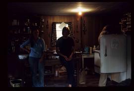
Image depicts the start of Joffre Creek Road, most likely somewhere in the Joffre Lakes Provincial Park.
File contains slides depicting places in the Lillooet area.
Image depicts three unknown individuals in a kitchen somewhere in Lillooet, B.C. They are possibly archaeology students.
Image depicts an old church located somewhere in Lillooet, B.C.
Image depicts a view of the Fraser River and the mountains surrounding Lillooet, B.C.
File contains slides depicting places around and between Lillooet and Howe Sound.
Image depicts some farmland in Lillooet, B.C.
Image depicts two bridges over the Fraser River, located somewhere in Lillooet, B.C.
Image depicts Lillooet, B.C.
Image depicts a view of Lillooet, B.C.
File contains slides depicting places in and around the Kamloops and Lillooet regions.
Image depicts a gathering of people for an uncertain event at an uncertain location, possibly in Lillooet, B.C. A few tents are set up in the picture.
Image depicts a rail road bridge over the Fraser River, possibly somewhere in the Lillooet area.
Image depicts a view of the Fraser River in Lillooet, B.C.