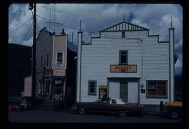
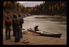
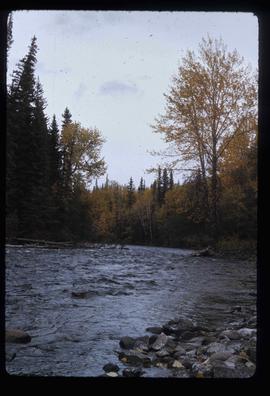
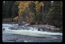
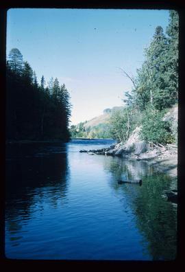
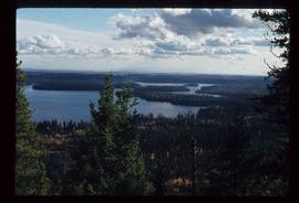
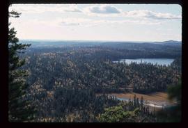
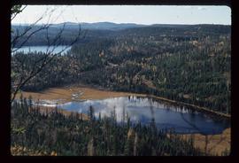
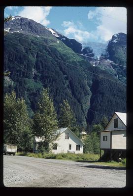
Image depicts a view of the area around Tabor Mountain in Prince George, B.C.
Image depicts Tabor Mountain from the airport in Prince George, B.C.
Image depicts a view of Prince George, from Gunn Point in the L.C. Gunn Park.
Image depicts the Tabor Lake Subdivision in Prince George, B.C.
Image depicts a view of Tabor Lake.
Image depicts grooving on Tabor Mountain in Prince George, B.C.
Image depicts grooves on Tabor Mountain in Prince George, B.C.
Image depicts a trailer for a logging truck suspended off the ground by a wooden structure. This is used to load the trailer onto the back of the truck. The name on the truck says "Rormarniewich Trucking Ltd."
Image depicts objects, including a flag pole, that the slide labels as "survey equipment." The slide also places it as a "Peyto icefall," on the Peyto Galcier in the Banff National Park in Alberta, B.C.
Image depicts a sunshine recorder at an uncertain location.
Image depicts the Sunset Theatre in Wells, B.C.
Image depicts a view of a sunset at an uncertain location, possibly in the Peace River Region.
Image depicts Summit Lake.
Image depicts Sue Sedgwick standing on the bank of a river.
Image depicts Sue Sedgwick standing next to a camper.
Image depicts Studio 2880 Arts Complex in Prince George, B.C. Map coordinates 53°54'36.9"N 122°46'30.3"W
Image depicts a building which is a part of the Studio 2880 Arts Complex on 15th Avenue in Prince George, B.C.
Image depicts a street of houses somewhere in Prince George, B.C.
Image depicts a street in Giscome B.C. The Giscome Store is located on the left side of the image with the church in the background. Map coordinates 54°04'18.5"N 122°21'57.7"W
Image depicts a street in Giscome. The store was previously located on the left. The church is in the background. Map coordinates 54°04'18.5"N 122°21'57.7"W
Image depicts a small stream running through a cluster of trees somewhere in or around Seton Portage, B.C.
Image depicts a small stream somewhere on Cottonwood Island.
Image depicts a stream somewhere along the White Pass railway.
Image depicts a downhill stream somewhere in the area surrounding Stewart, B.C.
Image depicts a view of the Dunkley Lumber Mill in Strathnaver, B.C.
Image depicts the BCR, as well as the Dunkley Lumber Mill, in Strathnaver, B.C.
Image depicts what is likely the Dunkley Lumber Mill in Strathnaver, B.C.
Image depicts an aerial view of Strathnaver, B.C.
Image depicts a few storage sheds somewhere in Prince George, B.C.
Image depicts a group of people stopped in the middle of the Fraser River in the Grand Canyon, B.C.
Image depicts the school site in Stoney Creek.
Image depicts a stone marker in Lamming Mills, B.C.
Image depicts the Robert Stewart house, built in 1910 and inhabited by the Stewart family until 1945. It is located in Stewart, B.C.
Image depicts Stewart Harbour in Stewart, B.C.
Image depicts an unknown individual leaning against a sign at the Stewart Access Road which warns travellers to pack several days of food. Located in Hazelton, B.C.
Image depicts a man, possibly Kent Sedgwick, leaning against a sign forbidding public traffic on the Stewart Access Road from between 5 am to 8 pm. Located in Hazelton, B.C.
Image depicts Stewart, with a section of Mt. Shorty Stevenson dominating the background.
Image depicts several houses in Stewart, B.C. A section of Mt. Shorty Stevenson is visible in the background.
Image depicts a couple of salmon in the Stellako River.
Image depicts a Fisherman wading in the Stellako River.
Image depicts the Stellako River.
Image depicts an unknown individual with a raft on the Stellako River. The slide is labelled "fisheries research."
Image depicts the Stellako River.