Mostrar 3025 resultados

Archival description
3025 resultados com objetos digitais Mostrar resultados com objetos digitais
View Back to Skagway
2012.13.1.100.05 · Item · 1999
Parte de J. Kent Sedgwick fonds

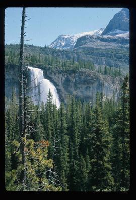
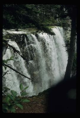
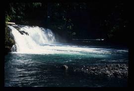
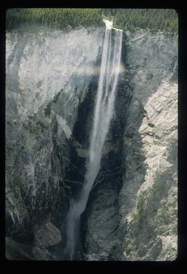
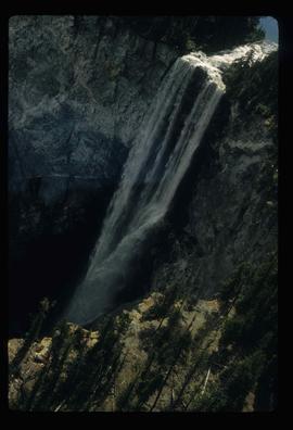
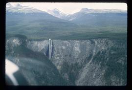
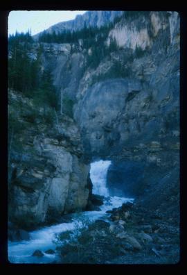
Image depicts a view over a forested, mountainous area and a river somewhere in the area of Skagway, Alaska.

View Down to Skagway
2012.13.1.100.23 · Item · 1999
Parte de J. Kent Sedgwick fonds

Image depicts a view over a forested, mountainous area and a river towards the vicinity of Skagway, Alaska.

View from City Hall
2012.13.1.3.045 · Item · Jan. 1978
Parte de J. Kent Sedgwick fonds

Image depicts a view of Prince George from City Hall looking northeast with the pulp mills in the background. Map coordinates 53°54'46.3"N 122°44'41.9"W

View from Gunn Point
2012.13.1.3.060 · Item · Nov. 1979
Parte de J. Kent Sedgwick fonds

Image depicts a view of Prince George from Gunn Point in the L.C. Gunn Park looking north. Map coordinates 53°54'26.2"N 122°43'35.8"W.

View from Gunn Point
2012.13.1.3.061 · Item · Nov. 1979
Parte de J. Kent Sedgwick fonds

Image depicts a view of Prince George from Gunn Point in the L.C. Gunn Park looking north. Map coordinates 53°54'26.2"N 122°43'35.8"W.

View from Gunn Point
2012.13.1.3.059 · Item · Nov. 1979
Parte de J. Kent Sedgwick fonds

Image depicts a view of Prince George from Gunn Point in the L.C. Gunn Park looking north. Map coordinates 53°54'26.2"N 122°43'35.8"W.

View from Gunn Point
2012.13.1.3.064 · Item · Nov. 1979
Parte de J. Kent Sedgwick fonds

Image depicts a view of Prince George from Gunn Point in the L.C. Gunn Park looking north. Map coordinates 53°54'26.2"N 122°43'35.8"W.

View from Gunn Point
2012.13.1.3.065 · Item · Nov. 1979
Parte de J. Kent Sedgwick fonds

Image depicts a view of Prince George from Gunn Point in the L.C. Gunn Park looking north. Map coordinates 53°54'26.2"N 122°43'35.8"W.

View from Gunn Point
2012.13.1.3.058 · Item · Nov. 1979
Parte de J. Kent Sedgwick fonds

Image depicts a view of Prince George from Gunn Point in the L.C. Gunn Park looking north. Map coordinates 53°54'26.2"N 122°43'35.8"W.

View from Gunn Point
2012.13.1.3.062 · Item · Nov. 1979
Parte de J. Kent Sedgwick fonds

Image depicts a view of Prince George from Gunn Point in the L.C. Gunn Park looking north. Map coordinates 53°54'26.2"N 122°43'35.8"W.

View from Gunn Point
2012.13.1.3.063 · Item · Nov. 1979
Parte de J. Kent Sedgwick fonds

Image depicts a view of Prince George from Gunn Point in the L.C. Gunn Park looking north. Map coordinates 53°54'26.2"N 122°43'35.8"W.

View from Gunn Point
2012.13.1.3.066 · Item · Nov. 1979
Parte de J. Kent Sedgwick fonds

Image depicts a view of Prince George from Gunn Point in the L.C. Gunn Park looking north. Map coordinates 53°54'26.2"N 122°43'35.8"W.

View from Gunn Point
2012.13.1.3.067 · Item · Nov. 1979
Parte de J. Kent Sedgwick fonds

Image depicts a view of Prince George from Gunn Point in the L.C. Gunn Park looking north. Map coordinates 53°54'26.2"N 122°43'35.8"W.

View of Cenotaph from City Hall
2012.13.1.3.166 · Item · May 2001
Parte de J. Kent Sedgwick fonds

Image depicts a view of Prince George from City Hall looking northeast along George Street. Includes a back view of the Prince George cenotaph. Map coordinates 53°54'46.3"N 122°44'41.9"W

View of Downtown Prince George
2012.13.1.3.156 · Item · Nov. 2000
Parte de J. Kent Sedgwick fonds

Image depicts downtown Prince George taken from across the Nechako River looking south. Map coordinates 53°56'00.0"N 122°44'29.7"W

View of Downtown Prince George
2012.13.1.3.157 · Item · Nov. 2000
Parte de J. Kent Sedgwick fonds

Image depicts downtown Prince George taken from across the Nechako River looking south. Map coordinates 53°56'00.0"N 122°44'29.7"W

View of Pine Pass
2012.13.1.93.55 · Item · 1978
Parte de J. Kent Sedgwick fonds

Image depicts a view of Pine Pass on the border between Alberta and British Columbia in the Rocky Mountains.

View South - Trees
2012.13.1.41.23 · Item · 2002
Parte de J. Kent Sedgwick fonds

Image depicts a view south, possibly of an abandoned grade for the BCR; possibly somewhere near Woodpecker, B.C.

W.A.C. Bennett Dam
2012.13.1.93.61 · Item · Sep. 1984
Parte de J. Kent Sedgwick fonds

Image depicts the W.A.C. Bennett Dam on the Peace River in Hudson's Hope, B.C.

W.A.C. Bennett Dam
2012.13.1.91.02 · Item · Sep. 1974
Parte de J. Kent Sedgwick fonds

Image depicts a section of the Peace River blocked off by the W.A.C. Bennett Dam. The dam itself is not visible in the image.

W.A.C. Bennett Dam?
2012.13.1.91.44 · Item · 1979
Parte de J. Kent Sedgwick fonds

Image depicts several unidentified individuals lying on a hill outside what is most likely the W.A.C. Bennett Dam in Hudson's Hope, B.C.

Waterfall
2012.13.1.56.12 · Item · 1973
Parte de J. Kent Sedgwick fonds

Image depicts a waterfall on a mountain side in Mt. Robson Provincial Park.

Waterfall
2012.13.1.46.40 · Item · 1980
Parte de J. Kent Sedgwick fonds

Image depicts a waterfall somewhere in South Tweedsmuir Provincial Park.

Waterfall
2012.13.1.84.41 · Item · 1994
Parte de J. Kent Sedgwick fonds

Image depicts a small waterfall at an uncertain location.

Waterfall
2012.13.1.46.17 · Item · 1980
Parte de J. Kent Sedgwick fonds

Image depicts an aerial view of a waterfall in South Tweedsmuir Provincial Park.

Waterfall
2012.13.1.46.16 · Item · 1980
Parte de J. Kent Sedgwick fonds

Image depicts an aerial view of a waterfall in South Tweedsmuir Provincial Park.

Waterfall
2012.13.1.46.19 · Item · 1980
Parte de J. Kent Sedgwick fonds

Image depicts an aerial view of a waterfall in South Tweedsmuir Provincial Park.

Watson Mansion - 108 Mile Roadhouse
2012.13.1.50.015 · Item · 1974
Parte de J. Kent Sedgwick fonds

Image depicts the Watson Mansion at Mile 108 of Highway 97. It was built by Captain Geoffrey Watson in 1904, and was burned down by a chimney fire in 1983.