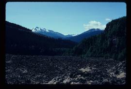
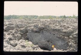
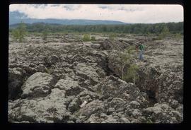
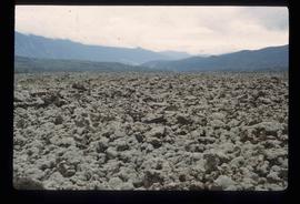
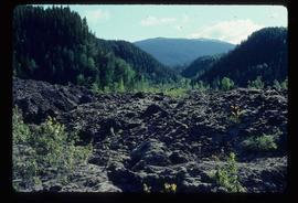
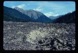
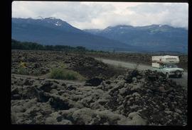
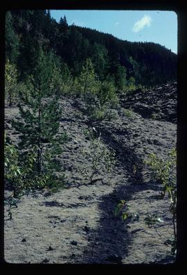
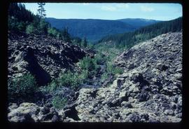
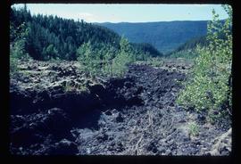
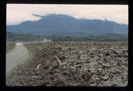
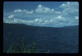
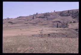
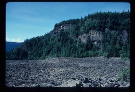
Image depicts old lava cliffs and the Tseax Lava Flow in Nisga'a Provincial Park, near New Aiyansh, B.C.
Image depicts the Tseax Lava Flow, with mountains in the distance.
Image depicts Kent Sedgwick standing in a drainage tunnel of the Tseax Lava Flow.
Image depicts an unknown individual standing on the Tseax Lava Flow.
Image depicts the Tseax Lava Flow.
Image depicts truncated spurs somewhere near McBride, B.C.
Image depicts numerous skiers at the cabin located at Troll Lake on Tabor Mountain in Prince George, B.C.
Image depicts a snow-covered cabin and a mountain in the distance. It is located somewhere near Birken, B.C.
Image depicts a mountain in the distance. It is located somewhere near Birken, B.C.
Image depicts a west-looking view of Trembleur Lake.
Image depicts a stand of trees and a shed at Island Cache.
Image depicts two old houses surrounded by numerous trees at an uncertain location.
Image depicts a green car among some trees on Cottonwood Island.
Image depicts numerous trees in an uncertain location; the slide itself is labelled "T.T. Cutting," possibly meaning "Telegraph Trail Cutting."
Image depicts a small copse of trees boxed in by very small concrete barriers somewhere in Kettle Valley, B.C.
Image depicts two unidentified individuals examining a thick log still attached to the machine that cut it down. It is located somewhere in Prince George, B.C.
Image depicts a train on the Hansard Bridge across the Fraser River looking west. Map coordinates 54°04'37.7"N 121°50'39.9"W
Image depicts the side of a train and the tracks it is on, somewhere in the Seton Portage area.
Image depicts a train in an uncertain location, though it is possibly Howe Sound in the background.
Image depicts a patch of snow-covered ground with a sign that reads "Trail of 98," somewhere along the White Pass railway.
Image depicts a tractor with a claw lifting logs at a saw mill in Prince George, B.C.
Image depicts a view of the scenery at an uncertain location with numerous individuals, possibly tourists, present. It is possibly somewhere near the Fraser River.
Image depicts a view of the landscape at an unknown location with a group of people, possibly tourists, present. It is possibly near the Fraser River.
Image depicts several individuals examining totem poles which are possibly undergoing a restoration process somewhere on Haida Gwaii.
Image depicts a totem pole at an uncertain location, possibly in Gitwinksihlkw, B.C.
Image depicts the tombstone of T.J. Menefee in the cemetery in Soda Creek, B.C.
Image depicts an old tomb stone at an uncertain location, possibly Fort St. James, B.C.
Image depicts a woman standing in a field, with a sign in a tree behind her pointing the way towards the Raven Cabin.
Image depicts three picnic tables, one of which is occupied with three unknown individuals, on a beach somewhere in Kitimat, B.C.
Image depicts three individuals and three dogs standing by a stream at an uncertain location, possibly somewhere in Bear Glacier Provincial Park. The woman in purple is possibly Sue Sedgwick.
Image depicts two individuals seated at a picnic table while a third stands closer to the water on a beach somewhere in Kitimat, B.C. What appears to be a harbour can be seen on the water.
Image depicts three unknown individuals at a campsite.
Image depicts three men and a dog on the hiking trail near Mt. Robson.
Image depicts a view of the scenery, with three hikers in the bottom left corner of the image.
Image depicts three unidentified children standing in the doorway of a house, with two goats ascending the porch steps. The location is uncertain, likely Sinclair Mills, B.C.
Image depicts a section of Isaac Lake which is apparently known as the "chute."
Image depicts the Bullion Pit in Likely, B.C. It is a man-made canyon from the days of the gold-rush, formed by the use of hydraulic monitors. The gold-mine operated from 1892 to 1942.
Image depicts a vehicle on a gravel road somewhere near Tête Jaune Cache, B.C.
Image depicts a forest service cabin somewhere near Tête Jaune Cache, B.C.
Image depicts a collapsing shack somewhere near Tête Jaune Cache, B.C.