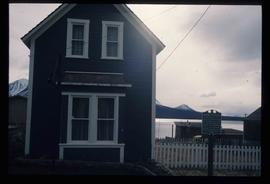
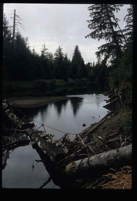
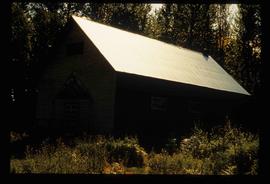
Image depicts the post office in Atlin, B.C.
Image depicts an old boat on the shore of Atlin Lake.
Image depicts a building which once served as the residence for two nurses in Atlin, B.C. A sign in front of the house reads: "Grateful Atlinites built this house in 1902 for their first missionary nurses, Helen Bone and Elizabeth Mitchell, who came here in 1899 and lived in a crude shack while valiantly and humanely caring for sick and dying pioneers."
Image depicts numerous old buildings on a main street in Atlin, B.C.
Image depicts an old building undergoing a restoration process, possibly in Atlin, B.C.
Image depicts a back street in Atlin, B.C.
Image depicts a dock on the shore of Atlin Lake, as well as a building that may have once been a hospital. The slide is simply labelled "hospital."
File contains slides depicting buildings and places in and around Ashcroft, Kamloops, and Hat Creek, B.C.
Image depicts Ash Street and Patricia Boulevard in Prince George, B.C.
Image depicts numerous buildings on the shore of Haida Gwaii as the ferry approaches.
Image depicts what appears to be an apartment building among several others in an uncertain location.
Image depicts another train on the White Pass railway along a forested mountain side.
Image depicts a view of D'Arcy, located on the southern end of Anderson Lake.
Image depicts a vehicle on a bridge somewhere near Anderson Lake in the Seton Portage area.
Image depicts power lines running alongside Anderson Lake near Seton Portage, B.C.
Image depicts the Anderson Lake.
Image depicts a view of Anderson Lake near Seton Portage, B.C. A vehicle on a mountain road is also visible.
Image depicts a view of Anderson Lake near Seton Portage, B.C.
Item is an original 1989 map depicting Anahim Lake in British Columbia, published by Energy Mines and Resources Canada.
Item consists of three maps pieced together to depict Anahim Lake, Bella Coola, and Quesnel in British Columbia originally published by the Department of Lands, Forests and Water Resources in Victoria B.C.
Image depicts the Alkali Lake Ranch in Alkali Lake, B.C.
Image depicts some farmland near Alexandria, B.C.
Image depicts the Alcan smelter in Kitimat, B.C.
Image depicts a small section of the Alaska Highway somewhere near Whitehorse, Y.T. The slide also appears to be labelled "army washing" for unknown reasons.
Image depicts the ferry to Alaska in the port of Prince Rupert, B.C.
Image depicts an old convenience store, with a sign on it labelled "Al Crosina." It is located at the 153 Mile House.
File contains slides depicting New and Old Aiyansh, as well as the Tseax Lava Flow.
File consists of notes and reproductions relating to air photographs of Prince George. File predominantly consists of reproduced air photos and photocopied air photos from the Royal BC Museum and Archives depicting Prince George and region. Includes: "RE: Archive Photos Gd" printed email from Gabrielle Dupuis to Kent Sedgwick (17 Oct. 2000) and "Aerial photograph data sheet" reproduction of a data sheet (27 June 1978).
Image depicts a marker for aerial photography at an uncertain location. The slide labels it as "Elizabeth Station."
Image depicts an aerial view of a forest somewhere in the area of Divide Lake.
Image depicts an aerial view of the land in the area of Divide Lake.
File contains slides depicting various places located across Canada.
Image depicts an old and abandoned, collapsing church at an uncertain location.
Image depicts an old, abandoned cabin with ivy growing up the side. The location is uncertain.
Image depicts an old and abandoned cabin with ivy growing up the side. The location is uncertain.
Image depicts a street in Wells, B.C. The Wells Hotel is present in the image.
Image depicts a street in Island Cache.
Image depicts what appears to be a shed at an uncertain location.
Image depicts a saw and numerous wooden boards at an uncertain location.
Image depicts a road somewhere in Tumbler Ridge, B.C. There are numerous construction vehicles present.
Image depicts a road somewhere in Tumbler Ridge, B.C. There are three bush planes in the image.
Image depicts a road somewhere in Tumbler Ridge, B.C.
Image depicts what appears to be a type of log bridge crossing a river somewhere on Haida Gwaii.
Image depicts a river in South Tweedsmuir Provincial Park. There is an unknown individual present in a canoe with the camera-man.