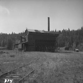
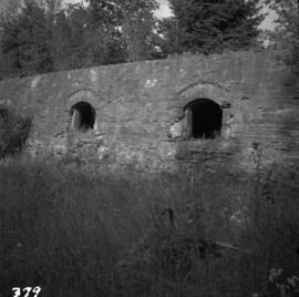
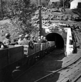
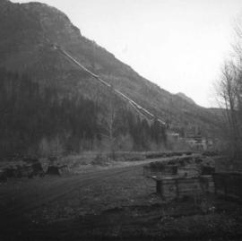
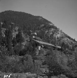
Photograph depicts a derelict gold mine at Hedley, BC.
Photograph depicts a derelict copper smelter at Princeton, BC. The ore comes from Copper Mountain.
Photograph depicts a C.P.R. wrecking train unit at Vancouver station.
Photograph depicts a C.P.R. lumber train at Cowichan Lake to go to Crofton Mill on Vancouver Island.
Map depicts the Cowichan Lake area, including rail trackage for the Western Forest Industries Logging Railway, the Canadian National Railway, and the BC Forest Products Logging Railway.
Real estate map depicts the areas around Coquitlam, Port Coquitlam, and Port Moody, including rail trackage.
Technical drawing depicts a condensed profile of the CN Albreda subdivision.
Photograph depicts the Cominco Ltd. In Kimberley, near Cranbrook. There is a 3' gauge overhead electric railway serving the underground workings of Sullivan mine. The view shows the C.P.R. access in the valley and the old mine portal, still used for in-going materials and supplies, at the right center of the photo.
Photograph depicts the coking ovens at Union Bay on Vancouver Island. They belong to the Canadian Collieries Ltd. and the date last used is unknown.
Photograph depicts the coaling wharf at Union Bay on Vancouver Island. It is the property of the Canadian Colliery Resources Ltd. It was last used on August 15, 1960. Thereafter, all equipment and railways were dismantled but the water tank is still standing.
Photograph depicts coal miners near Buckley Bay. The afternoon shift (3 p.m.) is going down the Tsable drift mine, which is the only working coal pit on Vancouver Island in 1964 and has a total of 70 employees. It is run by the Comox Colliery Co. and has a daily production of 200-300 tons.
Photograph depicts the Tsable coal pit on Vancouver Island as the first coal of the afternoon shift being hauled up.
Map depicts the city of Vancouver and its railways.
Map depicts passenger routes on the Canadian Pacific Railway and its connecting lines in 1925.
Map depicts the CNR system in Canada and the United States and all of its connecting lines, including the Central Vermont Railway, the Grand Trunk Western Railroad, and the Duluth Winnipeg & Pacific Railway.
Map depicts the Canadian National Railway system, including trackage for the Central Vermont Railway, the Detroit & Toledo Shore Line Railroad, the Grand Trunk Western Railroad, the Duluth Winnipeg & Pacific Railway, and the Northern Alberta Railway.
Map depicts Canadian railways in operation at 2011.
Map depicts railways in British Columbia, with insets for the Lower Mainland and the Kootenays.
Government map depicts railway lands, lands "disposed of", grazing leases, and timber berths. Shows the British Columbia 'railway belt' running from Greater Vancouver to Field, B.C.
Photograph depicts a beehive burner at Brownsville Sawmills Ltd. On Olson St. in south Westminster, Surrey. It is on the banks of the Fraser River just below the Patullo Bridge.
Photograph depicts a baby seal at C.N. log drop at Cowichan Lake on Vancouver Island.
Map depicts the Abbotsford area, including railway lines.
Photograph depicts an abandoned coal mine in Coal Creek, 5 miles east of Fernie, BCThe entrance to the mine is unusual and is 2/3rds up the mountainside. The mine was closed in 1959. Flat ground in foreground is littered with at least 100 mine tubs of approximately 3'0' gauge.
Plan depicts sections, elevations, and floor plans for the addition to the Kamloops roundhouse.
Plan depicts "scheme B" of the proposed 6 stall addition to the roundhouse at Kamloops, BC.
Architectural block plan depicts a proposed addition to the CNR roundhouse in Kamloops.
Photograph depicts a 10 ton Wallis & Stevens Ltd. #7985 steam roller. It was built at Basingstoke, England from about 1925 to 1927. It is located at 6110 Curtis St. in Burnaby, BC