2008.2.010
                      
                                     · 
                        
              Item            
                      
                                                                 · 
                            
                1924              


            Part of             NBCA Maps and Plans Collection           
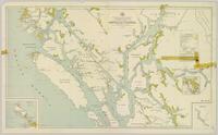
              Colour-coded map depicting lands surveyed as alienated, reserved, and having a timber license, lease, or sale. Depicts land recording divisions, land district boundaries, communities, bodies of water, and transport routes. Includes insets of Stephens Island and Egeria Reach.