


Área de título y declaración de responsabilidad
Título apropiado
Tipo general de material
- Graphic material
Título paralelo
Otra información de título
Título declaración de responsabilidad
Título notas
Nivel de descripción
Institución archivística
Código de referencia
Área de edición
Declaración de edición
Declaración de responsabilidad de edición
Área de detalles específicos de la clase de material
Mención de la escala (cartográfica)
Mención de proyección (cartográfica)
Mención de coordenadas (cartográfica)
Mención de la escala (arquitectónica)
Jurisdicción de emisión y denominación (filatélico)
Área de fechas de creación
Fecha(s)
-
1907-1920 (Criação)
- Produtor
- Holland, Arthur H.
Área de descripción física
Descripción física
1 album (475 photographs)
Área de series editoriales
Título apropiado de las series del editor
Títulos paralelos de serie editorial
Otra información de título de las series editoriales
Declaración de responsabilidad relativa a las series editoriales
Numeración dentro de la serie editorial
Nota en las series editoriales
Área de descripción del archivo
Nombre del productor
Historia biográfica
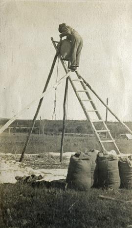
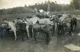
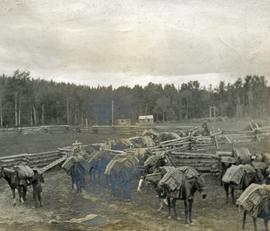
Arthur Hagarty Holland was born in Coburg, Ontario, on August 6, 1875. His father was Henry F. Holland, a Solicitor, and his mother was Selvia E. Holland (nee Fraser) and he attended public school, collegiate, and Victoria College in Coburg. In 1892, he went to Bridgeport Connecticut, where he apprenticed in Electrical Engineering. He returned home in 1895 and the following year he moved west to work as rodman with the Canadian Pacific Railway survey in British Columbia. By 1900, he was in Vancouver working as a chainman and in 1904 he entered into articles with Noel Humphrys, BCLS, CE, and became British Columbia Land Surveyor #14 in 1907.
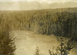
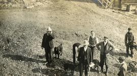
From 1909 to 1911 Holland mainly surveyed for a land company associated with the Grand Trunk Railway. In the fall of 1910 he surveyed in an area northeast of Prince George but the exact location and why he was there are unknown; but there are some interesting photographs from there. In 1911, he surveyed in and around Fort Fraser and in 1912 he was in the Cariboo. He took several photos this latter year but unfortunately they are small and many are unlabeled. In 1914 and 1915 Holland surveyed east of Prince George and there are some newspaper articles about his work there. Historian Jay Sherwood said: “The 1913 photos and survey are definitely the highlight of Holland's early career and would make a great re-photography project.”
In February 1916, Holland went overseas and served with the Royal Canadian Engineers and later with the Railway Troops, gaining a commission as Lieutenant. After returning from overseas in 1919, he resumed his survey work for the Provincial Government until 1922 in the Prince George area and later in the Similkameen area. In his 1919 report to the Surveyor General, he reported on the excellent forage crops on the Stuart River with one exception to one pre-emption wherein he said: “… whose only production came from an illicit still.”
He suffered from a stroke in 1947 and retired from private practice. He never did recover from the stroke and eventually died in his 80th year on September 21, 1954.
Alcance y contenido
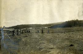
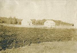
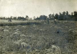
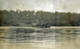
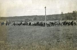
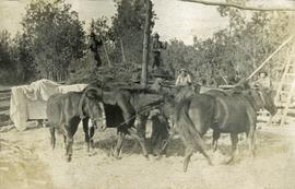
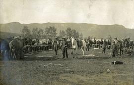
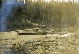
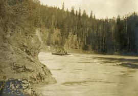
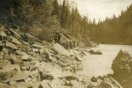
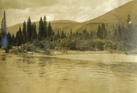
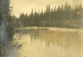
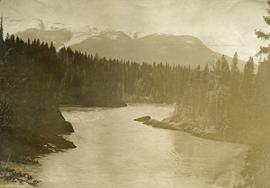
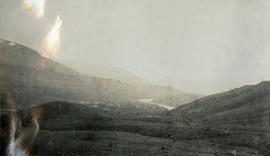
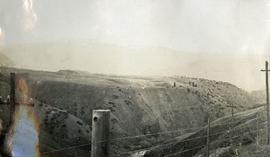
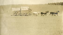
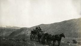
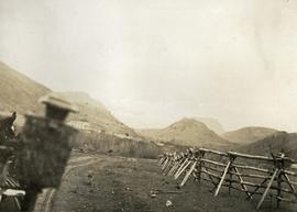
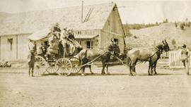
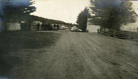
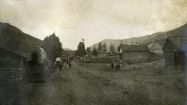
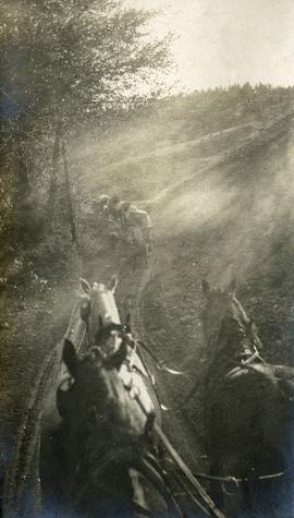
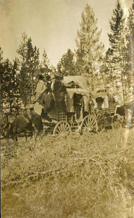
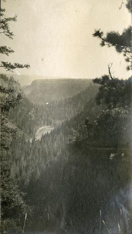
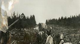
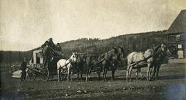
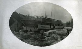
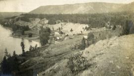
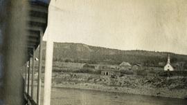
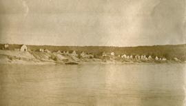
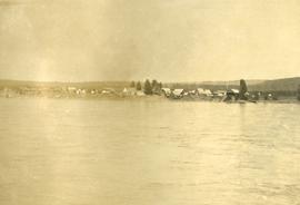
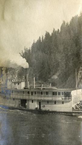
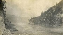
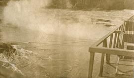
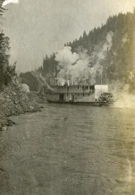
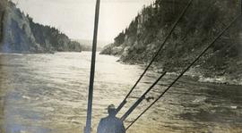
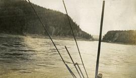
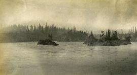
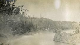
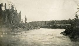
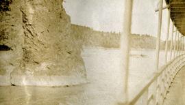
Collection consists of a photograph album from A. H. Holland, a British Columbia Land Surveyor, that was created while working in the Central Interior, the Cariboo, the Chilcotin and southeast British Columbia. This album visually documents steamboat, stagecoach and horse travel in British Columbia and also captures the prepatory work and dawn of the age of rail travel.
Área de notas
Arreglo
Original order maintained.
Idioma del material
- inglés
Escritura del material
Ubicación de los originales
Disponibilidad de otros formatos
Restricciones de acceso
No restrictions.
Condiciones de uso, reproducción, y publicación
Personal or academic use of materials is welcomed under the standard fair use and educational use clauses of Canadian Copyright Law. Commercial use is, however, forbidden without the express permission of the copyright holder. For information on obtaining written permission from the copyright holder, please contact the Northern B.C. Archives and Special Collections.
Instrumentos de descripción
Materiales asociados
Acumulaciones
Nota general
Finding aid creation for this collection was made possible through the efforts and financial support of private individuals and organizations including: Jay Sherwood; The Historical and Biographical Committee of the Association of British Columbia Land Surveyors; Northern Regional Group of British Columbia Land Surveyors; Underhill Geomatics Ltd., in Memory of Ivan Royan, BCLS; British Columbia Land Title & Survey Authority; Robert Allen, BCLS (Life Member), CLS (ret.);
Chapman Land Surveying Ltd.; Association of British Columbia Land Surveyors Lower Mainland OIP Group; McElhanney Consulting Services Ltd., Kitimat; McElhanney Consulting Services Ltd., Prince George; Scott Pengelly, BCLS; Vector Geomatics Land Surveying Ltd.; Sandra Wards, BCLS, CLS, Peng; Strait Land Surveying Inc.; Steven E. Wong Land Surveying Inc.