Title and statement of responsibility area
Titel
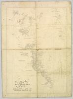
Advanced Copy of a Map of the Queen Charlotte Islands
Algemene aanduiding van het materiaal
Cartographic material
Parallelle titel
Overige titelinformatie
Title statements of responsibility
J.M. Dawson, Geological Survey of Canada
Titel aantekeningen
Beschrijvingsniveau
Stuk
archiefbewaarplaats
referentie code
2009.7.3.2
Editie
Editie
Edition statement of responsibility
Class of material specific details area
Statement of scale (cartographic)
Statement of projection (cartographic)
Statement of coordinates (cartographic)
53°24'00.0"N 132°18'00.0"W
Statement of scale (architectural)
Issuing jurisdiction and denomination (philatelic)
Datering archiefvorming
Datum(s)
-
May 31, 1879 (Vervaardig)
Fysieke beschrijving
Fysieke beschrijving
1 map : 45 x 61 cm ; mounted on linen
Publisher's series area
Title proper of publisher's series
Parallel titles of publisher's series
Other title information of publisher's series
Statement of responsibility relating to publisher's series
Numbering within publisher's series
Note on publisher's series
Archivistische beschrijving
Naam van de archiefvormer
(1847 - 1922)
Geschiedenis beheer
Bereik en inhoud
Aantekeningen
Materiële staat
Linen mounting is very dirty and stained with some evidence of foxing. Linen edging is frayed. Paper map is torn along its centre creases. Some minor repairs along the paper edges have been completed.
Directe bron van verwerving
Ordening
Taal van het materiaal
Engels
Schrift van het materiaal
Plaats van originelen
Beschikbaarheid in andere opslagformaten
Restrictions on access
No restrictions.
Termen voor gebruik, reproductie en publicatie.
Personal or academic use of materials is welcomed under the standard fair dealing and educational use clauses of Canadian Copyright Law. Commercial use is, however, forbidden without the express permission of the copyright holder. For information on obtaining written permission from the copyright holder, please contact the Northern B.C. Archives and Special Collections.

