Natural Resources

Elements area

Taxonomy

Code

Scope note(s)

  • Land, water, minerals, forests, fisheries, soil, oil, and gas
  • Energy (eg. hydroelectric, thermal, solar)
  • Game management
  • Individuals, industries, and businesses related to natural resources
  • Regulatory and professional organizations
  • SEE ALSO: Business and Commerce; Environment; Industries; Land, Settlement and Immigration

Source note(s)

  • MemoryBC Subject Groups

Display note(s)

    Hierarchical terms

    Natural Resources

      Equivalent terms

      Natural Resources

        Associated terms

        Natural Resources

          6040 Archival description results for Natural Resources

          6040 results directly related Exclude narrower terms
          2007.1.80.1.15 · Item · Sept. 1998
          Part of Aleza Lake Research Forest fonds

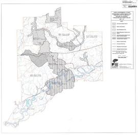
          Map commissioned from Ministry of Forests Prince George Region from Madrone Consultants shows Aleza Lake Research Forest Management Compartments and Administrative Boundaries. Map is 1 of 6. Map shows the Aleza Lake Ecological Reserve, Natural Forest Reserve, the Special Management Area, and Riparian Management Research Area.

          2007.1.80.1.20 · Item · Sept. 1998
          Part of Aleza Lake Research Forest fonds

          Map commissioned from Ministry of Forests Prince George Region from Madrone Consultants shows Aleza Lake Research Forest terrain themes. Map is 6 of 6. Map shows the following types of terrain units: typic, slope, percipitous, gullied, hummocky, rocky, alluvial, and organic. Ecosystem classification and mapping by Oikos Ecological Services Ltd.

          2007.1.80.1.18 · Item · Sept. 1998
          Part of Aleza Lake Research Forest fonds

          Map commissioned from Ministry of Forests Prince George Region from Madrone Consultants shows an Aleza Lake Research Forest TRIM Base Map. Map is 4 of 6. Map shows the following: roads, old roads, buildings, rail line, transmission line, definite streams, intermittent streams, indefinite streams, marshes, swamps, lakes, wooded area boundaries, intermediate contour lines (20m intervals), and index contour lines (100m intervals).

          2007.1.20.1 · File · 1946-1998
          Part of Aleza Lake Research Forest fonds

          File contains plot summaries of selected permanent sample plots, correspondence regarding field courses, records of management committee meetings from 1991 and 1990, documents and correspondence pertaining to the re-opening of the Aleza Lake Research Forest, partial cutting summaries, research proposals and studies, cost and revenues documents, a 1961 biography on Percy Barr, charts covering remeasurements of permanent sample plots, hand written correspondence from 1990 discussing the history of marking crews, and a brief history of the Aleza Lake Experiment Station.

          2007.1.20.2 · File · 1959-1999
          Part of Aleza Lake Research Forest fonds

          File contains various documents pertaining to the history of the Aleza Lake Experiment Station, correspondence regarding various administrative issues and research projects ranging from 1972 to 1996, field notes, 1996 meeting minutes, memoranda containing details on the management and preservation of the Aleza Lake Research Forest, various reports on research projects, 1987 permits, field notes, a 1970 working plan, and 6 colour photographs of the Aleza Lake Garbage Dump.

          2007.1.80.1.12 · Item · 1993
          Part of Aleza Lake Research Forest fonds

          Map reflects forest type boundary line, bogs and swampy non-forested areas, creeks, lakes, rivers, tree species labels of spruce, balsam, and birch, stand descriptions, historical timber sale boundaries, stand history symbol, gravelled secondary roads, unimproved old roads, management compartment boundary, research forest boundary, ecological reserve boundary, and old growth emphasis areas.

          2007.1.80.1.11 · Item · [after March 1992]
          Part of Aleza Lake Research Forest fonds

          Map reflects forest type boundary line, bogs and swampy non-forested areas, creeks, lakes, rivers, tree species labels of spruce, balsam, and birch, stand descriptions, historical timber sale boundaries, stand history symbol, gravelled secondary roads, unimproved old roads, management compartment boundary, research forest boundary, ecological reserve boundary, and old growth emphasis areas.

          2007.1.80.1.10 · Item · [after March 1992]
          Part of Aleza Lake Research Forest fonds

          Map reflects forest type boundary line, bogs and swampy non-forested areas, creeks, lakes, rivers, tree species labels of spruce, balsam, and birch, stand descriptions, historical timber sale boundaries, stand history symbol, gravelled secondary roads, unimproved old roads, management compartment boundary, research forest boundary, ecological reserve boundary, and old growth emphasis areas.

          2007.1 · Fonds · 1913-2001

          Contains significant materials covering a wide range of topics related to forestry research and forest management practices in Central British Columbia from the 1920s to the 1980s with the bulk of the materials dating from 1924 to 1963. Includes early surveys and descriptions of the Upper Fraser area, early maps and plans of the Research Forest, and historical meteorological registers from the area. Also includes unpublished scientific reports, communications, administrative and technical reports, timber sale records, and general forestry related reports and publications. Photographs include images of the Experimental Station dating from its inception and images of the Young Men's Forestry Training Program situated at Aleza Lake in 1936. Research records include experimental plot files that contain field notebooks dating from 1928 to 1958 which note locations of the experimental plots as well as sample plots from the surrounding areas of Hutton, Penny, and Foreman. The field notebooks also record growth and mortality data of white spruce balsam from 1928 to 1958 and soil types. The fonds also contains some records related to the re-emergence of the Aleza Lake Research Forest (ALRF) in the 1980s and 1990s.

          Aleza Lake Research Forest