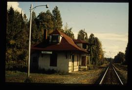
Image depicts the CN Station in Penny B.C.
File contains slides depicting a hike near the Geraldine Lakes.
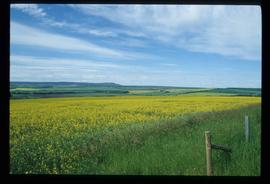
Image depicts a field of yellow plants at an uncertain location.
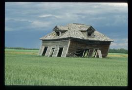
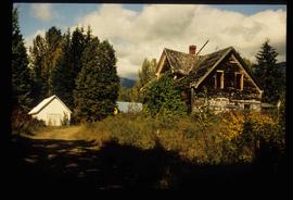
Image depicts an old, collapsing cabin which is sloped sideways. The location is uncertain.
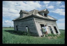
Image depicts Sue Sedgwick and a dog standing next to an old, collapsing cabin which is sloped sideways. The location is uncertain.
File consists of a special edition of the Prince George Citizen newspaper celebrating the 75th anniversary of Prince George (Aug. 1990).
File contains slides depicting numerous recreational locations from various places in Canada.
The item is a reproduction of a survey map drafted on 1 March 1910. The reproduction was likely created in 1990. The area highlighted is along the Fraser River. The map details subdivisions East of Ninth Street and South of Thapage Lane. Land Surveyor J. F. Templeton certified the plan. Annotation on the map states, "Pl. 727."
The item is a reproduction of a survey map drafted in approximately 1911 and revised in May 1914. The reproduction was likely created in 1990. The annotation states, "Plan 1391" and is circled in red ink. The area covered is along the Nechako and Fraser Rivers and Northeast of First Avenue.
The item is a reproduction of a survey map likely drafted in the 1910s. The reproduction was likely created in 1990. The area covered is South of Baillie Street, East of 22nd Avenue, North of Princess Street and West of 7th Avenue. Annotations state, "Pl. 833" and various lot descriptions.
The item is a photograph depicting the interior of the original Knox United Church built in 1922, located at the corner of Brunswick Street and 5th Avenue, Prince George. The photograph depicts a corner with multiple windows near the back of the church.
The item is a photograph depicting the interior of the original Knox United Church built in 1922, located at the corner of Brunswick Street and 5th Avenue, Prince George. The photograph depicts one side area of the church with five men standing together.
The item is a photograph depicting the interior of the original Knox United Church built in 1922, located at the corner of Brunswick Street and 5th Avenue, Prince George. The photograph depicts the back of the church with the exit and a section of the second level.
The item is a photograph depicting the exterior of the original Knox United Church built in 1922, located at the corner of Brunswick Street and 5th Avenue, Prince George. The photograph depicts the upper roof and chimney at the back of the church.
The item is a photograph depicting the plaque at the corner of 1st Avenue and George Street. The plaque is titled "Arrival of Steel."
File consists of notes, clippings, and reproductions relating to the postal service on the East Line in the Upper Fraser area.
Item is an original map depicting British Columbia published by the National Atlas Information Geographical Services Division.
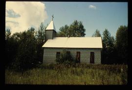
Image depicts a church at an uncertain location.
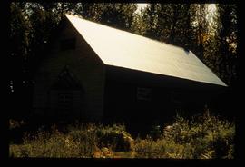
Image depicts what appears to be a shed at an uncertain location.
The map depicts British Columbia, including outlines of Indigenous tribal territories and a smaller map of Canada with Indigenous language families. The reverse side of the map is titled, "What Are You Ready For" and includes a timeline of information and Indigenous history.
The item is a photograph depicting the Prince George Railway Museum building ca. 1990. The building is white with a front deck and is situated behind a chain link fence.
The item is a reproduction of a section of survey map drafted on 18 March 1915 and revised on 23 May 1916. The reproduction was likely created in 1990. The Plan Number is 1268 and highlights the area along the Nechako and Fraser Rivers. The map details subdivisions East of Carney Street, North of Twentieth Avenue and South of Ninth Avenue. Annotations in pencil state different map scale variations and "cemetery setback."
The item is a reproduction of a section of survey map drafted in 1915. The reproduction was likely created in 1990. The Plan Number is 1268 and highlights the area along the Nechako River. The map details subdivisions East of Carney Street and North of Fifth Avenue. Some original street and avenue names have been crossed out and replaced with handwritten names. Annotation on reverse side of map states, "D.L. 343 Pl. 1268."
The item is a reproduction of a survey map drafted in July 1914. The reproduction was likely created in 1990. The area covered is along the Fraser River and east of Guelph Street. Annotations state, "PL 1409 D. L. 417 HBCo." and highlight different scales of measurement and changed street names.
The item is a reproduction of a survey map drafted in 1 Oct. 1913. The reproduction was likely created in 1990. The area covered is along the Fraser River and west of Linooln Avenue, south of Jackson Street and North of McKinley Street. Annotations state which maps and lots are adjacent to this one. An illegible signature is highlighted.
The item is a reproduction of a survey map drafted on 20 Nov. 1910. The reproduction was likely created in 1990. The subdivision is lot 2610 G. I. and part of lots 2507 and 2608 G. I. Cariboo District. The area covered is South of 8th Avenue, East of 19th Avenue, North of 8th Street and West of Quinn Street. Annotations state, "Pl. 847," and various notations regarding lot information.
The item is a reproduction of a survey map drafted on 27 July 1910. The reproduction was likely created in 1990. The area covered is South of Reserve Avenue, East of Victoria, North of Bird Avenue and West of 9th Street. Annotations state, "#796" and highlight the date and registered owner.
File consists of brochures relating to Prince George and the surrounding area. Includes: "Regional Parks" prepared by the Regional District of Fraser-Fort George; "A Guide to the Natural Habitat" prepared by the Habitat Information Group; "Wildlife Viewing at Forests for the World" prepared in co-operation with the Prince George Naturalists Club and British Columbia Wilflife Watch; "Your Guide to Downtown Prince George" prepared by the Prince George Town Centre Business Association; and "Welcome to the Forest" prepared by the City of Prince George.
The item is a map depicting the area surrounding the Hixon area in the Cariboo District. There are various annotations in pen and highlighted boundaries.
The item is a photograph depicting the Gaul residence at 1651 5th Avenue in Prince George. House is a proposed heritage building.
The item is a photograph of the Prince George Federal Government Building, commonly referred to as the 'old post office.' It has the Canadian coat of arms and "Prince George" above the main door. Annotation on the back states, "c. 1990." Building was previously located at 1239 3rd Avenue, Prince George.
The item is a photograph depicting the church bell at the original Knox United Church built in 1922, located at the corner of Brunswick Street and 5th Avenue, Prince George.
The item is a photograph depicting the interior of the original Knox United Church built in 1922, located at the corner of Brunswick Street and 5th Avenue, Prince George. The photograph depicts the upper half of the front wall and ceiling of the church.
The item is a photograph depicting the exterior of the original Knox United Church built in 1922, located at the corner of Brunswick Street and 5th Avenue, Prince George. The photograph depicts the church entrance.
File consists of an original typescript document relating to postal service in communities in and around Prince George. A later version of this document was published by the Fraser Fort George Regional Museum in 1990 as "Postscript '90 : commemorating 75 years of postal history in the Fraser-Fort George Region".
The item is a photograph depicting the original Knox United Church built in 1922, located at the corner of Brunswick Street and 5th Avenue, Prince George. The photograph depicts the front and side exterior of the church with some trees in front of the building.
The item is a photograph depicting the original Knox United Church built in 1922, located at the corner of Brunswick Street and 5th Avenue, Prince George. The photograph depicts the front and side exterior of the church.
The item is a photograph depicting the previous fire hall in South Fort George before it was remodeled into a house. Annotations on the reverse side of the photograph state, "S. Ft. Geo fire hall c. 1911 remodeled as house occupied 2009."
File contains slides depicting items and photographs in a museum.
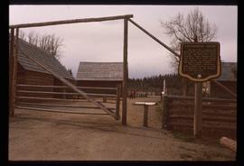
Image depicts the Cottonwood House Historic Site along Barkerville Highway, east of Quesnel, B.C. A sign posted by the fence reads: "For over half a century the Boyd family operated this haven for man and beast. Here weary travellers found lodging, food, and drink. Here fresh horses were hitched to stage-coaches and miners bought supplies. This historic road-house, built in 1864, stood as an oasis of civilization on the frontier of a rich new land."
The item is a reproduction of a survey map drafted on 10 July 1956 and registered on 31 Oct. 1956. The reproduction was likely created in 1990. The plan number is 7782.
The item is a reproduction of a survey map drafted June 1912. The reproduction was likely created in 1990. The area covered is Central Fort George, South of 5th Street, East of Alden Avenue, North of 12th Street and West of Fraser Street. Annotations state, "Plan 1085 Carney Addition."
The item is a reproduction of a survey map drafted on 29 Oct. 1910. The reproduction was likely created in 1990. The area covered is South of Princess Street, East of James Avenue, North of 8th Street and West of Rupert Avenue. Annotations state, "Jesse Hodgeson Crown grand in 1910 for $800..."
The item is a reproduction of a survey map drafted in 1909. The reproduction was likely created in 1990. The area covered is South of Fort George Avenue, East of Fraser Street, North of Mount Stephen Avenue, and West of Simpson Street. Annotations state, "Pl. 649."
The item is a photograph that depicts Erle's Iron Works shop with a man outside welding the turrets for the Sikh temple. Annotation states "Erle Muntz."
File consists of clippings, notes, and reproductions relating to the Crescents neighbourhood of Prince George. Includes: "Heritage inventory Crescents" inside a duotang (1990); "For Vanc - Carney St. study" typescript document (1990); "RE: Rezoning" typescript letter to Mr. LaChance from the City of Prince George (23 Jan. 1980); and "School Board Administrative Building" typescript document (2 Feb. 1976).
The item is a photograph depicting the side view of a house at 1085 Vancouver Street in Prince George.
The item is a photograph depicting the front view of a house at 1085 Vancouver Street in Prince George.
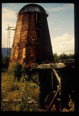
Image depicts an old beehive burner at an uncertain location.
Image depicts an old and abandoned cabin with ivy growing up the side. The location is uncertain.
