2012.13.1.86.28
·
Stuk
·
[1976?]
Part of J. Kent Sedgwick fonds
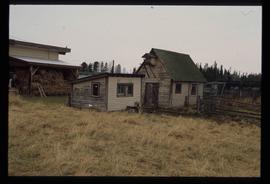
Image depicts an old, collapsing log building somewhere in Goat River, B.C.