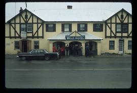
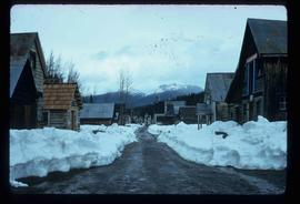
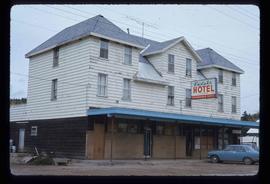
Image depicts the picnic site of the Cottonwood House Historic Site, located on the Barkerville Highway, east of Quesnel, B.C.
Image depicts the original main street of Quesnel, B.C.
Image depicts a rail road construct from Highway 97 at Mile 126; the slide is also labelled "McAlister."
Image depicts an aerial view of Strathnaver, B.C.
Image depicts the Wells Hotel in Wells, B.C.
Image depicts a hallway in an unknown building somewhere in Wells, B.C.
Image depicts a rail road bridge over the Fraser River, possibly somewhere in the Lillooet area.
Image depicts a bridge over the Fraser River, located at Chimney Creek, somewhere south-west of Williams Lake, B.C.
Image depicts a street in Barkerville, B.C.
Image depicts the interior of an old house, possibly the Cottonwood House, and most likely in or near Barkerville, B.C.
Image depicts the Watson Mansion at Mile 108 of Highway 97. It was built by Captain Geoffrey Watson in 1904, and was burned down by a chimney fire in 1983.
Image depicts an aerial view of a stretch of power lines somewhere near Williams Lake, B.C.
Image depicts a view of the Fraser River in Lillooet, B.C.
Image depicts some farmland in Lillooet, B.C.
Image depicts a Beehive Burner along the Nechako on River Road. Map coordinates 53°55'34.1"N 122°44'58.0"W
Image depicts the Pearson Homestead.
Image depicts a rural setting, most likely near the airport in Prince George, B.C.
Image depicts a gauging tower at Shelley, B.C.
Image depicts a bee-hive burner beside a rail-road track at an unidentified mill somewhere in Prince George, B.C.
Image depicts an aerial view of Williams Lake, B.C.
Image depicts the Endako Hotel in Endako, B.C.
Image depicts the Endako General Store in Endako, B.C.
Image depicts a Yellowhead Realty sign in Lamming Mills, B.C. It reads: "For Sale, entire community, 50 buildings, 60 acres."
Image depicts a beehive burner in the community of Crescent Spur, B.C.
Image depicts a cookhouse at Sinclair Mills, B.C.
Image depicts a snow-covered road with vehicle tracks, and several houses. The location is uncertain.
Image depicts a dilapidated house in Sinclair Mills, B.C.
Image depicts a small house with brightly coloured door and window frames in Penny, B.C.
Image depicts a house surrounded by trees and a mountain in the background; it is most likely located somewhere in or near Longworth, B.C.
Image depicts what appears to be a teepee at an uncertain location.
Image depicts a dirt road and a possibly abandoned building at an uncertain location.
Image depicts an older building with numerous vehicles parked out front in Upper Fraser, B.C. Map coordinates 54°07'03.5"N 121°56'34.4"W
Image depicts a row of houses in Upper Fraser, B.C. Map coordinates 54°06'51.6"N 121°56'26.3"W
Image depicts a field in Giscome, B.C. On the right side of the image, in the background, is a grey strip that appears to be a mine, possibly the quarry at Eaglet Lake in Giscome, B.C. Map coordinates 54°03'52.9"N 122°22'10.0"W
Image depicts the Giscome B.C. townsite from across the railroad tracks looking southeast. Map coordinates 54°04'19.7"N 122°22'04.7"W
Image depicts a house with the main floor and entrance high off the ground. The location is uncertain, likely Giscome, B.C.
Image depicts a large, old and collapsing barn, as well as a nearby house of the dairy farm in Giscome, B.C. Map coordinates 54°03'53.3"N 122°21'22.6"W
Image depicts several old buildings in a field, one of which has a caved-in roof, in Newlands, B.C. Map coordinates 54°06'28.2"N 122°12'01.0"W
Image depicts three people standing at the front door of a house at an uncertain location.
Image depicts a grave-marker with several names, it reads: "In Memory of Edith Golder, Winnifred Golder, Baby Pelton, Mrs. Nazarek, Baby Nazarek, Baby Wazylyk 1915 - 1929." It is located in the Willow River Cemetery.
Image depicts the mill site at Giscome, B.C. Map coordinates 54°04'19.7"N 122°22'04.7"W
Image depicts the mill site at Giscome, B.C. A sign in the foreground reads "Maynard's Industrial Auctioneers." Map coordinates 54°04'19.7"N 122°22'04.7"W
Image depicts a food stand at the mill site at Giscome, B.C. Map coordinates 54°04'19.7"N 122°22'04.7"W
Image depicts a street in Giscome B.C. The Giscome Store is located on the left side of the image with the church in the background. Map coordinates 54°04'18.5"N 122°21'57.7"W
Image depicts the Giscome, B.C. town site with the Giscome railway station and the Giscome store in the center surrounded by vehicles. Map coordinates 54°04'18.5"N 122°21'57.7"W
Image depicts an old building that was possibly once a gas station in the community of Newlands, B.C.
Image depicts a church school in the community of Crescent Spur, B.C.
Image depicts several buildings in the community of Loos, B.C.
Image depicts a beehive burner covered in snow in Sinclair Mills, B.C. Map coordinates 54°01'17.4"N 121°40'53.0"W