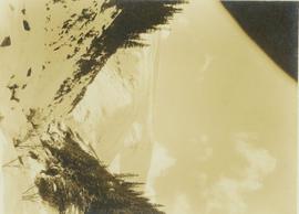
Photograph depicts snow covered mountain peaks seen through a mountain pass near Jasper Park.
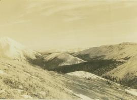
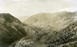
Photograph depicts a vista from the Canadian Rockies with patches of snow.
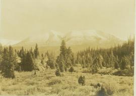
Photograph depicts a Rocky Mountain vista seen across a forested plateau.
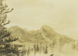
Photograph depicts Roche Myette along Davona Creek near a campsite.
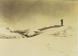
Photograph depicts one unidentified man surveying a landscape from a snowy mountain peak with other mountain ranges in the background.
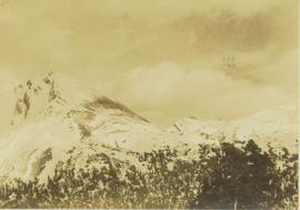
Photograph depicts a snow-covered mountain slope with trees at the base of the mountain.
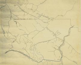
Map depicts the rivers, railways, and select lakes and towns located at Jasper Park between the northern boundary of the park and the townsite of Jasper. Part of the border between Alberta and British Columbia is visible on the west of the map.
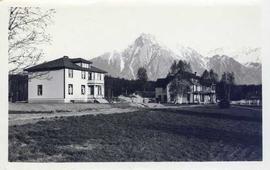
Photograph depicts two houses with snow-covered mountains in the background and a grassy yard in the foreground.
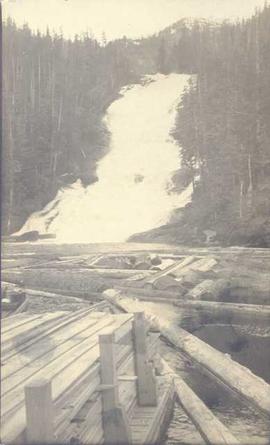
Photograph depicts piles of wood planks and log booms in the foreground with a waterfall in the background.
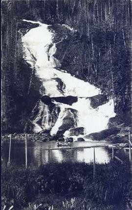
Photograph depicts four men in a boat on a lack with a waterfall in the background running through a forest into the lake. Annotation on verso of photograph states: "The water fall + flume for Brown's sawmill Hoscall River BC"
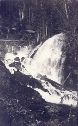
Photograph depicts a waterfall in a forested area with a riverbank in the foreground.
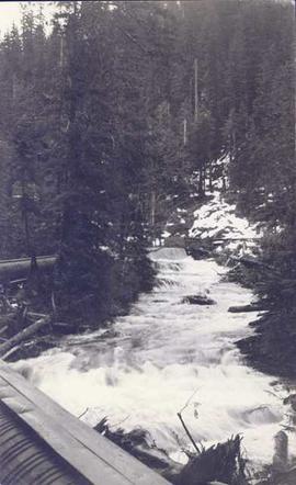
Photograph depicts a landscape shot of rushing water with a forested area in the background.
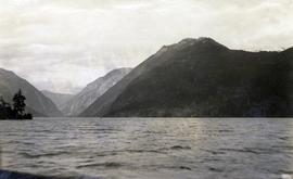
Photograph depicts a landscape shot of a body of water with mountains in background and forested shore in midground.
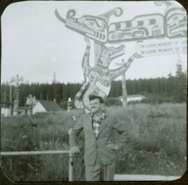
Photograph depicts James Joseph Claxton standing in front of a fence with a memorial pole in the background. The memorial pole depicts painted First Nations designs, with additional totem poles and houses visible in background. Handwritten annotation in pen on verso reads: “Jim Claxton 1959”
Photograph depicts a man in uniform and a woman posing for a photo on a road situated between a fenced area featuring totem poles. Along the water’s edge in the background there is a float plane, wharf and the Camosun vessel. Handwritten annotation on verso reads: “Alert Bay B.C. Union Steamships Ltd.”; “Alert Bay BC”; photographer’s stamp on verso states: “W.E. Nicholson, 268 E. 10th, Vancouver 10, B.C.”
Photograph depicts a memorial totem pole in front of a fence line and a forested environment. Inscription on memorial pole states: “In loving memory of Tlaqwa Latle of the Qidwasudinuk Tribe, Died Nov. 9 - ” Photographer’s stamp on verso: “W.E. Nicholson, 268 E. 10th, Vancouver 10, B.C.”
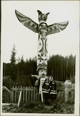
Photograph depicts three young, First Nations girls standing in front of a memorial totem pole with houses and a forested environment visible in the background. Photographer’s stamp on verso: “W.E. Nicholson, 268 E. 10th, Vancouver 10, B.C.”
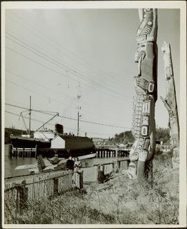
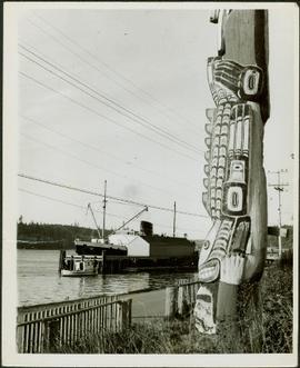
Photograph depicts a close-up of a totem pole behind a fence overlooking a wharf and a ship named Camosun. Photographer’s stamp on verso: “W.E. Nicholson, 268 E. 10th, Vancouver 10, B.C.”
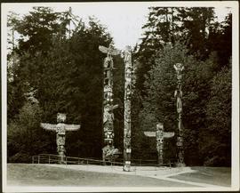
Photograph depicts five totem poles of various sizes in a fenced enclosure with a forested area in the background. Photographer’s stamp on verso: “W.E. Nicholson, 268 E. 10th, Vancouver 10, B.C.”
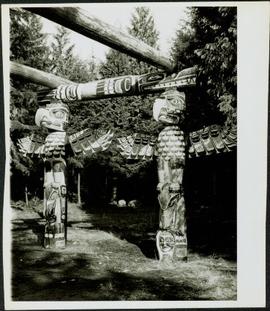
Photograph depicts a close-up of Alert Bay house posts adorned with First Nations carvings. Photographer’s stamp on verso: “W.E. Nicholson, 268 E. 10th, Vancouver 10, B.C.”
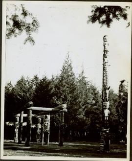
Photograph depicts several carved totem poles and house posts in a clearing with a forested area in the background. Photographer’s stamp on verso: “W.E. Nicholson, 268 E. 10th, Vancouver 10, B.C.”
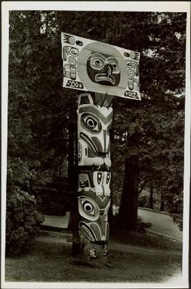
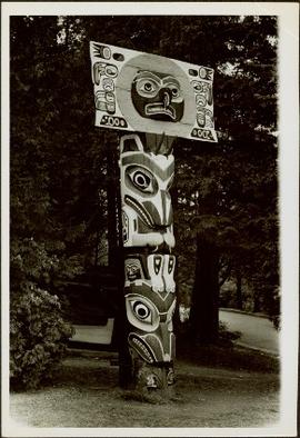
Photograph depicts a small totem pole in front of trees and a roadway. Photographer’s stamp on verso: “W.E. Nicholson, 268 E. 10th, Vancouver 10, B.C.”
Photograph depicts a small totem pole in front of trees and a roadway. Photographer’s stamp on verso: “W.E. Nicholson, 268 E. 10th, Vancouver 10, B.C.”
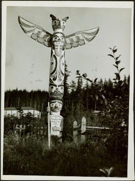
Photograph depicts a totem pole standing in front of a forested environment with a fence line in the foreground. Photographer’s stamp on verso: “W.E. Nicholson, 268 E. 10th, Vancouver 10, B.C.”
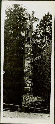
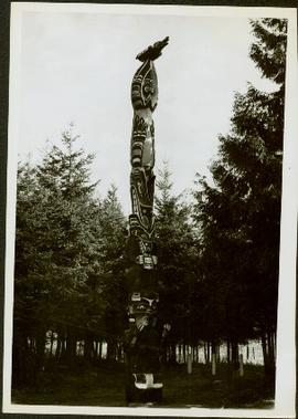
Photograph depicts a totem pole standing amidst a forested environment. Handwritten annotations on verso read: “Raven, ?, Sea Lions, Grizzly Bear, Dzondgwa”; “Kwakiutl Pole, Alert Bay & Fort Rupert” photographer’s stamp on verso: “W.E. Nicholson, 268 E. 10th, Vancouver 10, B.C.”
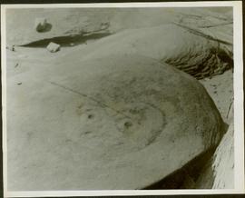
Photograph depicts a Kwakiutl petroglyph in Fort Rupert near Port Hardy. Handwritten annotations on verso reads: “Reversed negative, dry rock, 1957”; “Dry Rock, 1957”
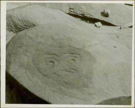
Photograph depicts a Kwakiutl petroglyph exposed at low tide in Fort Rupert near Port Hardy. Handwritten annotations on verso read: “1957 Port Hardy, visible at low tide”; “Right negative, rock (?) Port Hardy visible at low tide”
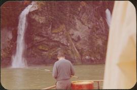
Photograph depicts a man on a boat standing with his back to the camera while holding a fishing rod. A waterfall and rocky cliff face are visible in the background. Handwritten annotation in pencil on verso reads: “Jim M.V. Columbia 1959”
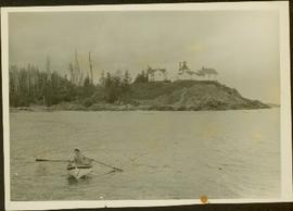
Photograph depicts a woman wearing a Cowichan sweater rowing a boat away from a rocky island with a lighthouse. Handwritten annotation in pencil on verso reads: “Gal in boat wearing Indian sweater knit by my mother Eileen M. Jackson (she also spun the wool) for her brother J.J. Claxton, cook on the Columbia Coast Mission Boat. - S.K. Jackson”
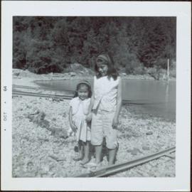
Photograph depicts two unidentified, young First Nations girls standing hand in hand on a rocky beach. Rail tracks extending from the water to the shore are visible in the lower right corner and in the background. Handwritten annotation on verso reads: “Kingcome Reserve”
Photograph depicts rows of palm trees shadowing the Pacific Park Motel with a mountain range in the background.
File contains slides depicting maps for land use in Prince George.
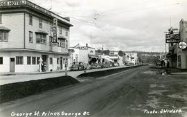
Handwritten annotation on verso of photograph reads: "George St. Prince George BC Photo. S Wrathall". Prince George Hotel and Cafe stand on left side of street in foreground, and many other buildings and businesses can be seen. Vehicles line the street, cut banks visible in background. Photograph believed to have been taken while George Street was being prepared for a new lawyer of asphalt.
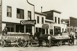
Street view photograph of a commercial section in downtown Prince George with several "Campbell's" delivery carts parked along the road. Visible establishments include "Campbell's All Cash Store" and "Club Cafe." Handwritten annotation in blue ballpoint pen on recto reads: "Howdy from Prince George! Going easy with all these kids- good to see Kathee. Snow here. Have fun at the sports show & don't over do it. Thinking of you guys, love Judy and Vic. P.S. Can't wait to go home to somewhere peaceful and quiet. 2-27-83." Postcard is addressed to: "Mr. & Mrs. Hauffer 8429-221 PL. Sn. Edmonds, WA. U.S. 98020." Verso is affixed with four Canadian 8-cent stamps.
This collection consists of photographs and "real photo" postcards that depict the construction and operation of the Pacific Great Eastern Railway line, communities nearby the railway line, and regional geography of areas adjacent to the PGE line.
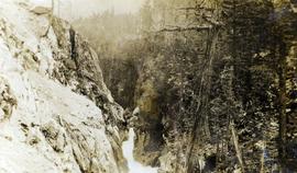
Photograph depicts an unknown canyon. It may be located in the area of Cheakamus Canyon near Squamish.
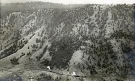
Photograph depicts the Pacific Great Eastern Railway line at Pavilion looking south. An irrigation ditch line is also visible.
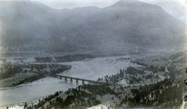
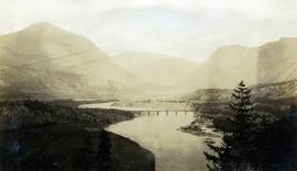
Photograph depicts a view of the Pacific Great Eastern Railway bridge across the Fraser River and the nearby Lillooet surrounding area. The photograph shows Lillooet looking up Town Creek Valley. Chinese gold washing activity is visible nearby the bridge.
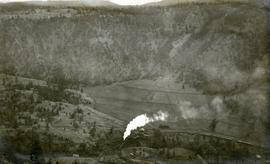
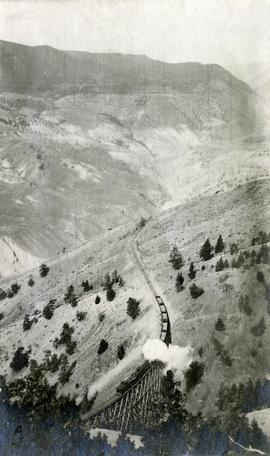
Photograph depicts a Pacific Great Eastern Railway train on Pavilion Creek trestle at Mile 20.3. Also visible are a water tank and possibly the graveyard at Pavilion.
The ca. 1921-1927 “PGE Bridge List” from the notebook of William H. Hewlett (1914-1968) references a 389.4 foot long, 34 ft. high, framed trestle with 26 spans of 14.8 feet at Mile 20.3 carrying the line over Pavilion Creek. There was a water tank at Pavilion located between the North end of the siding and the South end of the trestle. A track profile chart confirms that the track at this point is on a 12 degree curve. This photograph was taken from a vantage point up the hill to the North. The structures at the lower left of this image (2020.08.82) are consistent with a small construction camp, which accounts for the presence of a camp cook in image 2020.08.83.
"Canadian Railway and Marine World" reported in their January 1916 issue (p. 11, c.1), that track had been laid to within ½ mile of Clinton (Mile 45.0) on Dec. 14, 1915. If a constant rate of construction had been maintained from Mile 14, reached on July 30, 1915 as previously discussed, to Clinton, the approximate date of completion to Pavilion would be around the end of August, 1915 which is probably the earliest possible date for this photograph.
Photograph depicts a view of the Pacific Great Eastern Railway bridge across the Fraser River at Lillooet.
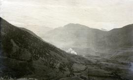
Photograph depicts a view of a train on the Pacific Great Eastern Railway line approximately 2 miles south of the Pavilion station.
Photograph depicts a view of a train crossing the Sallus Creek wooden trestle along the Pacific Great Eastern Railway line near Lillooet, Fountain, and Pavilion. The angle of the photograph is looking north towards the Fraser River.
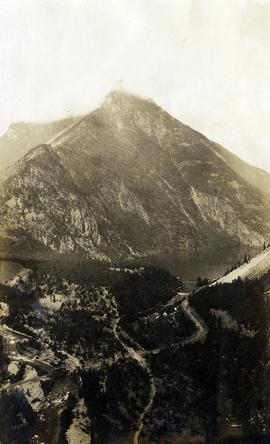
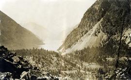
Photograph depicts a view of Seton Lake and the surrounding area, including the Pacific Great Eastern railway line. The railway grade is visible at left. Also visible is the Seton Lake fish hatchery at the east end of the lake and its employee boarding house, superintendent's cottage, and weir at the head of what was then referred to as "Lake Creek". The road seen in the centre foreground travelled from Lillooet to Seton Lake then to Golden Cache Mine.
Photograph depicts a view of Seton Lake taken at Retasket, looking towards Lillooet. Retasket was a whistle stop siding on the Pacific Great Eastern Railway line.
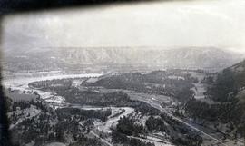
Photograph depicts a view of the Lillooet Indian Reserve in the foreground; the town of Lillooet and the Fraser River are visible beyond.
Photograph depicts the confluence of the Cayoosh Creek outflow into the Fraser River in Lillooet, BC. Seton River is visible in the foreground. This area is Cayoose Creek Band (Sekw'el'wás First Nation) territory and includes land currently encompassed within Cayoosh Creek Indian Reserve 1. The Pacific Great Eastern Railway bridge over the Fraser River is also visible in the background.
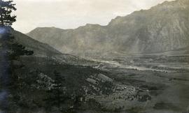
Photograph depicts a view of the Fraser River, scrub land, and mountains in the Moran Canyon area near Lillooet.
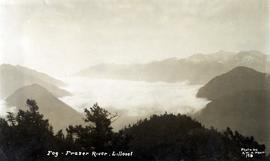
Photograph depicts a view of fog over the Fraser River in the Lillooet area.
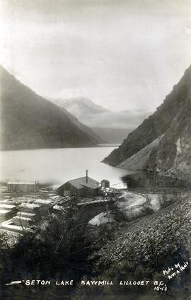
Photograph depicts a view of the east end of Seton Lake. The Seton Lake sawmill and Seton Lake fish hatchery are visible in the foreground. The PGE railway grade alongside the lake has not yet been constructed, dating this photograph at or before 1914.
Photograph depicts the steam-operated Durban & Sons sawmill at the east end of Seton Lake. This photograph was taken before the PGE railway grade was built alongside the lake circa 1914-1915.
